Search
You Searched For
Search Results
- Published / Created:
- 1880
- Call Number:
- 40 R66 1880B
- Container / Volume:
- BRBL_00218
- Image Count:
- 1
- Resource Type:
- Maps, Atlases & Globes
- Description:
- Shows principal highways and railroads.
- Publisher:
- Lit. Verano e Teano,
- Subject (Geographic):
- Campagna di Roma (Italy)--Maps
- Found in:
- Beinecke Rare Book and Manuscript Library > Carta Stradale della Provicia di Roma.
- Published / Created:
- 1880
- Call Number:
- 40 R66 1880A
- Container / Volume:
- BRBL_00218
- Image Count:
- 1
- Resource Type:
- Maps, Atlases & Globes
- Description:
- Shows tramway and railway lines and principal highways.
- Publisher:
- Lit. Verano e Teano,
- Subject (Geographic):
- Rome (Italy : Province)--Maps
- Found in:
- Beinecke Rare Book and Manuscript Library > Carta Stradale della Provicia di Roma.
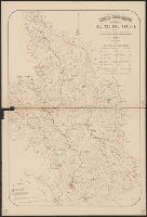
- Published / Created:
- 1879
- Call Number:
- 40 R66 1879
- Container / Volume:
- BRBL_00218
- Image Count:
- 8
- Resource Type:
- Maps, Atlases & Globes
- Description:
- [1.] Title page -- [2.] Arsoli -- [3.] Palo -- [4.] Roma -- [5.] Subiaco -- [6.] Nettuno -- [7.] Civita-Castellana -- [8.] Civita-Vecchia -- [9.] Cisterna.
- Publisher:
- Lit. Virano e Teano,
- Subject (Geographic):
- Italy--Maps
- Found in:
- Beinecke Rare Book and Manuscript Library > Carta Topografica dell'agro Romano Territori Limitrofi.
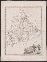
- Creator:
- Olivieri, Bernardino, cartographer
- Published / Created:
- 1803
- Call Number:
- 4065 1803
- Container / Volume:
- BRBL_00236
- Image Count:
- 1
- Resource Type:
- Maps, Atlases & Globes
- Alternative Title:
- Carta della provincia dell' Umbria
- Description:
- Relief shown pictorially.
- Publisher:
- Presso la Calcografia camle,
- Subject (Geographic):
- Umbria (Italy)--Maps
- Subject (Name):
- Calcografia camerale (Rome, Italy)
- Found in:
- Beinecke Rare Book and Manuscript Library > Carta della provincia dell'Umbria / Bernardo. Olivieri inc.
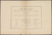
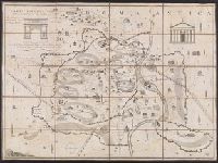
- Published / Created:
- 1880
- Call Number:
- 40cbj T433 1880
- Container / Volume:
- BRBL_00229
- Image Count:
- 2
- Resource Type:
- Maps, Atlases & Globes
- Description:
- Includes table showing areas of subbasins.
- Subject (Geographic):
- Tiber River Watershed (Italy)--Maps
- Subject (Topic):
- Hydrology--Italy--Tiber River Watershed--Maps
- Found in:
- Beinecke Rare Book and Manuscript Library > Carta idrografica del Bacino del Tevere : con l'indicazione dei bacini dei principali affluenti non che delle stazioni meteorologiche pluvometriche ed idrometriche.
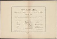
- Published / Created:
- 1880
- Call Number:
- 40 R66 1880
- Image Count:
- 6
- Resource Type:
- Maps, Atlases & Globes
- Description:
- [Title sheet] -- Roma -- Civita-Vecchia -- Nettuno -- Palo -- Civita-Castellana.
- Publisher:
- Lit. Virano e Teano,
- Subject (Geographic):
- Civita Castellana (Italy)--Maps, Civitavecchia (Italy)--Maps, Nettuno (Italy)--Maps, Palo (Italy)--Maps, Rome (Italy)--Maps, Rome Region (Italy)--Maps, and Velletri (Italy)--Maps
- Subject (Name):
- Canevari, Raffaello and Lit. Virano e Teano
- Found in:
- Beinecke Rare Book and Manuscript Library > Carta topografica dell'agro romano e territori limitrofi in scala di 1 a 80.000 [cartographic material].
- Creator:
- Manazzale, Andrea, cartographer
- Published / Created:
- 1805
- Call Number:
- 400am R66 1805
- Container / Volume:
- BRBL_00233
- Image Count:
- 1
- Resource Type:
- Maps, Atlases & Globes
- Alternative Title:
- Carta topografica dell' antichità di Roma
- Description:
- "La quale esattamente contiene tutte le vestigie delle Antiche fabriche, e monumenti secondo il giro metodico di tutte le Antichità".
- Publisher:
- Si vende in Roma nel Negozio si Stampe, e Libri di Venanzia, Monaldini in Piazza di Spagna ...,
- Subject (Geographic):
- Rome (Italy)--Maps
- Subject (Name):
- Monaldini, Venanzio and Pronti, Domenico, 1750- engraver
- Subject (Topic):
- Geography, Ancient--Maps
- Found in:
- Beinecke Rare Book and Manuscript Library > Carta topografica dell'antichità di Roma [cartographic material] / Andrea Manazzale inv. ; D. Pronti inc.
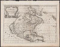
- Creator:
- Sanson, Guillaume
- Published / Created:
- 1687
- Call Number:
- 71 1687
- Container / Volume:
- BRBL_00360
- Image Count:
- 1
- Resource Type:
- Maps, Atlases & Globes
- Description:
- Relief shown pictorially.
- Publisher:
- Gio. Giacomo de Rossi,
- Subject (Geographic):
- North America--Maps--Early works to 1800
- Subject (Name):
- Rossi, Giovanni Giacomo de, 17th cent and Widman, Georgio
- Found in:
- Beinecke Rare Book and Manuscript Library > L'America Settentrionale : nuovamente corretta, et accresciuta secondo le relationi più moderne / da Guglielmo Sansone ... e data in luce da Gio. Giacomo de Rossi ; Giorgio Widman Sculp.
- Creator:
- Cassini, Giovanni Maria, fl. 1788-1815
- Published / Created:
- 1788
- Call Number:
- 70 1788
- Container / Volume:
- BRBL_00357
- Image Count:
- 1
- Resource Type:
- Maps, Atlases & Globes
- Description:
- Includes decorative cartouche.
- Publisher:
- Presso la Calcografia Camle,
- Subject (Geographic):
- America--Maps--Early works to 1800
- Subject (Name):
- Calcografia camerale (Rome, Italy)
- Found in:
- Beinecke Rare Book and Manuscript Library > L'America secondo leultime osservazioni divisa né suoistati principali / Gio. Ma. Cassini Somo. inc.
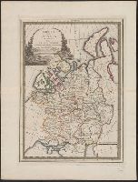
- Published / Created:
- 1795
- Call Number:
- 352 1795
- Container / Volume:
- BRBL_00723
- Image Count:
- 1
- Resource Type:
- Maps, Atlases & Globes
- Publisher:
- Presso la Calcografica Camerale,
- Subject (Geographic):
- Russia--Maps--Early works to 1800
- Found in:
- Beinecke Rare Book and Manuscript Library > L'Impero della Russia in Europa ... / Gio: Ma: Cassini Somco: inc: