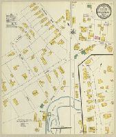
Sanborn fire insurance maps are a rich source of historic data on the urban built environment of North America during the 19th and early 20th centuries. The atlases were created for the purpose of underwriting fire insurance policies, which depended u...
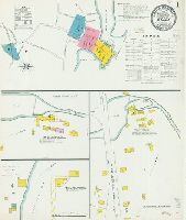
Description:
"(6399)."
Subject (Geographic):
Plainfield (Conn.)--Maps
Subject (Name):
Library of Congress Stamp and Library of Congress. Map Division Stamp
Subject (Topic):
Fire risk assessment--Connecticut--Plainfield--Maps and Real property--Connecticut--Plainfield--Maps
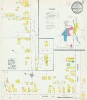
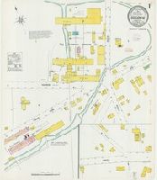
Sanborn fire insurance maps are a rich source of historic data on the urban built environment of North America during the 19th and early 20th centuries. The atlases were created for the purpose of underwriting fire insurance policies, which depended u...
Alternative Title:
Feb. 1908, Clinton, Conn.
Description:
"4 sheets, 83."
Subject (Geographic):
Clinton (Conn.)--Maps
Subject (Name):
Library of Congress Stamp and Library of Congress. Map Division Stamp
Subject (Topic):
Fire risk assessment--Connecticut--Clinton--Maps and Real property--Connecticut--Clinton--Maps
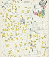
Sanborn fire insurance maps are a rich source of historic data on the urban built environment of North America during the 19th and early 20th centuries. The atlases were created for the purpose of underwriting fire insurance policies, which depended u...
Alternative Title:
Aug. 1908, Colchester, Conn.
Description:
"3 sheets. 544."
Subject (Geographic):
Colchester (Conn.)--Maps
Subject (Name):
Library of Congress Stamp and Library of Congress. Map Division Stamp
Subject (Topic):
Fire risk assessment--Connecticut--Colchester--Maps and Real property--Connecticut--Colchester--Maps
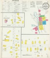
Sanborn fire insurance maps are a rich source of historic data on the urban built environment of North America during the 19th and early 20th centuries. The atlases were created for the purpose of underwriting fire insurance policies, which depended u...
Alternative Title:
Dec. 1903, Collinsville, Conn.
Description:
"6650. 4 sheets."
Subject (Geographic):
Collinsville (Conn.)--Maps
Subject (Name):
Library of Congress Stamp and Library of Congress. Map Division Stamp
Subject (Topic):
Fire risk assessment--Connecticut--Collinsville--Maps and Real property--Connecticut--Collinsville--Maps
Sanborn fire insurance maps are a rich source of historic data on the urban built environment of North America during the 19th and early 20th centuries. The atlases were created for the purpose of underwriting fire insurance policies, which depended u...
Alternative Title:
July 1903, Danielson, Conn.
Description:
"8 sheets. 6386."
Subject (Geographic):
Killingly (Conn. : Town)--Maps
Subject (Name):
Library of Congress Ownership and Library of Congress. Map Division Stamp
Subject (Topic):
Fire risk assessment--Connecticut--Killingly (Town)--Maps and Real property--Connecticut--Killingly (Town)--Maps
Sanborn fire insurance maps are a rich source of historic data on the urban built environment of North America during the 19th and early 20th centuries. The atlases were created for the purpose of underwriting fire insurance policies, which depended u...
Alternative Title:
Aug. 1908, East Hampton, Conn.
Description:
"2 sheets. #539."
Subject (Geographic):
East Hampton (Conn. : Town)--Maps
Subject (Name):
Library of Congress Stamp and Library of Congress. Map Division Stamp
Subject (Topic):
Fire risk assessment--Connecticut--East Hampton (Town)--Maps and Real property--Connecticut--East Hampton (Town)--Maps
Sanborn fire insurance maps are a rich source of historic data on the urban built environment of North America during the 19th and early 20th centuries. The atlases were created for the purpose of underwriting fire insurance policies, which depended u...
Alternative Title:
Feb. 1908, Essex, Conn.
Description:
"7 sheets. 133."
Subject (Geographic):
Essex (Conn. : Town)--Maps
Subject (Name):
Library of Congress Stamp and Library of Congress. Map Division Stamp
Subject (Topic):
Fire risk assessment--Connecticut--Essex (Town)--Maps and Real property--Connecticut--Essex (Town)--Maps
Sanborn fire insurance maps are a rich source of historic data on the urban built environment of North America during the 19th and early 20th centuries. The atlases were created for the purpose of underwriting fire insurance policies, which depended u...
Alternative Title:
Mar. 1908, Higganum, Conn.
Description:
"2 sheets. 162."
Subject (Geographic):
Higganum (Conn.)--Maps
Subject (Name):
Library of Congress Stamp and Library of Congress. Map Division Stamp
Subject (Topic):
Fire risk assessment--Connecticut--Higganum--Maps and Real property--Connecticut--Higganum--Maps
Sanborn fire insurance maps are a rich source of historic data on the urban built environment of North America during the 19th and early 20th centuries. The atlases were created for the purpose of underwriting fire insurance policies, which depended u...
Alternative Title:
Danbury, Fairfield County, Connecticut and Feb. 1904, Danbury, Conn.
Description:
"23 sheets. (6774)."
Subject (Geographic):
Danbury (Conn.)--Maps
Subject (Name):
Library of Congress Stamp and Library of Congress. Map Division Stamp
Subject (Topic):
Fire risk assessment--Connecticut--Danbury--Maps and Real property--Connecticut--Danbury--Maps
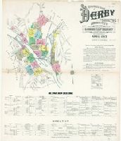
Sanborn fire insurance maps are a rich source of historic data on the urban built environment of North America during the 19th and early 20th centuries. The atlases were created for the purpose of underwriting fire insurance policies, which depended u...
Alternative Title:
Apr. 1912, Derby, Conn., Apr. 1912, Derby, Conn. Shelton., and Derby and Shelton, New Haven County, Connecticut.
Description:
"22 sheets. (4763)."
Subject (Geographic):
Derby (Conn.)--Maps and Shelton (Conn.)--Maps
Subject (Name):
Library of Congress Stamp and Library of Congress. Map Division Stamp
Subject (Topic):
Fire risk assessment--Connecticut--Derby--Maps, Fire risk assessment--Connecticut--Shelton--Maps, Real property--Connecticut--Derby--Maps, and Real property--Connecticut--Shelton--Maps