Coast chart ; no. 103(2), Mount Desert Island Maine, and U.S.C. & G.S. (Series) ; no. 103(2)
Description:
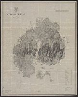
Includes a chart of heights of mountains and hills above mean high water, a chart of summer level of lakes and ponds above mean high water, and latitude and longitude of Baker's I Light House and Mt. Desert light on Green Mt. and Relief shown by hachures.
Publisher:
U.S. Coast and Geodetic Survey,
Subject (Geographic):
Maine--Maps
Subject (Name):
Donn, J. W. (John W.), 1835-1905, Hilgard, J. E. (Julius Erasmus), 1825-1891, and Patterson, C. P. (Carlile Pollock), 1816-1881