Search
You Searched For
Search Results
- Creator:
- Wit, Frederik de
- Published / Created:
- [1675]
- Call Number:
- 21cea 1680
- Container / Volume:
- BRBL_00682
- Image Count:
- 1
- Resource Type:
- Maps, Atlases & Globes
- Alternative Title:
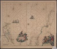
- Terra Neuf, en de custen van Nieu Engeland, Nieu Nederland, Nieu Andalusia, Guiana en Venezuela
- Description:
- Covers the Atlantic Ocean west of the Azores and Cape Verde Islands, and the coasts of northeastern North America and northern South Amerca.
- Publisher:
- Gedruckt by Fredrick de Wit in de Kalverstrae,
- Subject (Geographic):
- Atlantic Provinces--Maps--Early works to 1800 and North Atlantic Ocean--Maps--Early works to 1800
- Subject (Name):
- Wit, Frederik de. Orbis Maritimus ofte Zee Atlas
- Subject (Topic):
- Nautical charts--Atlantic Ocean--Early works to 1800
- Found in:
- Beinecke Rare Book and Manuscript Library > Terra Nova ac maris tractus circa Novam Franciam, Angliam, Belgium, Venezuelam, Novam Andalusiam, Guianam, et Brasiliam / Apu[d] F. de Wit = Terra Neuf en de custen van Nieu Engeland, Nieu Nederland, Nieu Andalusia, Guiana en Venezuela / Fredrick de Wit.
- Creator:
- Wit, Frederik de
- Published / Created:
- [ca. 1680?]
- Call Number:
- 51 1680
- Container / Volume:
- BRBL_00278
- Image Count:
- 1
- Resource Type:
- Maps, Atlases & Globes
- Alternative Title:
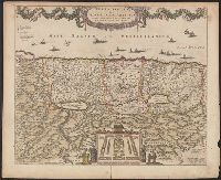
- Promissionis, olim Palestina
- Description:
- "20" in upper right corner.
- Publisher:
- Gedruckt tot Amsterdam by Frederick de Wit in de Calverstraet by den Dam inde Witte Paskaert,
- Subject (Geographic):
- Palestine--History--To 70 A.D.--Maps and Palestine--Maps--Early works to 1800
- Subject (Name):
- Wit, Frederik de. Atlas
- Found in:
- Beinecke Rare Book and Manuscript Library > Terra Sancta, sive Promissionis, olim Palestina / recens delineata, et in lucem edita per Fredericum de Wit.
- Creator:
- Wit, Frederik de
- Published / Created:
- [1715]
- Call Number:
- 70 1715
- Container / Volume:
- BRBL_00686
- Image Count:
- 1
- Resource Type:
- Maps, Atlases & Globes
- Alternative Title:
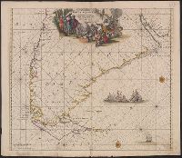
- Terra neuf, en de custen van Nieu Vranckryck, Nieu Engeland, Nieu Nederland, Nieu Andalusia, Guiana en Venezuela
- Description:
- At upper right corner: Fol. 26.
- Publisher:
- Gedruckt by L. Renard,
- Subject (Geographic):
- North Atlantic Ocean--Maps--Early works to 1800
- Subject (Name):
- Renard, Louis. Atlas de la navigation et du commerce
- Subject (Topic):
- Nautical charts--North Atlantic Ocean--Early works to 1800
- Found in:
- Beinecke Rare Book and Manuscript Library > Terra nova, ac maris tractus circa Novam Franciam, Angliam, Belgium, Venezuelam Novam, Andalusiam, Guianan, et Brasiliam / L. Renard = Terra neuf, en de custen van Nieu Vranckryck, Nieu Engeland, Nieu Nederland, Nieu Andalusia, Guiana en Venezuela.
- Creator:
- Wit, Frederik de
- Published / Created:
- [ca. 1700?]
- Call Number:
- 70 1700A
- Container / Volume:
- BRBL_00354
- Image Count:
- 1
- Resource Type:
- Maps, Atlases & Globes
- Alternative Title:
- Terra neuf, en de custen van Nieu Vranckryck, Nieu Engeland, Nieu Nederland, Nieu Andalusia, Guiana en Venezuela
- Description:
- Covers the Atlantic Ocean west of the Azores and Cape Verde Islands, and the coasts of northeastern North America and northern South Amerca.
- Publisher:
- Gedruckt by Fredrick de Wit in de Kalverstraet,
- Subject (Geographic):
- North Atlantic Ocean--Maps--Early works to 1800
- Subject (Topic):
- Nautical charts--North Atlantic Ocean--Early works to 1800
- Found in:
- Beinecke Rare Book and Manuscript Library > Terra nova, ac maris tractus circa Novam Franciam, Angliam, Belgium, Venezuelam Novam, Andalusiam, Guianan, et Brasiliam = Terra neuf, en de custen van Nieu Vranckryck, Nieu Engeland, Nieu Nederland, Nieu Andalusia, Guiana en Venezuela / F. de Wit.
- Creator:
- Wit, Frederik de
- Published / Created:
- ca. 1675]
- Call Number:
- 90cea 1650
- Container / Volume:
- BRBL_00698
- Image Count:
- 1
- Resource Type:
- Maps, Atlases & Globes
- Alternative Title:
- Nieuwe perfecte pascaert van t' Suyderlyckste deel van Suyt America van Rio de la Plata door de straet Magellaen tot Toral
- Description:
- Appears in Wit's Orbis Maritimus ofte Zee Atlas.
- Publisher:
- Frederick de Wit,
- Subject (Geographic):
- Magellan, Strait of (Chile and Argentina)--Maps--Early works to 1800 and South America--Maps--Early works to 1800
- Subject (Name):
- Wit, Frederik de. Orbis Maritimus ofte Zee Atlas
- Subject (Topic):
- Coasts--South America--Maps--Early works to 1800 and Nautical charts--Magellan, Strait of (Chile and Argentina)--Maps--Early works to 1800
- Found in:
- Beinecke Rare Book and Manuscript Library > Tractus Australior Americae Meridionalis : a Rio de la Plata per Fretum Magellanicum ad Toraltum = Nieuwe perfecte pascaert van t' Suyderlyckste deel van Suyt America van Rio de la Plata door de straet Magellaen tot Toral.