
- Creator:
- Geological Survey of New Jersey
- Published / Created:
- 1888]
- Call Number:
- 773cbf Eg31 1888
- Container / Volume:
- BRBL_00497
- Image Count:
- 1
- Resource Type:
- Maps, Atlases & Globes
- Description:
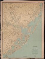
- "From original surveys and levelings based on the triangulation of the U.S. Coast and Geodetic Survey.", Geological Survey of New Jersey. Annual Report of the State Geologist 1887., Geological Survey of New Jersey. Atlas Sheet 16 (Egg Harbor) (1888)., and Relief shown by contours and spot heights; depths by isobaths and soundings.
- Publisher:
- Geological Survey of New Jersey,
- Subject (Geographic):
- Atlantic County (N.J.)--Maps, Burlington County (N.J.)--Maps, and Ocean County (N.J.)--Maps
- Found in:
- Beinecke Rare Book and Manuscript Library > A topographical map of Egg Harbor and vicinity [cartographic material] : including the Atlantic shore from Barnegat Bay to Egg Harbor.