Skip to search
Skip to main content
Skip to first result
Search
You Searched For
Extent of Digitization
Completely digitized
Format
cartographic
Subject (Topic)
Railroads--New York (State)--Maps
Search Results
Creator:
Published / Created:
[1910?]
Call Number:
754gme 1910A
Container / Volume:
BRBL_00420
Image Count:
1
Resource Type:
Maps, Atlases & Globes
Description:
Includes mileage charts of railways.
Publisher:
The Company,
Subject (Name):
Buffalo, Rochester, and Pittsburgh Railway Company and Buffalo, Rochester, and Pittsburgh Railway Company--Maps
Subject (Topic):
Railroads--New York (State)--Maps and Railroads--Pennsylvania--Maps
Found in:
Beinecke Rare Book and Manuscript Library > Buffalo, Rochester and Pittsburgh Railway and connections / Rand McNally & Co.
Creator:
Published / Created:
1861
Call Number:
75 1861D
Container / Volume:
BRBL_00402
Image Count:
1
Resource Type:
Maps, Atlases & Globes
Alternative Title:
Map of the great railroad routes from the Middle Atlantic ports to the Mississippi River., Map of the railroads of New England and eastern N. York., and Map of the United States & Canada
Description:
Includes statistical charts: Population of the United States (by state and territory, 1790-1860) -- Ratio of slaves to total population -- Positions of forts.
Publisher:
G.Q. Colton,
Subject (Geographic):
Canada--Maps and United States--Maps
Subject (Topic):
Railroads--New England--Maps, Railroads--New York (State)--Maps, and Railroads--United States--Maps
Found in:
Beinecke Rare Book and Manuscript Library > Goldthwait's map of the United States & Canada : exhibiting the railroads with their distances, single and double tracks and width of gauge, and the time compared with noon at Washington & Greenwich / by J.H. Goldthwait.
Creator:
Published / Created:
1845
Call Number:
766gme 1845N
Container / Volume:
BRBL_00475A
Image Count:
5
Resource Type:
Maps, Atlases & Globes
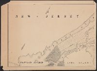
Abstract:
Detailed topographic strip map showing the coast from New York City to New Haven, Conn. Indicates drainage, relief by hachures, cities and towns, roads, and railroads. Chartered in 1844, organized in 1846, opened in 1849. [From published bibliography]...
Description:
Relief shown by hachures.
Publisher:
Snyder & Black Lithogrs.,
Subject (Name):
New York and New Haven Railroad Company--Maps and Snyder & Black Lithogrs
Subject (Topic):
Railroads--Connecticut--Maps and Railroads--New York (State)--Maps
Found in:
Beinecke Rare Book and Manuscript Library > Map exhibiting the experimental and located lines for the New-York and New-Haven Rail-Road. Projected and drawn by P. Anderson, civil engr.
Creator:
Published / Created:
1865]
Call Number:
734 1865
Container / Volume:
BRBL_00379
Image Count:
1
Resource Type:
Maps, Atlases & Globes
Alternative Title:
Golconda gold mines
Description:
"Entered according to Act of Congress in the year 1865 by J.H. Colton ..."
Publisher:
J.H. Colton,
Subject (Name):
Colton, J. H. (Joseph Hutchins), 1800-1893
Subject (Topic):
Gold mines and mining--Québec (Province)--Maps, Gold ores--Geology--Québec (Province)--Maps, Gold ores--Geology--Vermont--Maps, Railr, Railroads--New England--Maps, and Railroads--New York (State)--Maps
Found in:
Beinecke Rare Book and Manuscript Library > Map illustrating the geological position of the Golconda gold mines / by C.H. Hitchcock ; to which has been added the railway connections by J.H. Colton.
Creator:
Published / Created:
1868
Call Number:
771 1868A
Container / Volume:
BRBL_00479
Image Count:
1
Resource Type:
Maps, Atlases & Globes
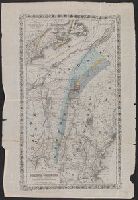
Description:
Covers areas of N.Y., Conn., and Mass. surrounding their intersection.
Publisher:
H.H. Lloyd & Co.'s Map Establishment,
Subject (Geographic):
Connecticut--Maps, Massachusetts--Maps, and New York (State)--Maps
Subject (Name):
Connecticut Western Railroad Co.--Maps and Dutchess and Columbia Railroad Co.--Maps
Subject (Topic):
Railroads--Connecticut--Maps, Railroads--Massachusetts--Maps, and Railroads--New York (State)--Maps
Found in:
Beinecke Rare Book and Manuscript Library > Map of portions of New York and New England showing the routes of the Dutchess and Columbia & Connecticut Western Rail Roads / Oliver W. Barnes.
Creator:
Published / Created:
[1863]
Call Number:
76gme 1863
Container / Volume:
BRBL_00446A
Image Count:
2
Resource Type:
Maps, Atlases & Globes
Description:
"Snow's Pathfinder railway guide, week ending Saturday, July 9, 1864. Supplement."
Publisher:
Geo. K. Snow & Hapgood,
Subject (Name):
Sharp, William Comely, 1822-1897
Subject (Topic):
Railroads--New England--Maps and Railroads--New York (State)--Maps
Found in:
Beinecke Rare Book and Manuscript Library > Map of railways in the New England states : engraved expressly for Snow's Pathfinder Railway Guide. 1863.
Creator:
Published / Created:
1893
Call Number:
771 Ad47 1893
Container / Volume:
BRBL_00480
Image Count:
4
Resource Type:
Maps, Atlases & Globes
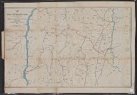
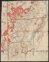
Description:
Includes inset "Railroad and county map of northern New York."
Publisher:
The Commission,
Subject (Geographic):
Adirondack Forest Preserve (N.Y.)--Maps and New York (State)--Public lands--Maps
Subject (Name):
Koetteritz, John B., 1853-
Subject (Topic):
Forests and forestry--New York (State)--Maps and Railroads--New York (State)--Maps
Found in:
Beinecke Rare Book and Manuscript Library > Map of the Adirondack Forest and adjoining territory : compiled from the official maps and field notes on file in the State Department at Albany, N.Y. / by J.B. Koetteritz ; by authority of the State Forest Commission.
Creator:
Published / Created:
1857
Call Number:
771gme 1857V
Container / Volume:
BRBL_00494
Image Count:
1
Resource Type:
Maps, Atlases & Globes
Description:
Copy 1: Imperfect
Publisher:
C. Van Benthuysen,
Subject (Name):
Van Benthuysen, C. (Charles), 1817-1881
Subject (Topic):
Railroads--New York (State)--Maps
Found in:
Beinecke Rare Book and Manuscript Library > Map of the rail-roads of the state of New York / prepared under the direction of the Rail Road Commission ; drawn by David Vaughan.
Creator:
Published / Created:
1857
Call Number:
771gme 1857V
Container / Volume:
BRBL_00494
Image Count:
1
Resource Type:
Maps, Atlases & Globes
Description:
Covers also parts of adjacent states.
Publisher:
C. Van Benthuysen,
Subject (Name):
Van Benthuysen, C. (Charles), 1817-1881
Subject (Topic):
Railroads--New York (State)--Maps
Found in:
Beinecke Rare Book and Manuscript Library > Map of the rail-roads of the state of New York / prepared under the direction of the Rail Road Commission ; drawn by David Vaughan.
Creator:
Published / Created:
1880
Call Number:
771gme 1880
Container / Volume:
BRBL_00494
Image Count:
2
Resource Type:
Maps, Atlases & Globes
Description:
Also shows drainage, canals and county boundaries.
Publisher:
Lith. by Weed, Parsons & Co.,
Subject (Geographic):
New York (State)--Administrative and political divisions--Maps and New York (State)--Maps
Subject (Name):
Seymour, Horatio, 1810-1886 and Smalley, Edward D
Subject (Topic):
Canals--New York (State)--Maps and Railroads--New York (State)--Maps
Found in:
Beinecke Rare Book and Manuscript Library > Map of the railroads of the State of New York / prepared under the direction of Horatio Seymour Jr., State Engr. & Surveyor, Edward D. Smalley, Deputy State Engr. & Survr.
Branch:v1.68.6 ,Deployed:2025-07-02T08:09:21-04:00