Search
You Searched For
Search Results
- Published / Created:
- 1774
- Call Number:
- 62 1774
- Container / Volume:
- BRBL_00333
- Image Count:
- 1
- Resource Type:
- Maps, Atlases & Globes
- Publisher:
- Printed for Robt. Sayer,
- Subject (Geographic):
- Ethiopia--Maps--Early works to 1800
- Found in:
- Beinecke Rare Book and Manuscript Library > A Map of Abyssinia and Nubia, By Samuel Dunn.
- Published / Created:
- [1833?]
- Call Number:
- 764 AM47 1833
- Container / Volume:
- BRBL_00453
- Image Count:
- 1
- Resource Type:
- Maps, Atlases & Globes
- Publisher:
- Pendleton Lith.,
- Found in:
- Beinecke Rare Book and Manuscript Library > A Map of Amherst with a view of the College ... by Alonzo Gray & Charles B. Adams ... 1833.
- Published / Created:
- [1840?].
- Call Number:
- 764 B77 1740
- Container / Volume:
- BRBL_00710
- Image Count:
- 1
- Resource Type:
- Maps, Atlases & Globes
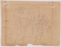
- Description:
- Perhaps traced from another map.
- Subject (Geographic):
- Brimfield (Mass. : Town)--Maps, Manuscript--Early works to 1800
- Found in:
- Beinecke Rare Book and Manuscript Library > A Map of Brimfield as it was from its settlement 1720 till 1740. [Rev.] J[ason] Morse.
- Published / Created:
- 1722]
- Call Number:
- 755 1722A
- Container / Volume:
- BRBL_00425
- Image Count:
- 1
- Resource Type:
- Maps, Atlases & Globes
- Publisher:
- s. n.,
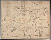
- Subject (Geographic):
- East (U.S.)--Maps--Early works to 1800
- Found in:
- Beinecke Rare Book and Manuscript Library > A Map of Carolana and the river of Meschacebe.
- Published / Created:
- 1757
- Call Number:
- 304 1757
- Container / Volume:
- BRBL_00033
- Image Count:
- 1
- Resource Type:
- Maps, Atlases & Globes
- Description:
- Preliminary record.
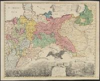
- Subject (Geographic):
- Europe, Central--Maps--Early works to 1800
- Found in:
- Beinecke Rare Book and Manuscript Library > A Map of Central Europe.
- Published / Created:
- 1801
- Call Number:
- 3191 1801
- Container / Volume:
- BRBL_00041
- Image Count:
- 1
- Resource Type:
- Maps, Atlases & Globes
- Description:
- Preliminary record.
- Publisher:
- Jones & Smith Se.,
- Subject (Geographic):
- Great Britain--Maps
- Found in:
- Beinecke Rare Book and Manuscript Library > A Map of England, Wales, & Scotland ... by W. Faden ...
- Published / Created:
- [1830?]
- Call Number:
- 764 H59 1830
- Container / Volume:
- BRBL_00457
- Image Count:
- 1
- Resource Type:
- Maps, Atlases & Globes
- Publisher:
- Pendleton's Lithog.,
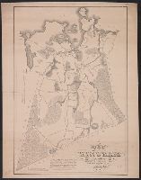
- Subject (Geographic):
- Hingham (Mass.)--Maps
- Found in:
- Beinecke Rare Book and Manuscript Library > A Map of Hingham surveyed by Jedediah Lincon and Reuben hersey Jr. in 1830.
- Published / Created:
- [1795?]
- Call Number:
- 327 1795A
- Container / Volume:
- BRBL_00072
- Image Count:
- 1
- Resource Type:
- Maps, Atlases & Globes
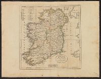
- Subject (Geographic):
- Ireland--Maps--Early works to 1800
- Found in:
- Beinecke Rare Book and Manuscript Library > A Map of Ireland ...
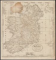
- Published / Created:
- 1795
- Call Number:
- 327 1795B
- Container / Volume:
- BRBL_00072
- Image Count:
- 1
- Resource Type:
- Maps, Atlases & Globes
- Description:
- From Carey's American Edition of Guthrie's Geography Improved.
- Publisher:
- Mathew Carey,
- Subject (Geographic):
- Ireland--Maps--Early works to 1800
- Found in:
- Beinecke Rare Book and Manuscript Library > A Map of Ireland according to the best authorities.
- Published / Created:
- [1798?]
- Call Number:
- 327 1798
- Container / Volume:
- BRBL_00073
- Image Count:
- 1
- Resource Type:
- Maps, Atlases & Globes
- Subject (Geographic):
- Ireland--Maps--Early works to 1800
- Found in:
- Beinecke Rare Book and Manuscript Library > A Map of Ireland according to the best authorities. Engraved for Plowden's Historical Review of the State of Ireland.