Search
You Searched For
Search Results
- Published / Created:
- [1797]
- Call Number:
- 85 1797
- Container / Volume:
- BRBL_00637
- Image Count:
- 1
- Resource Type:
- Maps, Atlases & Globes
- Description:
- W. Baker sculp. Engraved for Carey's American Edition of Gutherie's Geography improved.
- Publisher:
- ,
- Subject (Geographic):
- West Indies--Maps--Early works to 1800
- Found in:
- Beinecke Rare Book and Manuscript Library > A Chart of the West Indies, From the latest Marine Journals and Surveys.
- Published / Created:
- [1795?]
- Call Number:
- 11 1795A
- Container / Volume:
- BRBL_00006
- Image Count:
- 1
- Resource Type:
- Maps, Atlases & Globes
- Description:
- 2 copies.
- Subject (Geographic):
- World--Maps--Early works to 1800
- Found in:
- Beinecke Rare Book and Manuscript Library > A Chart of the World, According to Mercator's Projection, showing the latest discoveries of Capt. Cook.
- Published / Created:
- 1779
- Call Number:
- 771 1779A
- Container / Volume:
- BRBL_00477
- Image Count:
- 3
- Resource Type:
- Maps, Atlases & Globes
- Description:
- 3 sheets.
- Publisher:
- William Faden,
- Subject (Geographic):
- New York--Maps--Early works to 1800
- Found in:
- Beinecke Rare Book and Manuscript Library > A Chorographical map of the Province of New York ... Mayor General William Tryon, by Claude Joseph Sauthier Esqr.
- Published / Created:
- 1849
- Call Number:
- 771 1779
- Container / Volume:
- BRBL_00477
- Image Count:
- 1
- Resource Type:
- Maps, Atlases & Globes
- Description:
- Reproduction.
- Publisher:
- H. Pease,
- Subject (Geographic):
- New York--Maps--Early works to 1800
- Found in:
- Beinecke Rare Book and Manuscript Library > A Chorographical map of the Province of New York in North America, divided into counties, manors towns, patents and townships ... by Claude J. Sauthier ... London ... William Faden,1779.
- Published / Created:
- 1770
- Call Number:
- 785 1770
- Container / Volume:
- BRBL_00513
- Image Count:
- 1
- Resource Type:
- Maps, Atlases & Globes
- Description:
- From Streeter Collection -cat. no. 1132.
- Publisher:
- S. Hooper,
- Subject (Geographic):
- North Carolina--Maps--Early works to 1800
- Found in:
- Beinecke Rare Book and Manuscript Library > A Compleat Map of North-Carolina from an actual Survey. By Capnt. [John A. ] Collet, Governor of Fort Johnson, Engraved by I. Bayly. Published according to Act of Parliament May the 1st. 1770, by S. Hooper Nọ 25 Ludgate Hill, London.
- Published / Created:
- [1782?]
- Call Number:
- 48 1782
- Container / Volume:
- BRBL_00262
- Image Count:
- 1
- Resource Type:
- Maps, Atlases & Globes
- Subject (Geographic):
- Greece--Maps--Early works to 1800
- Found in:
- Beinecke Rare Book and Manuscript Library > A Correct Map of Antient Greece. Engraved for Miller's New Complete & Universal System of Geography. Conder, Sculp.
- Published / Created:
- [1745?]
- Call Number:
- 36 1745
- Container / Volume:
- BRBL_00118
- Image Count:
- 1
- Resource Type:
- Maps, Atlases & Globes
- Subject (Geographic):
- Germany--Maps--Early works to 1800
- Found in:
- Beinecke Rare Book and Manuscript Library > A Correct Map of the North West part of Germany containing Westphalia & Lower Saxony ... by Eman Bowen.
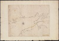
- Published / Created:
- 1714
- Call Number:
- 732 F963 1714
- Container / Volume:
- BRBL_00708
- Image Count:
- 1
- Resource Type:
- Maps, Atlases & Globes
- Description:
- Color: pen and ink drawing with some yellow.
- Subject (Geographic):
- Nova Scotia--Maps, Manuscript--Early works to 1800
- Found in:
- Beinecke Rare Book and Manuscript Library > A Draft of the Bay of Fundy by John Wells.
- Published / Created:
- ca. 1880]
- Call Number:
- 30 1880A
- Container / Volume:
- BRBL_00032
- Image Count:
- 1
- Resource Type:
- Maps, Atlases & Globes
- Description:
- Ancillary text: A chave do enigma.
- Subject (Geographic):
- Europe--Maps
- Subject (Topic):
- Caricature--Europe--Maps and Russo-Turkish War, 1877-1878--Maps
- Found in:
- Beinecke Rare Book and Manuscript Library > A Europa em 1877 : mappa burlesco da guerra / por Abdul-Azis ; Livrarie Ferreira, editora ... ; Lith. Palhares ...