Search
You Searched For
Search Results
- Published / Created:
- 1808
- Call Number:
- 89cea 1808
- Container / Volume:
- BRBL_00658
- Image Count:
- 4
- Resource Type:
- Maps, Atlases & Globes
- Description:
- Inset: Chart of the Virgin Islands.
- Publisher:
- W.Faden,
- Subject (Geographic):
- Central America--Maps
- Found in:
- Beinecke Rare Book and Manuscript Library > A General Chart of the West Indies and Gulf of Mexico, describing the Gulf and Winward Passages, Coasts of Florida, Louisiana and Mexico, Bay of Honduras and Musquito Shore ... Drawn from the surveys taken by Mr. Geo Gaulo ... by Foss Dessiou.
- Published / Created:
- 1796
- Call Number:
- 90 1796
- Container / Volume:
- BRBL_00661
- Image Count:
- 1
- Resource Type:
- Maps, Atlases & Globes
- Description:
- B. Tanner sculpt.
- Publisher:
- John Reid,
- Subject (Geographic):
- South America--Maps--Early works to 1800
- Found in:
- Beinecke Rare Book and Manuscript Library > A General Map Of South America. from the Best Surveys.
- Published / Created:
- 1776
- Call Number:
- 755 1776A
- Container / Volume:
- BRBL_00430
- Image Count:
- 1
- Resource Type:
- Maps, Atlases & Globes
- Description:
- From the American Military Pocket Atlas of the British Colonies, which now are or may be The Theatre of War. See 71.1774, Pamphlet box.
- Publisher:
- Printed for R. Sayer and J. Bennett,
- Subject (Geographic):
- East (U.S.)--Maps--Early works to 1800
- Found in:
- Beinecke Rare Book and Manuscript Library > A General Map of the Southern British Colonies in America, comprehending North and South Carolina, Georgia, East and West Florida, with the Neighboring Indian Countries ... by B. Romans, 1776.
- Published / Created:
- 1787
- Call Number:
- 11 1787
- Container / Volume:
- BRBL_00006
- Image Count:
- 2
- Resource Type:
- Maps, Atlases & Globes
- Description:
- Preliminary record.
- Publisher:
- Robert Sayer,
- Subject (Geographic):
- World--Maps--Early works to 1800
- Found in:
- Beinecke Rare Book and Manuscript Library > A General Map of the World or Terraqueous globe with all the new discoveries ... by Sam'l Dunn ...
- Published / Created:
- [1711?] and 1746.
- Call Number:
- 3191hc 1746
- Container / Volume:
- BRBL_00041
- Image Count:
- 1
- Resource Type:
- Maps, Atlases & Globes
- Description:
- G. Vertue, Sculp.
- Publisher:
- B. Lens,
- Subject (Geographic):
- Great Britain--Maps--Early works to 1800 and South America--Maps--Early works to 1800
- Found in:
- Beinecke Rare Book and Manuscript Library > A General map of Great Britain ..., To the right Honourable ... This map of South America ... H. Moll, Geographer. B. Lens, delin G. Vertus, Sculp.
- Published / Created:
- 1667
- Call Number:
- 66 1667
- Container / Volume:
- BRBL_00347
- Image Count:
- 1
- Resource Type:
- Maps, Atlases & Globes
- Subject (Geographic):
- Morocco--Maps--Early works to 1800
- Found in:
- Beinecke Rare Book and Manuscript Library > A Generall Mapp of the Coast of Barbarie, where in are the Kingdoms, and Estates of Morocco, Fez, Algiers, Tunis, and Tripolis: also, the Kingdoms, Estates, and Deserts of Barca, Egipt, Libya, Biledulgerid, Segelmesse, and Darha ... By Monsieur Sanson. Il
- Published / Created:
- 1796
- Call Number:
- 75 1796A
- Container / Volume:
- BRBL_00396
- Image Count:
- 1
- Resource Type:
- Maps, Atlases & Globes
- Subject (Geographic):
- United States--Maps--Early works to 1800
- Found in:
- Beinecke Rare Book and Manuscript Library > A Geographical View of all the Post Towns in the United States of America and their distances from each other according to the establishment of the Postmaster General, 1796. By Samuel A. Puddock, Accomptant, Boston. B. Callender, Sculp., Boston.
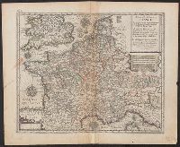
- Published / Created:
- [1660?]
- Call Number:
- 38 1660
- Image Count:
- 1
- Resource Type:
- Maps, Atlases & Globes
- Publisher:
- Printed and Sould by Jo. Ouerton,
- Subject (Geographic):
- France--Maps--Early works to 1800
- Found in:
- Beinecke Rare Book and Manuscript Library > A Geographicall description of France ...
- Published / Created:
- [1822?]
- Call Number:
- 767CA 1822
- Container / Volume:
- BRBL_00476
- Image Count:
- 1
- Resource Type:
- Maps, Atlases & Globes
- Description:
- Engraved by A. Doolittle,1822.
- Subject (Geographic):
- Connecticut--Maps
- Found in:
- Beinecke Rare Book and Manuscript Library > A Geological Map of the Connecticut.
- Published / Created:
- [1750?]
- Call Number:
- 3211cea 1750
- Container / Volume:
- BRBL_00055
- Image Count:
- 2
- Resource Type:
- Maps, Atlases & Globes
- Description:
- Insets: Falmouth H., Plymouth Hr. Isle of Wight ca. 1:200,000.
- Publisher:
- Will. Mount and Tho. Page,
- Subject (Geographic):
- English Channel--Maps--Early works to 1800
- Found in:
- Beinecke Rare Book and Manuscript Library > A Large Chart of the Channel between England and France ... by Capt. Edmund Halley ...