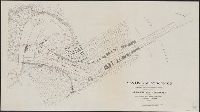
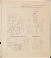
Atlas accompanying volumes I & IV, Geological survey of Wisconsin., Atlas accompanying volumes I and IV, Geological survey of Wisconsin., Geology of Wisconsin, survey of 1873-1879., and Wisconsin geological survey.
Description:
Cover title: Atlas accompanying volumes I & IV, Geological survey of Wisconsin.
Publisher:
Milwaukee Litho. & Engr. Co.,
Subject (Geographic):
Wisconsin--Maps
Subject (Name):
Chamberlin, Thomas C. (Thomas Chrowder), 1843-1928, Irving, R. D, and Strong, Moses McCure
Copy 2: Imperfect: disbound; all sheets but Belluno, Trient, Padua, and Verona wanting; trimmed along neat line, with loss of marginal data. Sheets dissected and mounted on cloth. Stamps on verso: K.K. Un
Publisher:
Im Verlage der Herder'schen Kunst und Buchhandlung,
Copy 1: Imperfect: disbound; all sheets but Padua, Verona, and Milano wanting; trimmed along neat line, with loss of marginal data. Sheets dissected and mounted on cloth.
Publisher:
Im Verlage der Herder'schen Kunst und Buchhandlung,
Manuscript, on parchment, in unidentified hand of pseudo(?)-Eustachi' Tabulae Anatomicae. Includes 307 pen and ink anatomical drawings, many hand colored, with commentary. Consisting of three parts written by the same hand and bound together: part 1 (...
Alternative Title:
Bartholomaei Eustachii Tabulae quaedam anatomicae cum explicatione autographa, quae diu apud haeredes Matthaei Pini Urbinatis delituerunt; tandemque anno MDCCXV inventae sunt and Tabulae quaedam anatomicae : cum explicatione autographa
Description:
In Latin.
Subject (Topic):
Human anatomy, Medicine, Medieval, Medicine, and Manuscripts
Homann Erben (Firm) Mayer, Tobias, 1723-1762 Schneider, R. A.
Published / Created:
1747 [i.e. 1748?]
Call Number:
1975 Folio 31
Collection Title:
[Atlas factice of 42 maps, produced by the Homann Erben firm]
Image Count:
1
Alternative Title:
Carte des XVII. provinces ou de l’Allemagne inferievre, dressee suivant la projection stereographique, et appueyee par les mesures faites de Mess. Cassini, Snellius et Mouschenbrok, par Mr. Tob. Majer de la Societe geographique, et publiee par les Heritiers de Homann, l’An 1748
Publisher:
Cura et Studio Homannianorum Heredum
Subject (Geographic):
Belgium --Maps --Early works to 1800, Benelux countries --Maps --Early works to 1800, Luxembourg --Maps --Early works to 1800, and Netherlands --Maps --Early works to 1800
[Atlas factice of 32 maps and 1 distance table, produced by the Homann Erben firm]
Image Count:
2
Alternative Title:
Carte des XVII. provinces ou de l’Allemagne inferievre, dressee suivant la projection stereographique, et appueyee par les mesures faites de Mess. Cassini, Snellius et Mouschenbrok, par Mr. Tob. Majer de la Societe geographique, et publiee par les Heritiers de Homann, l’An 1748
Publisher:
Cura et Studio Homannianorum Heredum
Subject (Geographic):
Belgium --Maps --Early works to 1800, Benelux countries --Maps --Early works to 1800, Luxembourg --Maps --Early works to 1800, and Netherlands --Maps --Early works to 1800
[Atlas factice of 42 maps, produced by the Homann Erben firm]
Image Count:
1
Resource Type:
Maps, Atlases & Globes
Alternative Title:
Belgium Catholicum seu decem provinciae Germaniae inferioris and Carte des Pais Bas catholiques ou des X provinces de l’Allegmagne inferieure, etc. dessinee au juste selon les exactes observations astronomiques et operations geometriques des Messur. Cassini, Snellius, Muschenbrok, etc. dressee par Sr. Tobias Maier, mathematicien; aux depens des Heritiers de Homann
Publisher:
Edentibus Homannianis heredib
Subject (Geographic):
Belgium --Maps --Early works to 1800 and Luxembourg --Maps --Early works to 1800