
You Searched For
1 - 5 of 5
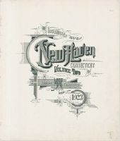
Search Results

2.
- Creator:
- Sanborn Map Company, issuing body
- Published / Created:
- 1924
- Call Number:
- 766 N46 1924
- Image Count:
- 92
- Resource Type:
- Maps, Atlases & Globes
- Abstract:
- Sanborn fire insurance maps are a rich source of historic data on the urban built environment of North America during the 19th and early 20th centuries. The atlases were created for the purpose of underwriting fire insurance policies, which depended u...
- Alternative Title:
- Insurance maps of New Haven, Connecticut, including East Haven, Insurance maps of New Haven, Connecticut, including Hamden and North Haven, Insurance maps of New Haven, Connecticut, including West Haven, and New Haven, Connecticut
- Description:
- Partial cadastral maps.
- Subject (Geographic):
- East Haven (Conn.)--Maps, Hamden (Conn.)--Maps, New Haven (Conn.)--Maps, North Haven (Conn.)--Maps, and West Haven (Conn.)--Maps
- Subject (Name):
- Library of Congress Ownership
- Subject (Topic):
- Fire risk assessment--Connecticut--East Haven--Maps, Fire risk assessment--Connecticut--Hamden--Maps, Fire risk assessment--Connecticut--New Haven--Maps, Fire risk assessment--Connecticut--North Haven--Maps, Fire risk assessment--Connecticut--West Haven--Maps, Real property--Connecticut--East Haven--Maps, Real property--Connecticut--Hamden--Maps, Real property--Connecticut--New Haven--Maps, Real property--Connecticut--North Haven--Maps, and Real property--Connecticut--West Haven--Maps
- Found in:
- Beinecke Rare Book and Manuscript Library > Insurance maps of New Haven, Connecticut. Volume 2.
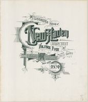
3.
- Creator:
- Sanborn Map Company, issuing body
- Published / Created:
- 1924
- Call Number:
- 766 N46 1924
- Image Count:
- 92
- Resource Type:
- Maps, Atlases & Globes
- Abstract:
- Sanborn fire insurance maps are a rich source of historic data on the urban built environment of North America during the 19th and early 20th centuries. The atlases were created for the purpose of underwriting fire insurance policies, which depended u...
- Alternative Title:
- Insurance maps of New Haven, Connecticut, including East Haven, Insurance maps of New Haven, Connecticut, including Hamden and North Haven, Insurance maps of New Haven, Connecticut, including West Haven, and New Haven, Connecticut
- Description:
- Partial cadastral maps.
- Subject (Geographic):
- East Haven (Conn.)--Maps, Hamden (Conn.)--Maps, New Haven (Conn.)--Maps, North Haven (Conn.)--Maps, and West Haven (Conn.)--Maps
- Subject (Name):
- Library of Congress Ownership
- Subject (Topic):
- Fire risk assessment--Connecticut--East Haven--Maps, Fire risk assessment--Connecticut--Hamden--Maps, Fire risk assessment--Connecticut--New Haven--Maps, Fire risk assessment--Connecticut--North Haven--Maps, Fire risk assessment--Connecticut--West Haven--Maps, Real property--Connecticut--East Haven--Maps, Real property--Connecticut--Hamden--Maps, Real property--Connecticut--New Haven--Maps, Real property--Connecticut--North Haven--Maps, and Real property--Connecticut--West Haven--Maps
- Found in:
- Beinecke Rare Book and Manuscript Library > Insurance maps of New Haven, Connecticut. Volume 4.
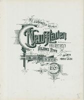
4.
- Creator:
- Sanborn Map Company, issuing body
- Published / Created:
- 1924
- Call Number:
- 766 N46 1924
- Image Count:
- 55
- Resource Type:
- Maps, Atlases & Globes
- Abstract:
- Sanborn fire insurance maps are a rich source of historic data on the urban built environment of North America during the 19th and early 20th centuries. The atlases were created for the purpose of underwriting fire insurance policies, which depended u...
- Alternative Title:
- Insurance maps of New Haven, Connecticut, including East Haven, Insurance maps of New Haven, Connecticut, including Hamden and North Haven, Insurance maps of New Haven, Connecticut, including West Haven, and New Haven, Connecticut
- Description:
- Partial cadastral maps.
- Subject (Geographic):
- East Haven (Conn.)--Maps, Hamden (Conn.)--Maps, New Haven (Conn.)--Maps, North Haven (Conn.)--Maps, and West Haven (Conn.)--Maps
- Subject (Name):
- Library of Congress Ownership
- Subject (Topic):
- Fire risk assessment--Connecticut--East Haven--Maps, Fire risk assessment--Connecticut--Hamden--Maps, Fire risk assessment--Connecticut--New Haven--Maps, Fire risk assessment--Connecticut--North Haven--Maps, Fire risk assessment--Connecticut--West Haven--Maps, Real property--Connecticut--East Haven--Maps, Real property--Connecticut--Hamden--Maps, Real property--Connecticut--New Haven--Maps, Real property--Connecticut--North Haven--Maps, and Real property--Connecticut--West Haven--Maps
- Found in:
- Beinecke Rare Book and Manuscript Library > Insurance maps of New Haven, Connecticut. Volume 5.
5.

- Call Number:
- Folio 469
- Collection Title:
- [Atlas factice of 13 maps by Nicolaes Visscher I, Nicolaes Visscher II, Guillaume Sanson, and
- Image Count:
- 2
- Description:
- Front matter for Folio 469.
- Subject (Geographic):
- Europe --Maps --Early works to 1800
- Subject (Topic):
- Atlases, Dutch --Early works to 1800
- Collection Created:
- 1677-1692
- Found in:
- Beinecke Rare Book and Manuscript Library > [Atlas factice of 13 maps by Nicolaes Visscher I, Nicolaes Visscher II, Guillaume Sanson, and Justus Danckerts]