Skip to search
Skip to main content
Skip to first result
Search
You Searched For
Extent of Digitization
Completely digitized
Genre
Maps
Subject (Topic)
Military maps
Search Results
Creator:
Published / Created:
1944
Call Number:
50 1945I
Container / Volume:
BRBL_00273
Image Count:
2
Resource Type:
Maps, Atlases & Globes
Description:
Cloth map.
Publisher:
Amy Map Service,
Subject (Geographic):
Kunming Region (China)--Maps
Subject (Name):
United States. Aeronautical Chart Service, United States. Army Air Forces, and United States. Army Map Service
Subject (Topic):
Military maps
Found in:
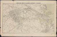
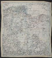
Beinecke Rare Book and Manuscript Library > AAF cloth chart. No. 133, Kun-Ming, Yunnan, China to Chabua, Assam, India Forces / prepared under the direction of the Commanding General, Army Air Forces, for the Aeronautical Chart Service, by the U.S. Coast and Geodetic Survey, Washington, D.C., Januar
Creator:
Published / Created:
1944
Call Number:
50 1945I
Container / Volume:
BRBL_00273
Image Count:
2
Resource Type:
Maps, Atlases & Globes
Description:
Cloth map.
Publisher:
Amy Map Service,
Subject (Geographic):
Kunming Region (China)--Maps
Subject (Name):
United States. Aeronautical Chart Service, United States. Army Air Forces, and United States. Army Map Service
Subject (Topic):
Military maps
Found in:
Beinecke Rare Book and Manuscript Library > AAF cloth chart. No. 133, Kun-Ming, Yunnan, China to Chabua, Assam, India Forces / prepared under the direction of the Commanding General, Army Air Forces, for the Aeronautical Chart Service, by the U.S. Coast and Geodetic Survey, Washington, D.C., Januar
Creator:
Published / Created:
[1865?]
Call Number:
783 1865C
Container / Volume:
BRBL_00509
Image Count:
1
Resource Type:
Maps, Atlases & Globes
Description:
Also covers Richmond city region.
Publisher:
U.S. Coast Survey Office,
Subject (Geographic):
Richmond Region (Va.)--History--Civil War, 1861-1865--Maps, Tidewater (Va. : Region)--History--Civil War, 1861-1865--Maps, and Virginia--History--Civil War, 1861-1865--Maps
Subject (Name):
Krebs, Charles G, Lindenkohl, A, Lindenkohl, H. (Henry), and Thompson, Gilbert, 1839-1909
Subject (Topic):
Military maps
Found in:
Beinecke Rare Book and Manuscript Library > Military map of south-eastern Virginia / compiled at the U.S. Coast Survey Office ; drawn by A. Lindenkohl.
Creator:
Published / Created:
1942?]
Call Number:
66 1942
Container / Volume:
BRBL_00347
Image Count:
4
Resource Type:
Maps, Atlases & Globes
Description:
Have hemmed edges.
Publisher:
MI9,
Subject (Geographic):
Africa, North--Maps and Africa, West--Maps
Subject (Topic):
Military maps
Found in:
Beinecke Rare Book and Manuscript Library > North Africa containing Morocco, Algeria, Tunisia, Italian Libya, and Spanish Rio de Oro.
Branch:v1.68.6 ,Deployed:2025-07-02T08:09:28-04:00