Skip to search
Skip to main content
Skip to first result
Search
You Searched For
Extent of Digitization
Completely digitized
Genre
Nautical charts
Search Results
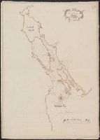
Creator:
Published / Created:
1751
Call Number:
732 H13 1751
Container / Volume:
BRBL_00708
Image Count:
1
Resource Type:
Maps, Atlases & Globes
Subject (Geographic):
Halifax Harbour (N.S.)--Maps--Early works to 1800
Subject (Topic):
Harbors--Nova Scotia--Halifax--Maps--Early works to 1800
Found in:
Beinecke Rare Book and Manuscript Library > A plan of the harbour of Halifax / by Charles Morris, chf. surveyr.
Creator:
Published / Created:
1677]
Call Number:
40 V55 1680A
Image Count:
1
Resource Type:
Maps, Atlases & Globes
Alternative Title:
English pilot The second book.
Description:
Appears in The English Pilot, The Second Book.
Publisher:
John Seller,
Subject (Geographic):
Adriatic Sea--Maps--Early works to 1800
Subject (Topic):
Coasts--Adriatic Sea--Maps--Early works to 1800
Found in:
Beinecke Rare Book and Manuscript Library > A sea chart of the Gulph of Venice : describing all the sea coasts and islands contained therein.
Published / Created:
1794
Call Number:
38cea 1757
Container / Volume:
BRBL_00169
Image Count:
1
Resource Type:
Maps, Atlases & Globes
Description:
Tables of data.
Publisher:
Laurie & Whittle,
Subject (Geographic):
Biscay, Bay of (France and Spain)--Maps--Early works to 1800
Found in:
Beinecke Rare Book and Manuscript Library > An accurate chart of the Bay of Biscay ... taken in 1756 & 1757 ... By Mr. Magin Engineer to the Marine.
Creator:
Published / Created:
25 May, 1775.
Call Number:
7345cea 1775
Container / Volume:
BRBL_00689
Image Count:
1
Resource Type:
Maps, Atlases & Globes
Description:
Appears in Thomas Kitchin's General atlas describing the whole universe.
Publisher:
Printed for Robt. Sayer, map & printseller,
Subject (Geographic):
Saint Lawrence River Valley--Maps--Early works to 1800 and Saint Lawrence River--Maps--Early works to 1800
Subject (Name):
Kitchin, Thomas, d. 1784. General atlas describing the whole universe and Sayer, Robert, 1725-1794
Subject (Topic):
Nautical charts--Saint Lawrence River--Early works to 1800
Found in:
Beinecke Rare Book and Manuscript Library > An exact chart of the river St. Laurence : from Fort Frontenac to the island of Anticosti shewing the soundings, rocks, shoals & c with views of the lands and all necessary instructions for navigating that river to Quebec / by ... Thos. Jefferys.
Creator:
Published / Created:
25 May, 1775.
Call Number:
7345cea 1775
Container / Volume:
BRBL_00381
Image Count:
1
Resource Type:
Maps, Atlases & Globes
Description:
Appears in Thomas Kitchin's General atlas describing the whole universe.
Publisher:
Printed for Robt. Sayer, map & printseller,
Subject (Geographic):
Saint Lawrence River Valley--Maps--Early works to 1800 and Saint Lawrence River--Maps--Early works to 1800
Subject (Name):
Kitchin, Thomas, d. 1784. General atlas describing the whole universe and Sayer, Robert, 1725-1794
Subject (Topic):
Nautical charts--Saint Lawrence River--Early works to 1800
Found in:
Beinecke Rare Book and Manuscript Library > An exact chart of the river St. Laurence : from Fort Frontenac to the island of Anticosti shewing the soundings, rocks, shoals & c with views of the lands and all necessary instructions for navigating that river to Quebec / by ... Thos. Jefferys.
Creator:
Published / Created:
1904
Call Number:
57 1904
Container / Volume:
BRBL_00302
Image Count:
1
Resource Type:
Maps, Atlases & Globes
Alternative Title:
Charts, etc.
Description:
"No. 2156."
Publisher:
Hydrographic Office,
Subject (Geographic):
China--Maps, Japan--Maps, and Korea--Maps
Found in:
Beinecke Rare Book and Manuscript Library > Asia, Japan and Korea : with the surrounding seas and the adjacent coastal region of China / published at Washington, D.C. Feb. 1904, at the Hydrographic Office. H.M. Hodges, Lieutenant Commander, U.S.N. Hydrographer.
Creator:
Published / Created:
1904
Call Number:
556cea 1904
Container / Volume:
BRBL_00293
Image Count:
1
Resource Type:
Maps, Atlases & Globes
Alternative Title:
Charts, etc.
Description:
"No. 2156."
Publisher:
Hydrographic Office,
Subject (Geographic):
China--Maps, Japan--Maps, and Korea--Maps
Found in:
Beinecke Rare Book and Manuscript Library > Asia, Japan and Korea : with the surrounding seas and the adjacent coastal region of China / published at Washington, D.C. Feb. 1904, at the Hydrographic Office. H.M. Hodges, Lieutenant Commander, U.S.N. Hydrographer.
Creator:
Published / Created:
Aug. 16th. 1852 [i.e. 1865]
Call Number:
26cea 1851A
Container / Volume:
BRBL_00023
Image Count:
1
Resource Type:
Maps, Atlases & Globes
Description:
"Corrections ... March 65."
Publisher:
Published according to Act of Parliament at the Hydrographic Office of The Admiralty,
Subject (Geographic):
Australia, Southeastern--Maps
Found in:
Beinecke Rare Book and Manuscript Library > Australia east coast. Sheet I, Cape Howe to Barriga Point / from a running survey by Captn. J. Lort Stokes ... 1851.
Creator:
Published / Created:
Aug. 16th. 1852 [i.e. 1865]
Call Number:
26cea 1851B
Container / Volume:
BRBL_00023
Image Count:
1
Resource Type:
Maps, Atlases & Globes
Description:
"Corrections to ... Mar. 65."
Publisher:
Published according to Act of Parliament at the Hydrographic Office of The Admiralty : and Sold by J.D. Potter Agent for the Admiralty charts 31 Poultry,
Subject (Geographic):
Australia, Southeastern--Maps
Found in:
Beinecke Rare Book and Manuscript Library > Australia east coast. Sheet II, Barriga Point to Jervis Bay / from a running survey by Captn. J. Lort Stokes ... 1851 ; engraved by J. & C. Walker.
Creator:
Published / Created:
Aug. 16th. 1852 [i.e. 1862]
Call Number:
26cea 1851D
Container / Volume:
BRBL_00023
Image Count:
1
Resource Type:
Maps, Atlases & Globes
Description:
"2144".
Publisher:
Published according to Act of Parliament at the Hydrographic Office of The Admiralty : and Sold by J.D. Potter Agent for the Admiralty charts 31 Poultry,
Subject (Geographic):
Australia, Southeastern--Maps
Found in:
Beinecke Rare Book and Manuscript Library > Australia east coast. Sheet IV, Broken Bay to Sugarloaf Point / from a running survey by Captn. J. Lort Stokes ... 1851 ; engraved by J. & C. Walker.
Branch:v1.68.7 ,Deployed:2025-07-09T09:08:07-04:00