Skip to search
Skip to main content
Skip to first result
Search
You Searched For
Extent of Digitization
Completely digitized
Subject (Topic)
World maps--Early works to 1800
Search Results
Creator:
Published / Created:
1695
Call Number:
11 1695A
Container / Volume:
BRBL_00004
Image Count:
1
Resource Type:
Maps, Atlases & Globes
Alternative Title:
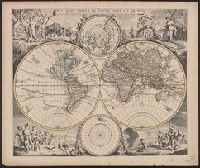
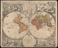
Mappemonde ou carte marine vniverselle reduite
Description:
"L'ontrouve sur les paralleles ou degrés de latitude de cette carte les heures des jours selon le signe où se trouve le soleil, la difference des ombres, par le moïen des quelles feu Mr. d'Estoubeuille pretendoit demonstrer les longitudes."
Publisher:
[s.n.],
Subject (Geographic):
World--Maps--Early works to 1800
Subject (Topic):
Longitude--Measurement--Maps--Early works to 1800 and World maps--Early works to 1800
Found in:
Beinecke Rare Book and Manuscript Library > Mappemonde ou carte marine universelle reduite : où sont l'Asie, l'Afrique, l'Europe, l'Amerique septentrionale, l'Amerique meridionale / par Pierre Moullart-Sanson, geographe du Roi.
Creator:
Published / Created:
1784
Call Number:
11 1784A
Container / Volume:
BRBL_00006
Image Count:
1
Resource Type:
Maps, Atlases & Globes
Description:
Includes text and tables "Graden-Tafel" and "Meilen-Maas".
Publisher:
Homannischen Erben,
Subject (Topic):
World maps--Early works to 1800
Found in:
Beinecke Rare Book and Manuscript Library > Neue Welt-Karte welch auf zwoo Klugelflaechen die Haupt-Theile der Erde, Inseln, Insel-Gruppen, Theile des Welt-Meers und der en Benennungen den fünsten Welt-theil und die neuesten Entdekkungen nach den Karten und Reisebeschreibungen der berühmtesten Se
Creator:
Published / Created:
1700
Call Number:
11 1700
Container / Volume:
BRBL_00004
Image Count:
1
Resource Type:
Maps, Atlases & Globes
Alternative Title:
New and correct sea chart of the whole world shewing the variations of the compass as they were found in the year MDCC and Nova et accuratissima totius terrarum orbis tabula nautica, variationum magneticarum index juxta observationes anno. 1700
Description:
Text at bottom: "Sold by R. & W. Mount and T. Page in Postern Row, Tower Hill".
Publisher:
Sold by R. Mount & T. Page ... ,
Subject (Topic):
World maps--Early works to 1800
Found in:
Beinecke Rare Book and Manuscript Library > Nova & accuratissima totius terrarum orbis tabula nautica, variationum magneticarum index juxta observationes anno. 1700 ... / per Edm: Halley ; I Harris sculp. = A new and correct sea chart of the whole world shewing the variations of the compass as they
Creator:
Published / Created:
[1720?]
Call Number:
11 1720A
Container / Volume:
BRBL_00680
Image Count:
1
Resource Type:
Maps, Atlases & Globes
Alternative Title:
Nova orbis tabvla in lvcem edita
Description:
Allegorical vignettes of the four seasons.
Publisher:
Apud Ioannem Covens et Cornelium Mortier,
Subject (Name):
Cóvens, Jean and Mortier, Corneille
Subject (Topic):
World maps--Early works to 1800
Found in:
Beinecke Rare Book and Manuscript Library > Nova orbis tabula in lucem edita / a. F. de Wit.
Creator:
Published / Created:
[between 1635 and 1650]
Call Number:
11 1635
Container / Volume:
BRBL_00003
Image Count:
2
Resource Type:
Maps, Atlases & Globes
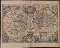
Description:
Appears in the author's Theatrum orbis terrarum. 1635.
Publisher:
Excudebat Gulielmus Blaeuw,
Subject (Geographic):
World--Maps--Early works to 1800
Subject (Name):
Arnold, Robert M.--Ownership
Subject (Topic):
World maps--Early works to 1800
Found in:
Beinecke Rare Book and Manuscript Library > Nova totius terrarum orbis geographica ac hydrographica tabula / auct. Guiljelmo Blaeuw ; Ja. van den Ende sculpsit.
Creator:
Published / Created:
1638/39]
Call Number:
11 1630
Container / Volume:
BRBL_00680
Image Count:
1
Resource Type:
Maps, Atlases & Globes
Alternative Title:
Nova totivs terrarvm orbis geographica ac hydrographica tabvla
Description:
Appears in Jan Jansson's Appendix novi Atlantis (1637) and Jan Jansson and Hendrik Hondius's Atlas novus (1638).
Publisher:
Hendrik Hondius,
Subject (Name):
Jansson, Jan, 1588-1664
Subject (Topic):
World maps--Early works to 1800
Found in:
Beinecke Rare Book and Manuscript Library > Nova totius terrarum orbis geographica ac hydrographica tabula / auct. Henr. Hondio.
Creator:
Published / Created:
1668]
Call Number:
11 1668
Container / Volume:
BRBL_00680
Image Count:
1
Resource Type:
Maps, Atlases & Globes
Description:
Imperfect: mutilated along folds, with some loss of text. Cross collection no. 24.
Publisher:
[s.n.,
Subject (Topic):
World maps--Early works to 1800
Found in:
Beinecke Rare Book and Manuscript Library > Nova totius terrarum orbis tabula / [cartographic material] / ex officina F. de Wit.
Creator:
Published / Created:
1597]
Call Number:
11 1597
Container / Volume:
BRBL_00680
Image Count:
1
Resource Type:
Maps, Atlases & Globes
Description:
Cross Collection no. 9.
Publisher:
s.n. ,
Subject (Name):
Porro, Girolamo, 1520-1604
Subject (Topic):
World maps--Early works to 1800
Found in:
Beinecke Rare Book and Manuscript Library > Orbis terrae compendiosa descriptio : ex ea, quam ex magna universali Mercatoris / Rumoldus Mercator fieri curabat in hac comodiore forma a Hieron: Porro redact.
Creator:
Published / Created:
1595?]
Call Number:
11 1587A
Image Count:
1
Resource Type:
Maps, Atlases & Globes
Description:
Includes text in lower margin.
Publisher:
s.n.,
Subject (Topic):
World maps--Early works to 1800
Found in:
Beinecke Rare Book and Manuscript Library > Orbis terrae compendiosa descriptio : quam ex magna universali Gerardi Mercatoris Domino Richardo Gartho, geographie ac ceterarum bonarum artium amatori ac fautori summo, in veteris amicitie ac familiaritatis memoriam Rumoldus Mercator fieri curabat A[nn]
Creator:
Published / Created:
[1658]
Call Number:
11 1658
Image Count:
1
Resource Type:
Maps, Atlases & Globes
Description:
"J. de Vissscher sculpsit".
Publisher:
[Jan Jansson],
Subject (Name):
Berchem, Nicolaas Pietersz, 1620-1683., Jansson, Jan, 1588-1664. Novus Atlas., and Visscher, Jan de, 1633-approximately 1692.
Subject (Topic):
World maps--Early works to 1800
Found in:
Beinecke Rare Book and Manuscript Library > Orbis terrarum nova et accuratissima tabula / auctore Nicolao Visscher.
Branch:v1.68.6 ,Deployed:2025-07-02T08:09:28-04:00