Great Britain. Hydrographic Dept Stokes, J. Lort (John Lort), 1811-1885
Published / Created:
Aug. 16th. 1852 [i.e. 1865]
Call Number:
26cea 1851B
Container / Volume:
BRBL_00023
Image Count:
1
Resource Type:
Maps, Atlases & Globes
Description:
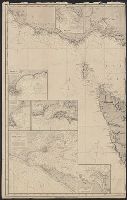
"Corrections to ... Mar. 65.", Chart "2142.", and Chart of coast from Barriga Point to Jervis Bay with relief shown by hachures, bathymetric soundings and spot heights.
Publisher:
Published according to Act of Parliament at the Hydrographic Office of The Admiralty : and Sold by J.D. Potter Agent for the Admiralty charts 31 Poultry,
"Additions to ... Mar. 65.", Chart no. "2143.", and Chart of coast from Jervis Bay to Broken Bay with relief shown by hachures, bathymetric soundings and spot heights.
Publisher:
Published according to Act of Parliament at the Hydrographic Office of the Admiralty : and Sold by J.D. Potter for the Admiralty charts 31 Poultry,
"2144"., "Corrections Sept. 1862.", and Chart of coast from Broken Bay to Sugarloaf Point with relief shown by hachures, bathymetric soundings and spot heights.
Publisher:
Published according to Act of Parliament at the Hydrographic Office of The Admiralty : and Sold by J.D. Potter Agent for the Admiralty charts 31 Poultry,
Imray, James F. (James Frederick), 1829?-1891, author James Imray and Son, publisher
Call Number:
23cea 1884
Container / Volume:
BRBL_00021
Image Count:
2
Resource Type:
Maps, Atlases & Globes
Alternative Title:
Cape Northumberland to Cape Howe and Chart no. 2, Cape Northumberland to Cape Howe
Description:
Imperfect: sheet torn in half, edges chipped, with some loss of text. Backed with paper. Manuscript annotations on map. Some locations highlighted in yellow. Label on verso: Chart and In lower left margin: Cor. VII, 83, XII, 83, 84, VII, VIII, IX.