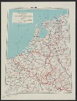
Its A.M.S. 6201 and Series (Standard map series designation system) ; 6201.
Description:
"Lambert conformal conic projection.", Elevations shown by hachures and spot heights in meters., and Two classes of roads and five classes of railroads are shown.
Subject (Topic):
Transportation--Belgium--Maps, Transportation--Luxembourg--Maps, and Transportation--Netherlands--Maps
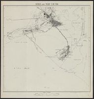
Geographical Section, General Staff ; no. 4241 and GSGS (Series) ; 4241.
Description:
"Compiled by Army Map Service, U. S. A. 1942. Revised ... by War Office, 1943.", "Form line interval 20 feet (approximate)", Important streets are named., In upper margin: Morocco ..., and Military grid.
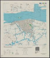
Its A.M.S. ; L901 and Series (Standard map series designation system) ; L901.
Description:
"Contour interval 20 meters.", "Place names transcribed according to the modified Wade-Giles system.", "Polyconic projection.", In upper margin: China city plans., Includes "Glossary.", Marginal maps: Covera, Military grid., and Some streets and buildings are named.