Search
You Searched For
Search Results
- Creator:
- Moll, Herman, d. 1732
- Published / Created:
- [1732]
- Call Number:
- E1015 M66 1732
- Collection Title:
- Atlas minor: or a set of sixty-two new and correct maps, of all parts of the world. All composed
- Image Count:
- 1
- Found in:
- Beinecke Rare Book and Manuscript Library > A new map of ye north parts of America claimed by France under ye names of Louisiana. Mississipi, Canada & New France, with the adjoyning territories of England & Spain. By H. Moll geographer.
- Creator:
- Visscher, Nicolaes, 1649-1702
- Published / Created:
- Undated
- Call Number:
- 1973 Folio 71
- Collection Title:
- [Atlas nouveau contenant toutes les parties du monde ou sont exactement marques les empires
- Image Count:
- 1
- Resource Type:
- Maps, Atlases & Globes
- Found in:
- Beinecke Rare Book and Manuscript Library > A new mapp of the kingdome of England, representing the princedome of Wales, and other provinces, cities, market towns, with the roads from town to town and the number of reputed miles between them, are given by inspection without scale or compass
- Call Number:
- 1977 Folio 78
- Collection Title:
- A New and accurate chart of the West-India Islands and coast, with the gulf passage through the New
- Image Count:
- 1
- Resource Type:
- Maps, Atlases & Globes
- Found in:
- Beinecke Rare Book and Manuscript Library > A plan of Fort St. Louis harbour on the south side of Hispaniola, pl. 31.
- Call Number:
- 1977 Folio 78
- Collection Title:
- A New and accurate chart of the West-India Islands and coast, with the gulf passage through the New
- Image Count:
- 1
- Resource Type:
- Maps, Atlases & Globes
- Found in:
- Beinecke Rare Book and Manuscript Library > A plan of Monte-Christe Bay with the Seven Brothers on the north coast of St. Domingo, pl. 38
- Call Number:
- Ik P810 +Z745
- Collection Title:
- A plan of Mr. Pope’s garden : as it was left at his death, with a plan and perspective view of the
- Image Count:
- 1
- Resource Type:
- Books, Journals & Pamphlets
- Found in:
- Beinecke Rare Book and Manuscript Library > A plan of Mr. Pope's garden as it was left at his death
- Call Number:
- 1977 Folio 78
- Collection Title:
- A New and accurate chart of the West-India Islands and coast, with the gulf passage through the New
- Image Count:
- 1
- Resource Type:
- Maps, Atlases & Globes
- Found in:
- Beinecke Rare Book and Manuscript Library > A plan of the road of Port Paix in the island of Hispaniola, pl. 35.
- Call Number:
- CF2041 +L54
- Collection Title:
- A true & exact history of the island of Barbados. Illustrated with a mapp of the island, as also
- Image Count:
- 1
- Resource Type:
- Maps, Atlases & Globes
- Found in:
- Beinecke Rare Book and Manuscript Library > A topographicall description and admeasurement of the yland of Barbados in the West Indyaes with the m.rs names of the seuerall plantacons
- Creator:
- Smith, John, 1580-1631
- Published / Created:
- 1631
- Call Number:
- Taylor 316
- Image Count:
- 2
- Found in:
- Beinecke Rare Book and Manuscript Library > Advertisements for the unexperienced planters of New-England, or anywhere, or, The path-way to experience to erect a plantation : With the yearely proceedings of this country in fishing and planting, since the yeare 1614. to the yeare 1630. and their present estate. Also how to prevent the greatest inconveniences, by their proceedings in Virginia, and other plantations, by approved examples. With the countries armes, a description of the coast, harbours, habitations, land-markes, latitude and longitude: with the map, allowed by our royall King Charles. By Captaine Iohn Smith, sometimes governour of Virginia, and admirall of Nevv-England.
- Published / Created:
- [1542]
- Call Number:
- Taylor 86
- Collection Title:
- Rvdimenta cosmographica
- Image Count:
- 1
- Found in:
- Beinecke Rare Book and Manuscript Library > Africa
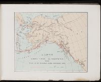
- Creator:
- Harriman, Edward Henry, 1848-1909
- Call Number:
- ZZc86 899ha
- Collection Title:
- A souvenir of the Harriman Alaska Expedition : May-August, 1899 [graphic]
- Image Count:
- 1
- Resource Type:
- Maps, Atlases & Globes
- Found in:
- Beinecke Rare Book and Manuscript Library > Alaska with parts of Siberia Canada and Washington showing the route of the Harriman Alaska Expedition 1899