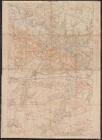
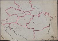
"Groupe de Ganevas de Tir ; 27 Julliet 1918 ; secret"., Pencil and color annotations on printed base map., Relief shown by contours and spot heights., and Shows infantry routes, roads not to be used by infantry, and objectives.
Publisher:
s.n.],
Subject (Geographic):
Picardy (France)--Maps
Subject (Name):
United States.--Army.--Division, 32nd--Maps
Subject (Topic):
Aisne, Battle of the, France, 1918--Maps and World War, 1914-1918--Regimental histories--United States--Maps
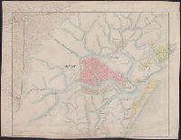
A strip of paper has been overlaid within the lower left neat line., Central Venice and some outlying areas appear finished, but there are extensive unfinished areas with notations in pencil., dgvmp2008., and Map extends beyond neat lines.
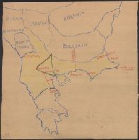
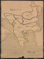
Legend indicates boundaries according to San Stefano in pink crayon, and boundaries according to Berlin in blue crayon. and Title supplied by cataloger.
Publisher:
s.n.,
Subject (Geographic):
Balkan Peninsula--Maps and Europe, Eastern--Maps
Subject (Topic):
Boundaries--Balkan Peninsula--Russo-Turkish War, 1877-1878 and Boundaries--Europe, Eastern--Russo-Turkish War, 1877-1878
Map includes historical regions of Eastern Roumelia, Dobruja, and Bessarabia. Borders drawn in black ink, countries outlined in crayon. and Title supplied by cataloger.
Publisher:
s.n.,
Subject (Geographic):
Balkan Peninsula--Maps and Europe, Eastern--Maps
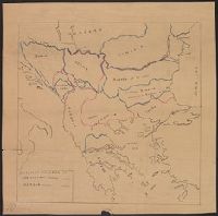
Subject (Topic):
Boundaries--Balkan Peninsula--Maps and Boundaries--Europe, Eastern--Maps