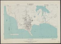
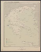
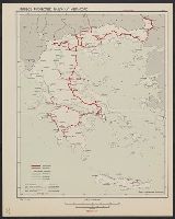
Great Britain. Royal Air Force. Central Interpretation Unit
Published / Created:
1944
Call Number:
475 D93 1944
Container / Volume:
BRBL_00262
Image Count:
1
Resource Type:
Maps, Atlases & Globes
Alternative Title:
Great Britain. War Office. General Staff. Geographical Section. [G.S.G.S.] ; 4415 and GSGS (Series) ; 4415.
Description:
"Form lines from air photographs at intervals of 15 metres.", "Ground information supplied by I.S.T.D.", In upper margin: Albania 1:8,000 ..., and Mediterranean Grid.
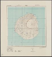
Panama Canal vs. national highways, you own the first, do you want to own the second?
Description:
Includes population chart, lengths for "tentative designation of national highways," and text. and Shows tentative locations for a national highway system.
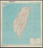
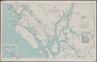
Its A.M.S. ; 5207 and Series (Standard map series designation system) ; 5207.
Description:
"Polyconic projection.", Elevations are shown by hachures and spot heights in meters., and Two classes of roads, and three classes of railroads are shown.
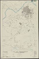
Its A.M.S. ; L991 and Series (Standard map series designation system) ; L991.
Description:
"Contour interval 10 meters, with auxiliary contours at 5 meter intervals.", "Place names are transcribed according to the modified Hepburn (Romaji) system.", "Polyconic projection.", At head of title: Formosa city plans ..., Includes "Glossary.", and Marginal map