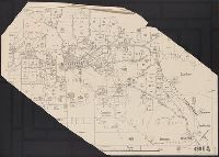
Covers area from Greeley and Hall counties on the west to Sioux City and Omaha on the east, Antelope and Dakota counties on the north and Hall County and city of Lincoln on the south., Label on upper left covering original title and legend: O.F. Davis, (late Land Commissioner U.P.R.R.), Webster Snyder, Nebraska Land Agency, Davis & Snyder, 1505 Farnam St., Omaha, Neb., general dealers in real estate ... Omaha, May 15th, 1880., Shows railroads, drainage, and township and range grid., and Title taken from original text covered by label in upper left.
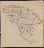
Map of portion of San Rafael Grazing District, Utah
Description:
Accompanied by note dating map in 1940, and annotated in black ink to indicate error on map., Relief shown by contours., and Title devised by cataloger.
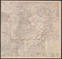
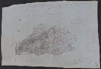
Relief shown by hachures and spot heights. and Shows route of company from Portland to Whitman Station (scene of Whitman Massacre); route from Whitman to Blue Mountains, escorting J.L. Meek's party; route in search of Cayuse Indians; scout through Palouse and Cayuse countries; route of detachment to Colville Agency; and return route from Whitman Station to Oregon City.