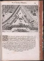
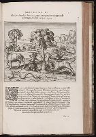
Regnum Congo hoc est vera descriptio regni Africani : quod tam ab incolis quam Lusitanis Congus
Image Count:
1
Subject (Geographic):
Africa --Description and travel --Early works to 1800, Africa --Discovery and exploration --Early works to 1800, Kongo Kingdom --Description and travel --Early works to 1800, and Kongo Kingdom --Discovery and exploration --Early works to 1800
Regnum Congo hoc est vera descriptio regni Africani : quod tam ab incolis quam Lusitanis Congus
Image Count:
1
Resource Type:
Books, Journals & Pamphlets
Subject (Geographic):
Africa --Description and travel --Early works to 1800, Africa --Discovery and exploration --Early works to 1800, Kongo Kingdom --Description and travel --Early works to 1800, and Kongo Kingdom --Discovery and exploration --Early works to 1800
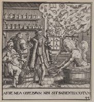
Title from item., From: Johann de Bry, Emblemate saecularis, Francoforti: J.T. and J.I. de Bry, 1596., In image lower right: 44., This electronic record is derived from historic data and may not reflect our current information. Review and updating of records is ongoing., and Temporary local Medical Library subject terms: Dropsy; Insanity.
Boehm, Augustus Gottlieb Hase, Johann Matthias, 1684-1742 Homann Erben (Firm)
Published / Created:
1744
Call Number:
1983 Folio 23
Collection Title:
[Atlas factice of 50 maps, primarily by Johann Baptist Homann and/or issued by the Homann Erben
Image Count:
1
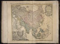
Alternative Title:
Asia secundum legitimas projectionis stereographicae regulas et juxta recentissimas observationes and Carte de l’Asie, projettee stereographiquement, tiree des relations et observations
Boehm, Augustus Gottlieb Hase, Johann Matthias, 1684-1742 Homann Erben (Firm)
Published / Created:
1744
Call Number:
1975 Folio 31
Collection Title:
[Atlas factice of 42 maps, produced by the Homann Erben firm]
Image Count:
1
Alternative Title:
Asia secundum legitimas projectionis stereographicae regulas et juxta recentissimas observationes and Carte de l’Asie, projettee stereographiquement, tiree des relations et observations
[Atlas factice of 96 maps by Blaeu, Visscher, Jansson, Hondius and others]
Image Count:
2
Resource Type:
Maps, Atlases & Globes
Description:
All four sides of map decorated with city views and costumed figures of different social classes. Includes coats of arms., Imperfect: torn along fold, with some loss of text; portions of decorative border cut or torn and repaired, with missing sections replicated in ms.; tears repaired., and No. 5 of 92 maps bound together.