Skip to search
Skip to main content
Skip to first result
Search
You Searched For
Genre
Atlases
Genre
Maps
Language
Latin
New Search
Search Results
Creator:
Published / Created:
ca. 1757
Call Number:
1973 Folio 30
Collection Title:
[Atlas factice of 32 maps and 1 distance table, produced by the Homann Erben firm]
Image Count:
2
Publisher:
[Tobias Conrad Lotter]
Subject (Geographic):
Saxony (Germany) --Maps --Early works to 1800
Subject (Topic):
Atlases, German --Early works to 1800
Collection Created:
[Nuremberg : s.n., 1701-1760]
Found in:
Beinecke Rare Book and Manuscript Library > Electoratus Saxonici Praefecturae Annaburgensis, Pretzschens[is] Torgaviensis, Schweinicensis, Muehlbergensis studio geographico / [cartographic material] / ita depictae, ut urbes, oppida, vici, pagi, aedes solitar cum vicinia accurate distingui possint a
Creator:
Published / Created:
[ca. 1758]
Call Number:
1973 Folio 30
Collection Title:
[Atlas factice of 32 maps and 1 distance table, produced by the Homann Erben firm]
Image Count:
2
Publisher:
Anjezo im Verlag bey Tobias Conrad Lotter, Geogr. ...
Subject (Geographic):
Saxony-Anhalt (Germany) --Maps --Early works to 1800
Subject (Topic):
Atlases, German --Early works to 1800
Collection Created:
[Nuremberg : s.n., 1701-1760]
Found in:
Beinecke Rare Book and Manuscript Library > Episcopatus Numburgensis et cizensis delineatio geographica adjectis praefecturis Portensi, Pegaviensi, Tautenburg et finitimis / [cartographic material] / cura Matth. Seutteri Geogr. Caes
Creator:
Published / Created:
A. MDCCXXXXIII [1743]
Call Number:
1975 Folio 31
Collection Title:
[Atlas factice of 42 maps, produced by the Homann Erben firm]
Image Count:
1
Alternative Title:
Europe, dessinee suivant les regles le plus precises d’une nouvelle projection stereographique
Publisher:
Edita curis Homannianorum Heredum
Subject (Geographic):
Europe --Maps --Early works to 1800
Subject (Topic):
Atlases, German --Early works to 1800
Collection Created:
[Nuremberg,
Found in:
Beinecke Rare Book and Manuscript Library > Europa, secundum legitimas projectionis stereographicae regulas : et juxta recentissimas observationes aeque ac relationes adhibitis quoq[ue] veterum monumentorum subsidiis / descripta et in partes suas methodicas X divisa a Ioh. Matth. Hasio, Math. P.P.O
Creator:
Published / Created:
A. MDCCXXXXIII [1743]
Call Number:
1973 Folio 30
Collection Title:
[Atlas factice of 32 maps and 1 distance table, produced by the Homann Erben firm]
Image Count:
1
Alternative Title:
Europe, dessinee suivant les regles le plus precises d’une nouvelle projection stereographique ...
Publisher:
Edita curis Homannianorum Heredum
Subject (Geographic):
Europe --Maps --Early works to 1800
Subject (Topic):
Atlases, German --Early works to 1800
Collection Created:
[Nuremberg : s.n., 1701-1760]
Found in:
Beinecke Rare Book and Manuscript Library > Europa, secundum legitimas projectionis stereographicae regulas [cartographic material] : et juxta recentissimas observationes aeque ac relationes adhibitis quoq[ue] veterum monumentorum subsidiis / descripta et in partes suas methodicas X divisa a Ioh. M
Creator:
Published / Created:
[ca. 1680]
Call Number:
1973 Folio 10
Image Count:
1
Resource Type:
Maps, Atlases & Globes
Description:
No. 45 of 69 maps bound together in composite atlas., Oriented with north to bottom right., Place-names in Dutch., and Scale not given.
Publisher:
Gedruckt tot Amsterdam by Fredrick de Wit ...
Subject (Geographic):
Amsterdam (Netherlands) --Aerial views --Early works to 1800 and Amsterdam (Netherlands) --Maps --Early works to 1800
Found in:
Beinecke Rare Book and Manuscript Library > Exactissima Amstelodami veteris et novissimi delineatio
Creator:
Published / Created:
[ca. 1689]
Call Number:
1973 Folio 10
Image Count:
1
Resource Type:
Maps, Atlases & Globes
Description:
Bat. cum Privil. Ordin. Gener, Belgii Faederati--Title cartouche., Features include ornate title cartouche (top left) with cherubs, male and female figures and royal coat-of-arms supported by lion and unicorn, arms of Scotland supported by cherubs (above scale cartouche at top right), compass indicator and coasts shaded outwards., In Latin with some place names in English; explanations and title for index to places in Dutch and English., No. 7 of 69 maps bound together in composite atlas., Relief shown pictorially., Scale [ca. 1:960 000]., Scale statement reads: Milliaria Germanica Communia 15 in uno Gradu, with scale bar graded [0]-10; Milliaria Scotica Communia quorum 50 in uno Gradu, with scale bar graded [0]-34; Milliaria Gallica quae et Horae Itineris 20 in uno Gradu, with scale bar graded [0]-14., Shows grid, rivers and tributaries, lochs (shaded), trees, place and county names, settlements (symbols classified by importance in legend), territorial boundaries., Shows Scotland including the Hebrides and Orkney Islands., and The four cardinal points are written in the borders.
Publisher:
[Nicolaes Visscher]
Subject (Geographic):
Scotland --Maps --Early works to 1800
Found in:
Beinecke Rare Book and Manuscript Library > Exactissima Regni Scotiae tabula tam in septentrionalem et meriodionalem quam in minores earundem provincias, insulasq[ue], ei undique praetensas accurate divisa
Creator:
Published / Created:
[1700?]
Call Number:
1973 Folio 10
Image Count:
1
Resource Type:
Maps, Atlases & Globes
Description:
Appears in Schenk's Atlas contractus [ca. 1700]., Bar scales in milliaria Germanica communia, milliaria Gallica sive horae itineris, milliaria Italia, and milliaria Anglica., Ferro meridian., Includes decorative vignette in upper left of map., No. 48 of 69 maps bound together in composite atlas., Relief shown pictorially., and Scale [ca. 1:330 000].
Publisher:
[Peter Schenck]
Subject (Geographic):
Belgium --Maps --Early works to 1800 and Flanders --Maps --Early works to 1800
Found in:
Beinecke Rare Book and Manuscript Library > Flandriae comitatus : in suastoparchias optime distinctus, una cum vicinis et finitimis
Creator:
Published / Created:
1720?
Call Number:
1975 Folio 31
Collection Title:
[Atlas factice of 42 maps, produced by the Homann Erben firm]
Image Count:
1
Publisher:
Johann Baptist Homann
Subject (Geographic):
Balkan Peninsula --Maps --Early works to 1800
Subject (Topic):
Atlases, German --Early works to 1800
Collection Created:
[Nuremberg,
Found in:
Beinecke Rare Book and Manuscript Library > Fluviorum in Europa principis Danubii [cartographic material] : cum adiacentibus regnis nec non totius Graeciae et archipelagi novissima tabula / authore Joh. Baptista Homanno
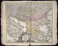
Creator:
Published / Created:
1720?
Call Number:
1973 Folio 30
Collection Title:
[Atlas factice of 32 maps and 1 distance table, produced by the Homann Erben firm]
Image Count:
2
Publisher:
Johann Baptist Homann
Subject (Geographic):
Balkan Peninsula --Maps --Early works to 1800
Subject (Topic):
Atlases, German --Early works to 1800
Collection Created:
[Nuremberg : s.n., 1701-1760]
Found in:
Beinecke Rare Book and Manuscript Library > Fluviorum in Europa principis Danubii [cartographic material] : cum adiacentibus regnis nec non totius Graeciae et archipelagi novissima tabula / authore Joh. Baptista Homanno
Creator:
Published / Created:
a. 1751
Call Number:
1973 Folio 30
Collection Title:
[Atlas factice of 32 maps and 1 distance table, produced by the Homann Erben firm]
Image Count:
2
Alternative Title:
Helvetia tredecim statibus liberis, quos cantones vocant composita and Suisse, divisee en ses treze cantons, ses alliez et ses sujets
Publisher:
Luci publicae tradita ab Homannianis Heredibus
Subject (Geographic):
Switzerland --Maps --Early works to 1800
Subject (Topic):
Atlases, German --Early works to 1800
Collection Created:
[Nuremberg : s.n., 1701-1760]
Found in:
Beinecke Rare Book and Manuscript Library > Helvetia tredecim statibvs liberis, qvos cantones vocant composita [cartographic material] : una cum foederatis & subjectis provinciis, ex probatissimis subsidiis / geographice delineata per Dm. Tobiam Mayerum, Professorem Matth., Goettingensem
Branch:v1.61.8 ,Deployed:2024-06-20T11:14:46-04:00