Search
You Searched For
Search Results
- Creator:
- Braun, Georg, 1540 or 1-1622
Hierat, Anton, fl.1597-1627
Hogenberg, Abraham, fl. 1608-1653
Hogenberg, Franz, d. 1590?
- Published / Created:
- 1572]-1618
- Call Number:
- 1975 Folio 41
- Image Count:
- 1
- Resource Type:
- Maps, Atlases & Globes
- Alternative Title:
- Civitates orbis terrarum ...
- Publisher:
- [Coloniae Agrippinae,
- Subject (Geographic):
- Rome--Antiquities--Early works to 1800 and Rome--Antiquities--Maps
- Subject (Topic):
- Cities and towns, Medieval and Maps, Pictorial -- (LC)
- Found in:
- Beinecke Rare Book and Manuscript Library > Civitates orbis terrarvm ...
- Creator:
- Visscher, Nicolaes, 1649-1702
- Published / Created:
- ca. 1684
- Call Number:
- Folio 469
- Collection Title:
- [Atlas factice of 13 maps by Nicolaes Visscher I, Nicolaes Visscher II, Guillaume Sanson, and
- Image Count:
- 1
- Publisher:
- Nicolaes Visscher
- Subject (Geographic):
- Europe --Maps --Early works to 1800 and Hainaut (Belgium) --Maps --Early works to 1800
- Subject (Topic):
- Atlases, Dutch --Early works to 1800
- Collection Created:
- 1677-1692
- Found in:
- Beinecke Rare Book and Manuscript Library > Comitatus Hannoniae et Archiepiscopatus Cameracensis tabula / [cartographic material] / per Nicolaum Visscher
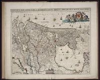
- Creator:
- Danckerts, Justus, 1635-1701
- Published / Created:
- ca. 1680
- Call Number:
- Folio 469
- Collection Title:
- [Atlas factice of 13 maps by Nicolaes Visscher I, Nicolaes Visscher II, Guillaume Sanson, and
- Image Count:
- 1
- Publisher:
- Justus Danckerts
- Subject (Geographic):
- Europe --Maps --Early works to 1800 and Netherlands --Maps --Early works to 1800
- Subject (Topic):
- Atlases, Dutch --Early works to 1800
- Collection Created:
- 1677-1692
- Found in:
- Beinecke Rare Book and Manuscript Library > Comitatus Hollandiae tabula / [cartographic material] / pluribus locis recens emendata a Iusto Danckerts
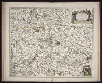
- Creator:
- Visscher, Nicolaes, 1649-1702
- Published / Created:
- ca. 1684
- Call Number:
- Folio 469
- Collection Title:
- [Atlas factice of 13 maps by Nicolaes Visscher I, Nicolaes Visscher II, Guillaume Sanson, and
- Image Count:
- 1
- Publisher:
- Nicolaes Visscher
- Subject (Geographic):
- Europe --Maps --Early works to 1800 and Namur (County) --Maps --Early works to 1800
- Subject (Topic):
- Atlases, Dutch --Early works to 1800
- Collection Created:
- 1677-1692
- Found in:
- Beinecke Rare Book and Manuscript Library > Comitatus Namurci / [cartographic material] / emendata delineatio nuperrime in lucem edita per Nicolaum Visscher
- Creator:
- Homann Erben (Firm)
Lotter, Tobias Conrad, 1717-1777
Seutter, Matthaeus, 1678-1756
- Published / Created:
- 1750
- Call Number:
- 1973 Folio 30
- Collection Title:
- [Atlas factice of 32 maps and 1 distance table, produced by the Homann Erben firm]
- Image Count:
- 2
- Publisher:
- [Matthaeus Seutter?]
- Subject (Geographic):
- Nordhausen (Germany : Landkreis) --Maps --Early works to 1800
- Subject (Topic):
- Atlases, German --Early works to 1800
- Collection Created:
- [Nuremberg : s.n., 1701-1760]
- Found in:
- Beinecke Rare Book and Manuscript Library > Comitatus Stolbergensis delineatio geographia, Praefecturas Hohnstein, Stolberg, Hayn Berenroda, Ebersburg, Ufftrungen, Rosla et Questen cum limitibus et vicinia accurate exhibens / [cartographic material] / caelo Matthaei Seutteri. Georgraphi Caesarei ;
- Creator:
- Homann Erben (Firm)
Trenckmann, Johannes Paulus
- Published / Created:
- a. 1760
- Call Number:
- 1973 Folio 30
- Collection Title:
- [Atlas factice of 32 maps and 1 distance table, produced by the Homann Erben firm]
- Image Count:
- 2
- Alternative Title:
- Comitatus Schoenburgensis
- Publisher:
- Edentibus Homannianis Heredibus
- Subject (Geographic):
- Zwickau (Germany : Landkreis) --Maps --Early works to 1800
- Subject (Topic):
- Atlases, German --Early works to 1800
- Collection Created:
- [Nuremberg : s.n.,
- Found in:
- Beinecke Rare Book and Manuscript Library > Comitatvs Schoenburgensis [cartographic material] : in quo celsissimorum comitum de Schoenburg regiones ad circulum Saxoniae superiorem Imperii Romano-Germanici pertinentes et in Marchionatu Misniae sitae, subfeuda porro Bohemico-Imperialia, nempe Dynasti
- Creator:
- Lotter, Tobias Conrad, 1717-1777
Seutter, Matthaeus, 1678-1756
- Published / Created:
- 1750
- Call Number:
- 1973 Folio 30
- Collection Title:
- [Atlas factice of 32 maps and 1 distance table, produced by the Homann Erben firm]
- Image Count:
- 2
- Publisher:
- [Matthaeus Seutter?]
- Subject (Geographic):
- Saxony-Anhalt (Germany) --Maps --Early works to 1800
- Subject (Topic):
- Atlases, German --Early works to 1800
- Collection Created:
- [Nuremberg : s.n., 1701-1760]
- Found in:
- Beinecke Rare Book and Manuscript Library > Delineatio geographica comitatus Mansfeldensis ad jurisdictionem tum Saxonicam tum Brandenburgicam spectans, cum praefectura Sangerhusana, Querfurtensi, Sittenbacensi, Allstaedensi, et loci finitimis / [cartographic material] / cura Matth. Seutteri, Geogr
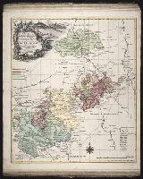
- Creator:
- Lotter, Georg Friedrich
Lotter, Tobias Conrad, 1717-1777
- Published / Created:
- ca. 1757
- Call Number:
- 1973 Folio 30
- Collection Title:
- [Atlas factice of 32 maps and 1 distance table, produced by the Homann Erben firm]
- Image Count:
- 2
- Publisher:
- [Tobias Conrad Lotter?]
- Subject (Geographic):
- Greiz (Germany : Landkreis) --Maps --Early works to 1800
- Subject (Topic):
- Atlases, German --Early works to 1800
- Collection Created:
- [Nuremberg : s.n.,
- Found in:
- Beinecke Rare Book and Manuscript Library > Delineatio geographica specialis territorii celsissimorum S.R.I. comitum Ruthenorum de Plauia [cartographic material] : utriusque linea senioris et iunioris partem Vogtlandiae / opera et studio Ioh. Gottlieb Schulzii, S.C.M. Ingen. Lieut. ; accurate edita
- Creator:
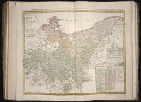
- Gussefeld, F. L. (Franz Ludwig), 1744-1807
Homann Erben (Firm)
Schmidt, I. M.
- Published / Created:
- 1780
- Call Number:
- 1983 Folio 23
- Collection Title:
- [Atlas factice of 50 maps, primarily by Johann Baptist Homann and/or issued by the Homann Erben
- Image Count:
- 1
- Alternative Title:
- Tabula Marchionatus Brandenburgici & Ducatus Pomeraniae quae sunt pars septrionalis Circuli Saxionae Superioris
- Publisher:
- [Homann Erben]
- Subject (Geographic):
- Brandenburg (Germany) --Maps --Early works to 1800 and Pomerania (Poland and Germany) --Maps --Early works to 1800
- Collection Created:
- [Nuremberg : Homann Erben, 1710-1786]
- Found in:
- Beinecke Rare Book and Manuscript Library > Der noerdliche Theil des Obersaechsischen Kreises oder die Mark Brandenburg und das Herzogthum Pommern / [cartographic material] / aufs neue entworfen durch F.L.G. ; und ans Licht gestellet von den Homan[n] Erben = Tabula Marchionatus Brandenburgici & Duc
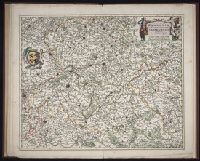
- Creator:
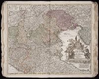
- Homann, Johann Baptist, 1663-1724
- Published / Created:
- 1720?
- Call Number:
- 1975 Folio 31
- Collection Title:
- [Atlas factice of 42 maps, produced by the Homann Erben firm]
- Image Count:
- 1
- Publisher:
- Johann Baptist Homann
- Subject (Geographic):
- Italy, Northern --Maps --Early works to 1800 and Veneto (Italy) --Maps --Early works to 1800
- Subject (Topic):
- Atlases, German --Early works to 1800
- Collection Created:
- [Nuremberg,
- Found in:
- Beinecke Rare Book and Manuscript Library > Dominii Veneti cum vicinis Parmae, Mutinae, Mantuae, et Mirandolae statibus nova descriptio / [cartographic material] / edita a Ioh. Baptista Homanno, sacrae caes. majestatis geographo