Skip to search
Skip to main content
Skip to first result
Search
You Searched For
Date
Unknown
Resource Type
Maps, Atlases & Globes
Date Created
[Missing]
New Search
Search Results
Creator:
Published / Created:
undated
Call Number:
WA MSS S-1741 BrSides
Collection Title:
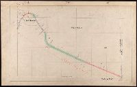
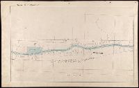
Colorado Midland Railway Company maps
Container / Volume:
Folder 4
Image Count:
11
Resource Type:
Maps, Atlases & Globes
Description:
Versos blank, not digitized.
Subject (Geographic):
Buena Vista (Colo.)--Maps, Colorado--Maps, and Park County (Colo.)--Maps
Subject (Name):
Colorado Midland Railway Company
Subject (Topic):
Mines and mineral resources--Colorado--Maps and Railroads--Colorado--Maps
Found in:
Beinecke Rare Book and Manuscript Library > [Maps of Park and Chaffee Counties, Colorado]
Creator:
Published / Created:
undated
Call Number:
WA MSS S-1741 BrSides
Collection Title:
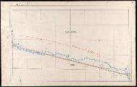
Colorado Midland Railway Company maps
Container / Volume:
Folder 5
Image Count:
12
Resource Type:
Maps, Atlases & Globes
Description:
Versos blank, not digitized. and Wanting Chaffee County Map 1[?]
Subject (Geographic):
Buena Vista (Colo.)--Maps, Chaffee County (Colo.)--Maps, Colorado--Maps, and Park County (Colo.)--Maps
Subject (Name):
Colorado Midland Railway Company
Subject (Topic):
Mines and mineral resources--Colorado--Maps and Railroads--Colorado--Maps
Found in:
Beinecke Rare Book and Manuscript Library > [Maps of Park and Chaffee Counties, Colorado]
Creator:
Published / Created:
undated
Call Number:
WA MSS S-1741 BrSides
Collection Title:
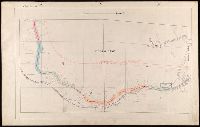
Colorado Midland Railway Company maps
Container / Volume:
Folder 6
Image Count:
13
Resource Type:
Maps, Atlases & Globes
Description:
Versos blank, not digitized.
Subject (Geographic):
Buena Vista (Colo.)--Maps, Chaffee County (Colo.)--Maps, and Colorado--Maps
Subject (Name):
Colorado Midland Railway Company
Subject (Topic):
Mines and mineral resources--Colorado--Maps and Railroads--Colorado--Maps
Found in:
Beinecke Rare Book and Manuscript Library > [Maps of Park and Chaffee Counties, Colorado]
Creator:
Published / Created:
undated
Call Number:
WA MSS S-1741 BrSides
Collection Title:
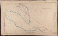
Colorado Midland Railway Company maps
Container / Volume:
Folder 7
Image Count:
10
Resource Type:
Maps, Atlases & Globes
Description:
Versos blank, not digitized.
Subject (Geographic):
Colorado--Maps, Eagle County (Colo.)--Maps, and Pitkin County (Colo.)--Maps
Subject (Name):
Colorado Midland Railway Company
Subject (Topic):
Mines and mineral resources--Colorado--Maps and Railroads--Colorado--Maps
Found in:
Beinecke Rare Book and Manuscript Library > [Maps of Pitkin and Eagle Counties, Colorado]
Creator:
Published / Created:
undated
Call Number:
WA MSS S-1741 BrSides
Collection Title:
Colorado Midland Railway Company maps
Container / Volume:
Folder 8
Image Count:
11
Resource Type:
Maps, Atlases & Globes
Description:
Versos blank, not digitized.
Subject (Geographic):
Colorado--Maps, Eagle County (Colo.)--Maps, and Pitkin County (Colo.)--Maps
Subject (Name):
Colorado Midland Railway Company
Subject (Topic):
Mines and mineral resources--Colorado--Maps and Railroads--Colorado--Maps
Found in:
Beinecke Rare Book and Manuscript Library > [Maps of Pitkin and Eagle Counties, Colorado]
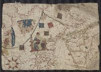
Creator:
Call Number:
Art Storage 1980 156
Image Count:
2
Resource Type:
Maps, Atlases & Globes
Description:
Contains eight compass roses., Decoration: armorial shields, city views with gilded banners, tents, and Madonna with child., In frame 92 x 118 cm., Pen-and-ink in brown, red, blue and green., Portolan chart with seaport names given for all coastlines., and Title devised by cataloger.
Subject (Geographic):
Baltic Sea--Maps--Early works to 1800., Mediterranean Sea--Maps--Early works to 1800., and North Atlantic Ocean--Maps--Early works to 1800.
Subject (Topic):
Manuscript maps --Mediterranean Region, Portolanos --Europe, and Portolanos --Mediterranean Region
Found in:
Beinecke Rare Book and Manuscript Library > [Portolan chart of the Mediterranean Sea, the North Atlantic Ocean, the Baltic Sea, and the West African coast].
Creator:
Call Number:
Art Storage 30cea 1555
Image Count:
2
Resource Type:
Maps, Atlases & Globes
Description:
Contains five compass roses., Decoration: city views with banners, figures holding armorial shields, animals, and Jesus Christ on the cross flanked by the Virgin Mary and Mary Magdalene., Includes degrees of latitude along left edge: 18°N to 63°N., Includes two North Atlantic islands "Frislandia" and "Stilanda" in upper left corner and inset map of the world in the lower center., Pen-and-ink in black, red, blue and green., Portolan chart with seaport names given for all coastlines., and Title devised by cataloger; last two numerals of date have been altered.
Subject (Geographic):
Baltic Sea--Maps--Early works to 1800, Mediterranean Sea--Maps--Early works to 1800, and North Atlantic Ocean--Maps--Early works to 1800
Found in:
Beinecke Rare Book and Manuscript Library > [Portolan chart of the Mediterranean Sea, the North Atlantic Ocean, the Baltic Sea, and the northwestern African coast].
Branch:v1.62.0 ,Deployed:2024-06-26T09:57:02-04:00