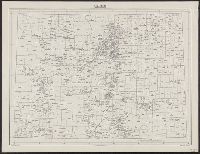
Great Britain. War Office. General Staff. Geographical Section
Published / Created:
1945
Call Number:
56 C442 1945
Container / Volume:
BRBL_00296
Image Count:
1
Resource Type:
Maps, Atlases & Globes
Alternative Title:
Great Britain. War Office. General Staff. Geographical Section. G.S.G.S. ; 2400. and Its G.S.G.S. ; 2400
Description:
"Form lines are shown at about 30 feet V.I.", "Polyconic projection.", "Published at W.O., Dec. 1908. G.S.G.S. revised edition, 1927-AMS 1, 1944.", In upper margin: China 1:63,360 ..., Military grid., and Soundings are shown for port areas.
Publisher:
Army Map Service, U.S. Army,
Subject (Geographic):
Beidaihe (China)--Maps and Qinhuangdao Shi (China)--Maps
Its A.M.S. ; M961 and Series (Standard map series designation system) ; M961.
Description:
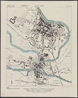
"Copied from a French map 1:6,000, Nouveau plan de Charleville-Mezieres.", At head of title: France 1:5,000., and Some streets and buildings are named.
National Geographic Society (U.S.). Cartographic Division
Published / Created:
1978
Call Number:
7821 1978A
Container / Volume:
BRBL_00506
Image Count:
2
Resource Type:
Maps, Atlases & Globes
Alternative Title:
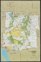
Arizona, New Mexico, Utah, Colorado, Close-up U.S.A., Arizona, New Mexico, Utah, Colorado, Close-up USA, Arizona, New Mexico, Utah, Colorado, Close-up USA, the Southwest, and Southwest
Description:
Above panel title: 3., Includes list of abbreviations., On verso bottom: 02703., Relief shown by shading and spot heights., Shows points of interest., and Text and col. ill on verso.
Publisher:
The Society,
Subject (Geographic):
Four Corners Region--Maps and Southwest, New--Maps
National Geographic Society (U.S.). Cartographic Division
Published / Created:
1979
Call Number:
738 1979
Container / Volume:
BRBL_00387
Image Count:
2
Resource Type:
Maps, Atlases & Globes
Description:
"Lambert conformal conic projection, standard parallels 51⁰25ʹ and 60⁰55ʹ.", "Supplement to the National Geographic, May 1979, page 650A, vol. 155, no. 5.", Folded title: Close-up, Canada, Saskatchewan, Manitoba, Northwest Territories., and Includes descriptive
National Geographic Society (U.S.). Cartographic Division
Published / Created:
1978
Call Number:
739 1978
Container / Volume:
BRBL_00389
Image Count:
2
Resource Type:
Maps, Atlases & Globes
Alternative Title:
Canada, British Columbia, Alberta, and the Yukon Territory
Description:
Folded title: Close-up, Canada, British Columbia, Alberta, Yukon Territory., Includes descriptive notes., On verso: Yukon Territory, 1:4,900,000.--Canada's Rocky Mountain Parks, 1:2,375,000.--Victoria and Vancouver,, and Relief shown by shading and spot heights.
Publisher:
The Society,
Subject (Geographic):
Alberta--Maps, British Columbia--Maps, and Yukon--Maps