Geological and Geographical Survey of the Territories (U.S.)
Published / Created:
1879
Call Number:
80cbj 1879
Container / Volume:
BRBL_00537
Image Count:
1
Resource Type:
Maps, Atlases & Globes
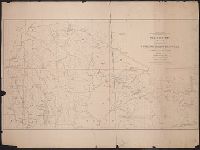
Description:
Relief shown by hachures and spot heights.
Publisher:
the Survey,
Subject (Geographic):
Green River Watershed (Wyo.-Utah)--Maps
Subject (Name):
Bechler, G. R, Chittenden, George B, Clark, Fred A, Gannett, Henry, 1846-1914, Hayden, F. V. (Ferdinand Vandeveer), 1829-1887, Julius Bien & Co, and Wilson, A. D. (Allen D.)
Subject (Topic):
Watersheds--Idaho--Maps, Watersheds--Utah--Maps, and Watersheds--Wyoming--Maps
In upper left margin: Eleventh Census of the United States., Includes text and table of railroads' statutory authorizations., Prime meridians: Washington and Greenwich., and Relief indicated by hachures.
"Julius Bien & Co. Lith. N.Y.", "Surveyed in 1899.", Plate CXXXVIII from the "Twenty-first annual report" of the U.S. Geological Survey, Part 5, Forest reserves (1900)., Relief shown by contours and spot heights., and Shows six classes of land cover.
Publisher:
The Survey,
Subject (Geographic):
Bighorn National Forest (Wyo.)--Maps and Sheridan County (Wyo.)--Maps
Subject (Name):
Geological Survey (U.S.). Annual report, Julius Bien & Co, and Tweedy, Frank, 1854-1937
Subject (Topic):
Forests and forestry--Wyoming--Sheridan County--Maps and Land capability for agriculture--Wyoming--Sheridan County--Maps
"Engraved Apr. 1901 by Julius Bien & Co.", "Surveyed, Plate CXLI from the "Twenty-first annual report" of the U.S. Geological Survey, Part 5, Forest reserves (1900)., Relief shown by contours and spot heights., and Shows four classes of land cover.
Publisher:
The Survey,
Subject (Geographic):
Black Hills National Forest (S.D. and Wyo.)--Maps and Weston County (Wyo.)--Maps
Subject (Name):
Geological Survey (U.S.). Annual report and Julius Bien & Co
Subject (Topic):
Forests and forestry--Wyoming--Weston County--Maps and Land capability for agriculture--Wyoming--Weston County--Maps