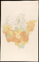
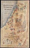
"To Dr. Lincoln B. Hale in appreciation and friendship, Jerusalem, Adar 5717 March 1957"., Autograph of David Ben-Gurion on recto., Autograph on verso: Barbara Richard Dains ... Seymour, Conn., Coordinates not present on map and are approximated., Manuscript note on verso: L.B. Hale, brother & Barbara's mother Mariam E. Hale (Richard)., On parchment., Title devised by cataloger., and Verses in English and Hebrew along borders.
Subject (Geographic):
Israel--Maps
Subject (Name):
Ben-Gurion, David,--1886-1973--Autograph., Dains, Barbara Richard--Autograph., and Hale, Lincoln B. (Lincoln Bell)
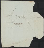
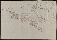
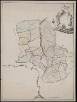
Map of Thunder Bay District, Canada, showing silver lands owned by Peter Mitchell and others
Description:
Accompanied by mailing envelope addressed in manuscript to R.H. Rickard., Coordinates not present on map and are approximated., From the Richard H. Rickard Papers., North oriented towards the upper right., and Title devised by cataloger from manuscript note on accompanying envelope.
Subject (Name):
Rickard, Richard H.,---1885--Ownership.
Subject (Topic):
Landowners--Ontario--Thunder Bay--Maps., Real property--Ontario--Thunder Bay--Maps., and Silver mines and mining--Ontario--Thunder Bay--Maps.
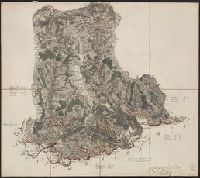
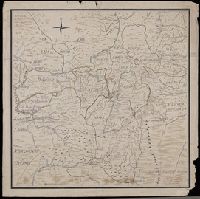
In manuscript on map: Kapitan" Matveĭ Loginov"; on verso: Ural-Gebiet, zwischen Kasan u. Jekaterinburg; stampf of the Königliches Kartographisches Institut, Berlin., Relief shown pictorially and by spot heights., and Title devised by cataloger.
Subject (Geographic):
Orenburgskai︠a︡ oblastʹ (Russia)--Maps--Early works to 1800. and Ural Mountains (Russia)--Maps--Early works to 1800.
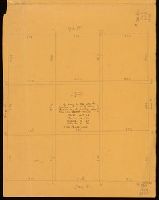
Color: pencil with pen notation., Elm St. 12ch. 66, Note on face of map: "By survey in 1848 after this Square was made by setting the fence in, the following dimensions were obtained., and On verso: "Deposited by the Treasurer's Office in writing of E.C. Herrick, Surveyor & Bookseller. Librarian 1843-58. Treasurer 1852-1862."
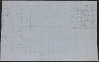
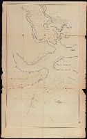
Coordinates not present on map and are approximated., Depths shown by soundings., From the Nathaniel Pendleton family papers., North oriented towards the right., Shows channel between Cumberland and Amelia Islands on the Georgia/Florida border where the Saint Marys River flows out to the Atlantic., Title devised by cataloger., and Watermark.
Subject (Geographic):
Saint Marys River (Ga. and Fla.)--Maps--Early works to 1800.