Search
You Searched For
Search Results
- Creator:
- Edinburgh Geographical Institute
- Published / Created:
- [ca. 1910].
- Call Number:
- 51 1910
- Container / Volume:
- BRBL_00280
- Image Count:
- 1
- Resource Type:
- Maps, Atlases & Globes
- Found in:
- Beinecke Rare Book and Manuscript Library > General map of Palestine, Ancient and Modern / J.G. Bartholomew.
- Creator:
- Geological Survey (U.S.)
- Published / Created:
- 1905?]
- Call Number:
- 837gce T764 1905
- Container / Volume:
- BRBL_00594
- Image Count:
- 1
- Resource Type:
- Maps, Atlases & Globes
- Found in:
- Beinecke Rare Book and Manuscript Library > General map of Truckee-Carson Project, Nevada / U.S. Geological Survey.
- Published / Created:
- 190-?]
- Call Number:
- 73GM 1909
- Container / Volume:
- BRBL_00376
- Image Count:
- 1
- Resource Type:
- Maps, Atlases & Globes
- Found in:
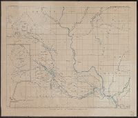
- Beinecke Rare Book and Manuscript Library > General map of north-western Canada, showing railways and navigable waters / sg'd. John Armstrong, chief engineer, Hudson Bay R'y Surveys.
- Creator:
- Anglo-Australian & China Telegraph Company, Limited
- Published / Created:
- 1863
- Call Number:
- BrSides Folio 2019 3
- Image Count:
- 1
- Resource Type:
- Maps, Atlases & Globes
- Found in:
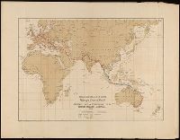
- Beinecke Rare Book and Manuscript Library > General map of telegraph lines between England & Australia / Anglo-Australian & China Telegraph Company, Limited.
- Creator:
- Davis, Charles Henry, 1807-1877
- Published / Created:
- 1867]
- Call Number:
- 89 1866
- Container / Volume:
- BRBL_00658
- Image Count:
- 1
- Resource Type:
- Maps, Atlases & Globes
- Found in:
- Beinecke Rare Book and Manuscript Library > General map of the American isthmuses : showing the various lines proposed for interoceanic communication / compiled by C.H. Davis ; drawn by Louis Waldecker.
- Creator:
- Geological Survey (U.S.)
- Published / Created:
- 1905?]
- Call Number:
- 847 Y12 1905
- Container / Volume:
- BRBL_00627
- Image Count:
- 1
- Resource Type:
- Maps, Atlases & Globes
- Found in:
- Beinecke Rare Book and Manuscript Library > General map of the Yakima Basin, Washington.
- Published / Created:
- 1843?]
- Call Number:
- 51 B.C. 17
- Container / Volume:
- BRBL_00280
- Image Count:
- 1
- Resource Type:
- Maps, Atlases & Globes
- Found in:
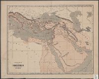
- Beinecke Rare Book and Manuscript Library > General map of the counties mentioned in the Bible.
- Creator:
- Wilson, James, Jr
- Published / Created:
- 1880
- Call Number:
- 812gbc 1880
- Container / Volume:
- BRBL_00556
- Image Count:
- 1
- Resource Type:
- Maps, Atlases & Globes
- Found in:
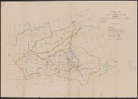
- Beinecke Rare Book and Manuscript Library > General map of the lead region showing the distribution of the lodes / by James Wilson, Jr.
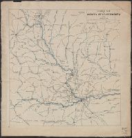
- Published / Created:
- 1913
- Call Number:
- 825 L487 1913
- Container / Volume:
- BRBL_00574
- Image Count:
- 1
- Resource Type:
- Maps, Atlases & Globes
- Found in:
- Beinecke Rare Book and Manuscript Library > General map of vicinity of Leavenworth.