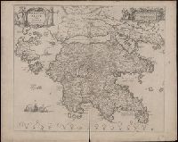
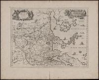
Achaiae noua & accurata descriptio and Achaiae nova et accurata descriptio
Description:
Coordinates not present on map and are approximated., Includes four bar scales., Manuscript number in upper left corner: 30. Cardinal directions written in Latin manuscript along neat line., Relief shown pictorially., and Verso blank.
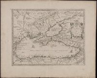
Archipelagi meridionalis, seu Cycladvm Insularum accurata delineatio
Description:
Includes three bar scales., Manuscript number in upper left corner: 33., Relief shown pictorially., and Verso blank.
Publisher:
[Jan Jansson],
Subject (Geographic):
Aegean Islands (Greece and Turkey)--Maps--Early works to 1800., Cyclades (Greece)--Maps--Early works to 1800., Dodecanese Islands (Greece)--Maps--Early works to 1800., and Sporades (Greece)--Maps--Early works to 1800.
Appears in Jansson's historical atlas editions from 1652-1684., Hand colored., and Relief shown pictorially.
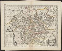
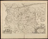
Publisher:
Apud Joannem Janssonium,
Subject (Geographic):
Benelux countries--Historical geography--Maps--Early works to 1800., Benelux countries--Maps--Early works to 1800., Europe, Central--Historical geography--Maps--Early works to 1800., Europe, Central--Maps--Early works to 1800., Europe, Eastern--Historical geography--Maps--Early works to 1800., Europe, Eastern--Maps--Early works to 1800., Germany--Historical geography--Maps--Early works to 1800., and Germany--Maps--Early works to 1800.
Subject (Name):
Jansson, Jan, 1588-1664
Subject (Topic):
Ethnology--Europe--Maps--Early works to 1800. and Germanic peoples--Maps--Early works to 1800.
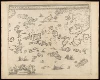
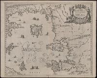
Insvlarvm archipelagi septentrionalis seu Maris Aegaei accurata delineatio
Description:
Coordinates not present on map and are approximated., Includes four bar scales., Manuscript number in upper left corner: 32., Relief shown pictorially., and Verso blank.
Publisher:
[Jan Jansson],
Subject (Geographic):
Aegean Islands (Greece and Turkey)--Maps--Early works to 1800.
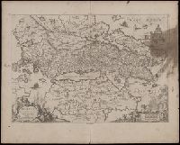
Relief shown pictorially., Verso blank., and Watermark. Manuscript number in upper left corner: 27. Manuscript annotations below neat line.
Publisher:
[Jan Jansson],
Subject (Geographic):
Albania, Albania--Maps--Early works to 1800., Europe--Macedonia, Greece--Maps--Early works to 1800., Macedonia (Republic)--Maps--Early works to 1800., and Macedonia--Maps--Early works to 1800.
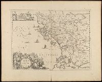
Coordinates not present on map and are approximated., Includes four bar scales., Relief shown pictorially., Verso blank., and Watermark. Manuscript number in upper left corner: 31. Manuscript annotation at top: Thebo.
Publisher:
[Jan Jansson],
Subject (Geographic):
Peloponnesus (Greece : Peninsula)--Maps--Early works to 1800.