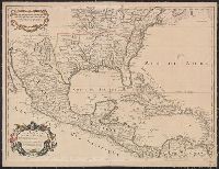
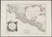
At bottom: Voyages in 12, Tome 74, Page 235. Tome 17, in 8⁰, Page 340., From A.F. Prévost's Histoire générale des voyages. Paris: Didot ..., 1746-1789., Ms. no., in green, on verso: 31. Sheet measures 55.5 x 36 cm. Cross Collection no. 105., and Relief shown pictorially.
Publisher:
s.n.,
Subject (Geographic):
Kamchatka Peninsula (Russia)--Maps--Early works to 1800
Subject (Name):
Prévost, abbé, 1697-1763. Histoire générale des voyages
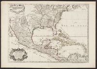
[American maps ; v. 1, no. 8] and Library of Congress. American maps ; v. 1, no. 8.
Description:
Imprint date from R.V. Tooley's French mapping of the Americas, item 50., Prime meridian: Ferro., Relief shown pictorially., and Yale's copy stamped on verso: Yale University Library, Karpinski-Von Wieser Map Collection.
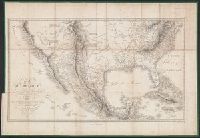
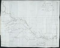
"Impr. par Kögel.", Includes "Profil de la route de Mexico á Veracruz" and ill. of "L'Ixtaccihuatl et le Popocatepetl vus de l'Ouest" and "Citlaltepetl et Sierra Negra vus de S-O.", and Relief shown by hachures and spot heights.
Publisher:
H. Müllhaupt,
Subject (Geographic):
Meseta Central (Mexico)--Maps
Subject (Name):
Kögel, Mullhaupt, H. H., 1820-1894, and Steinmann, G. (George)
Voyage dans les deux Lousiianes, et chez les nations sauvages du Missouri, par les Etats-Unis, l
Image Count:
1
Description:
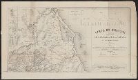
Between p. 178 & p. 179. and Teaching resource: Professor John Mack Faragher, History 141: The American West.
Subject (Geographic):
Louisiana --Description and travel --Early works to 1800, Mississippi River Valley --Description and travel, and Ohio River Valley --Description and travel