Skip to search
Skip to main content
Skip to first result
Search
You Searched For
Extent of Digitization
Unspecified
Format
cartographic
Genre
Engravings
New Search
Search Results
Creator:
Call Number:
1973 Folio 116
Collection Title:
The English pilot: describing the West-India navigation, from Hudson's-Bay to the river Amazones
Image Count:
1
Subject (Geographic):
Atlantic Ocean --Maps --Early works to 1800 and New York (State) --Maps --Early works to 1800
Subject (Topic):
Navigation --Early works to 1800, Pilot guides --Atlantic Coast (U.S.) --Early works to 1800, and Pilot guides --Caribbean Area --Early works to 1800
Collection Created:
London :
Found in:
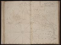
Beinecke Rare Book and Manuscript Library > A draught of New York from the Hook to New Yorktown
Creator:
Call Number:
1974 Folio 72
Collection Title:
The English pilot: describing the West-India navigation, from Hudson's-Bay to the river Amazones
Image Count:
1
Subject (Geographic):
Atlantic Ocean --Maps --Early works to 1800, James River (Va.) --Maps, and Virginia --Maps --Early works to 1800
Subject (Topic):
Navigation --Early works to 1800, Pilot guides --Atlantic Coast (U.S.) --Early works to 1800, and Pilot guides --Caribbean Area --Early works to 1800
Collection Created:
London : Printed for W. and J. Mount, T. Page and son, on Tower-Hill, MDCCLX [1760]
Found in:
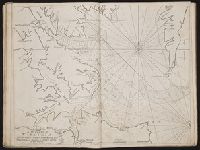
Beinecke Rare Book and Manuscript Library > A draught of Virginia from the capes to York in York River and to Kuiquotan or Hamton in James River
Creator:
Call Number:
1973 Folio 116
Collection Title:
The English pilot: describing the West-India navigation, from Hudson's-Bay to the river Amazones
Image Count:
2
Subject (Geographic):
Atlantic Ocean --Maps --Early works to 1800 and Virginia --Maps --Early works to 1800
Subject (Topic):
Navigation --Early works to 1800, Pilot guides --Atlantic Coast (U.S.) --Early works to 1800, and Pilot guides --Caribbean Area --Early works to 1800
Collection Created:
London :
Found in:
Beinecke Rare Book and Manuscript Library > A draught of Virginia from the capes to York in York River and to Kuiquotan or Hamton in James River
Call Number:
1974 Folio 72
Collection Title:
The English pilot: describing the West-India navigation, from Hudson's-Bay to the river Amazones
Image Count:
1
Subject (Geographic):
Atlantic Ocean --Maps --Early works to 1800, Guiana --Maps --To 1800, Guyana --Maps, South America --Maps --Early works to 1800, and Suriname --Maps
Subject (Topic):
Navigation --Early works to 1800, Pilot guides --Atlantic Coast (U.S.) --Early works to 1800, and Pilot guides --Caribbean Area --Early works to 1800
Collection Created:
London : Printed for W. and J. Mount, T. Page and son, on Tower-Hill, MDCCLX [1760]
Found in:
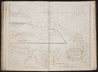
Beinecke Rare Book and Manuscript Library > A draught of the coast of Guiana from the river Oronoque to the river Amazones
Call Number:
1978 Folio 10
Collection Title:
The English pilot: describing the West-India navigation, from Hudson's-Bay to the river Amazones
Image Count:
1
Subject (Geographic):
Atlantic Ocean --Maps --Early works to 1800, Guiana --Maps --To 1800, Guyana --Maps, South America --Maps --Early works to 1800, and Suriname --Maps
Subject (Topic):
Navigation --Early works to 1800, Pilot guides --Atlantic Coast (U.S.) --Early works to 1800, and Pilot guides --Caribbean Area --Early works to 1800
Collection Created:
London : Printed for Thomas Page, William and Fisher Mount, in Postern-Row on Tower-hill, MDCCXXV [1725]
Found in:
Beinecke Rare Book and Manuscript Library > A draught of the coast of Guiana from the river Oronoque to the river Amazones
Call Number:
1973 Folio 116
Collection Title:
The English pilot: describing the West-India navigation, from Hudson's-Bay to the river Amazones
Image Count:
1
Subject (Geographic):
Atlantic Ocean --Maps --Early works to 1800, Dominican Republic --Maps, Manuscript --Early works to 1800, Haiti --Maps --Early works to 1800, Hispaniola --Maps --Early works to 1800, Puerto Rico --Maps --Early works to 1800, and West Indies --Maps --Early works to 1800
Subject (Topic):
Navigation --Early works to 1800, Pilot guides --Atlantic Coast (U.S.) --Early works to 1800, and Pilot guides --Caribbean Area --Early works to 1800
Collection Created:
London :
Found in:
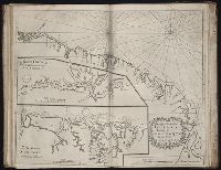
Beinecke Rare Book and Manuscript Library > A draught of the island of Beata, on the south side of Hispaniola
Call Number:
1973 Folio 116
Collection Title:
The English pilot: describing the West-India navigation, from Hudson's-Bay to the river Amazones
Image Count:
1
Description:
Imperfect: mutilated with some loss of image.
Subject (Geographic):
Africa, West --Maps --Early works to 1800, Atlantic Ocean --Maps --Early works to 1800, New England --Maps --Early works to 1800, Newfoundland and Labrador --Maps --Early works to 1800, Portugal --Maps --Early works to 1800, South America --Maps --Early works to 1800, and West Indies --Maps --Early works to 1800
Subject (Topic):
Navigation --Early works to 1800, Pilot guides --Atlantic Coast (U.S.) --Early works to 1800, and Pilot guides --Caribbean Area --Early works to 1800
Collection Created:
London :
Found in:
Beinecke Rare Book and Manuscript Library > A general chart of the western ocean
Creator:
Published / Created:
1771
Call Number:
Franklin 391 1755e
Collection Title:
Geographical, historical, political, philosophical and mechanical essays : the first, containing an
Image Count:
1
Description:
Bound facing p. 32., Broken into 12 tiles, backed with linen., and Hand-colored illustrations.
Subject (Geographic):
Erie, Lake., Middle Atlantic States--Maps., Ohio River Valley--Maps., and Ontario, Lake (N.Y. and Ont.)
Collection Created:
Philadelphia: Printed by B. Franklin, and D. Hall., MDCCLV [1755]
Found in:
Beinecke Rare Book and Manuscript Library > A general map of the middle British colonies in America
Creator:
Published / Created:
1755
Call Number:
391 +1755h
Collection Title:
Geographical, historical, political, philosophical and mechanical essays : the first, containing an
Image Count:
1
Resource Type:
Maps, Atlases & Globes
Description:
This second issue of the second edition includes the original map with title: A general map of the middle British colonies in America; viz. Virginia, Ma`riland, De`laware, Pensilvania, New-Jersey, New-York, Connecticut, and Rhode Island: of Aquanishuonigy
Subject (Geographic):
Erie, Lake., Middle Atlantic States--Maps., Ohio River Valley--Maps., and Ontario, Lake (N.Y. and Ont.)
Collection Created:
Philadelphia: Printed by B. Franklin, and D. Hall., MDCCLV [1755]
Found in:
Beinecke Rare Book and Manuscript Library > A general map of the middle British colonies in America
Published / Created:
1776
Call Number:
Cb23 27
Collection Title:
The American military pocket atlas : being an approved collection of correct maps, both general and
Image Count:
1
Alternative Title:
The Seat of war in the middle British colonies, containing Virginia, Maryland, the Delware counties, &ca
Description:
15th Oct. 1776., Inset: A Sketch of the upper parts of Canada., and Teaching resource: Professor John Mack Faragher, History 141: The American West.
Publisher:
Printed for R. Sayer & J. Bennett, Map, Chart & Printsellers, No. 53, Fleet Street, as the Act directs
Subject (Geographic):
New England --Maps --Early works to 1800, North America --Maps --Early works to 1800, and United States --History --Revolution, 1775-1783 --Maps
Collection Created:
London : Printed for R. Sayer and J. Bennet, [1776]
Found in:
Beinecke Rare Book and Manuscript Library > A general map of the middle British colonies in America. Containing Virginia, Maryland, the Delaware counties, Pennsylvania and New Jersey. With the addition of New York, and of the greatest part of New England, as also of the bordering parts of the province of Quebec, improved from several surveys made after the late war, and corrected from Governor Pownall's late map 1776.
Branch:v1.61.6 ,Deployed:2024-06-12T09:55:31-04:00