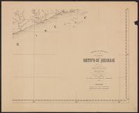
Depths shown by soundings; relief by shading., Includes three inset maps (Porto de barra do R. Inhamissengo; Porto e barra do R. Chinde; Porto e barra do R. Quilimane) and one vertical map (Corte do terreno entre o R. Chire e o mar)., and Title in manuscript on verso.
Publisher:
Commissão de Cartographia,
Subject (Geographic):
Zambezi River Delta (Mozambique)--Maps
Subject (Name):
Briezemeister, A. and Portugal. Comissão de Cartografia das Colónias
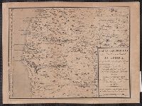
Each sheet includes notes on sources., Imperfect: 3 sheets wanting., Mossamedes-sá da Bandeira -- Pereira de Eça -- Vila Serpa Pinto -- Dirico -- Cuando., and Relief shown by contours and spot heights.
Publisher:
Ministério das Colónias, Comissão de Cartografia,
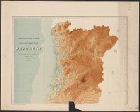
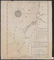
Color: red and black ink, longitude and latitude grid colored yellow., Coordinates not present on map and are approximated., and Includes information on seasonal currents.
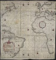
Below lower left margin: A.I.M. Faria. esc. 2., Contains nine compass roses., Copy printed on 4 sheets of vellum, joined together to form 1 sheet. Imperfect: top right edge mutilated. Hand-colored., Covers also continent of Europe as far east as Greece, Africa entire continent from north to south as far east as Libya, North America as far south west as Virginia, part of Cuba, Jamaica, West Indies, and South America as far south as far south as Buenos Aires., Dedication: "Offerecida ao Illustrissimo e Excellentisimo Senhor Luis de Vasconcellos e Souza, do Conselho de Sua Magestade Fidelissima, Vice Reij e Capitaõ General de Mar, e Terra do Estado do Brazil.", Each country and its imperial provinces demarcated with coat-of-arms., Historiated title cartouche., Includes foliated cartouche with: Declaracao Preliminar., No relief shown., Prime meridians: London, Paris, and Ferro; coordinates converted by cataloger to express longitude based on Greenwich prime meridian., and Shows continents, names of countries, coastal towns, cities, and islands.
Publisher:
[Simão Antônio da Rosa Pinheiro],
Subject (Geographic):
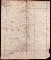
Atlantic Ocean--Maps, Manuscript--Early works to 1800
Subject (Name):
Faria, A. I. M.
Subject (Topic):
Nautical charts--Atlantic Ocean--Early works to 1800.