"Henry Gannet, Chief Geographer, H.M. Wilson, Geographer in charge; Topography by Frank Sutton and J.H. Jennings; surveyed in 1891-1892.", "Reprinted Nov. 1906.", "Surveyed in cooperation with the State of New York.", Contour interval 20 feet., and Relief shown by contours.
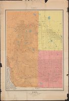
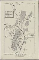
Map of the city of Duluth, St. Louis County, Minn., and vicinity
Description:
Includes advertisement., Library's copy missing upper left corner and separated in two sheets at center fold., Oriented with north to upper right., and Soundings in feet.
Publisher:
Albertson & Chamberlain,
Subject (Geographic):
Duluth Metropolitan Area (Minn.)--Maps and Superior (Wis.)--Maps