Skip to search
Skip to main content
Skip to first result
Yale University Library
Ask Yale Library
Reserve Rooms
Places to Study
Research
Quicksearch
Search Library Catalog (Orbis)
Search Law Library Catalog (MORRIS)
Search Borrow Direct
Search WorldCat
Search Articles+
Search Digital Collections
Search Archives at Yale
Research Guides
Find Databases by Title
Find eJournals by Title
Guide to Using Special Collections
Services
Your Personal Librarian
Subject Specialists
Research Support and Workshops
Citation Tools
OverDrive: Popular Audio and eBooks
Get It @ Yale (Borrow Direct, Interlibrary Loan, Scan & Deliver)
Course Reserves
Off-Campus Access
EliScholar
OverDrive: Popular Audio and eBooks
Bass Media Equipment
Libraries & Collections
Arts Library
Bass Library
Beinecke Library
Classics Library
Divinity Library
Film Study Center
Fortunoff Archive
Humanities Collections
International Collections
Law Library
Lewis Walpole Library
Library Collection Services
Manuscripts & Archives
Map Collection
Marx Science & Social Science Library
Medical Library
Music Library
Sterling Library
Yale Center for British Art
Information & Policies
Library Hours
Departments & Staff
Borrowing & Circulation
Services for Persons with Disabilities
Copyright Basics
Scanning, Printing & Copying
Computers & Wireless
Library Policies
About the Library
Giving to the Library
Purchase Request
Working at the Library
Terms Governing Use of Materials
Search in
All Fields
Creator
Title
Call Number
Date
Subject
Orbis ID
Full Text
Description
Full text
search for
Search
Search
Advanced Search
Digital Collections
Search
You Searched For
Genre
Maps
Resource Type
Maps, Atlases & Globes
New Search
« Previous
|
64
-
72
of
11,289
|
Next »
Sort
by relevance
relevance
Creator (A --> Z)
Creator (Z --> A)
Title (A --> Z)
Title (Z --> A)
Year (ascending)
Year (descending)
Number of results to display per page
9
per page
9
per page
30
per page
60
per page
99
per page
View results as:
List
List
Gallery
Gallery
Search Results
64.
A General Map of the Southern British Colonies in America, comprehending North and South Carolina, Georgia, East and West Florida, with the Neighboring Indian Countries ... by B. Romans, 1776.
Published / Created:
1776
Call Number:
755 1776A
Container / Volume:
BRBL_00430
Image Count:
1
Resource Type:
Maps, Atlases & Globes
Description:
From the American Military Pocket Atlas of the British Colonies, which now are or may be The Theatre of War. See 71.1774, Pamphlet box. and Insets: Plan of Charlestown and St. Augustine.
Publisher:
Printed for R. Sayer and J. Bennett,
Subject (Geographic):
East (U.S.)--Maps--Early works to 1800
Found in:
Beinecke Rare Book and Manuscript Library
>
A General Map of the Southern British Colonies in America, comprehending North and South Carolina, Georgia, East and West Florida, with the Neighboring Indian Countries ... by B. Romans, 1776.
65.
A General Map of the World or Terraqueous globe with all the new discoveries ... by Sam'l Dunn ...
Published / Created:
1787
Call Number:
11 1787
Container / Volume:
BRBL_00006
Image Count:
2
Resource Type:
Maps, Atlases & Globes
Description:
Preliminary record.
Publisher:
Robert Sayer,
Subject (Geographic):
World--Maps--Early works to 1800
Found in:
Beinecke Rare Book and Manuscript Library
>
A General Map of the World or Terraqueous globe with all the new discoveries ... by Sam'l Dunn ...
66.
A General map of Great Britain ... and To the right Honourable ... This map of South America ... H. Moll, Geographer. B. Lens, delin G. Vertus, Sculp.
Published / Created:
[1711?] and 1746.
Call Number:
3191hc 1746
Container / Volume:
BRBL_00041
Image Count:
1
Resource Type:
Maps, Atlases & Globes
Description:
G. Vertue, Sculp. and Insets: View of Potosi.
Publisher:
B. Lens,
Subject (Geographic):
Great Britain--Maps--Early works to 1800 and South America--Maps--Early works to 1800
Found in:
Beinecke Rare Book and Manuscript Library
>
A General map of Great Britain ..., To the right Honourable ... This map of South America ... H. Moll, Geographer. B. Lens, delin G. Vertus, Sculp.
67.
A Generall Mapp of the Coast of Barbarie, where in are the Kingdoms, and Estates of Morocco, Fez, Algiers, Tunis, and Tripolis: also, the Kingdoms, Estates, and Deserts of Barca, Egipt, Libya, Biledulgerid, Segelmesse, and Darha ... By Monsieur Sanson. Il
Published / Created:
1667
Call Number:
66 1667
Container / Volume:
BRBL_00347
Image Count:
1
Resource Type:
Maps, Atlases & Globes
Subject (Geographic):
Morocco--Maps--Early works to 1800
Found in:
Beinecke Rare Book and Manuscript Library
>
A Generall Mapp of the Coast of Barbarie, where in are the Kingdoms, and Estates of Morocco, Fez, Algiers, Tunis, and Tripolis: also, the Kingdoms, Estates, and Deserts of Barca, Egipt, Libya, Biledulgerid, Segelmesse, and Darha ... By Monsieur Sanson. Il
68.
A Geographical View of all the Post Towns in the United States of America and their distances from each other according to the establishment of the Postmaster General, 1796. By Samuel A. Puddock, Accomptant, Boston. B. Callender, Sculp., Boston.
Published / Created:
1796
Call Number:
75 1796A
Container / Volume:
BRBL_00396
Image Count:
1
Resource Type:
Maps, Atlases & Globes
Subject (Geographic):
United States--Maps--Early works to 1800
Found in:
Beinecke Rare Book and Manuscript Library
>
A Geographical View of all the Post Towns in the United States of America and their distances from each other according to the establishment of the Postmaster General, 1796. By Samuel A. Puddock, Accomptant, Boston. B. Callender, Sculp., Boston.
69.
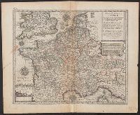
A Geographicall description of France ...
Published / Created:
[1660?]
Call Number:
38 1660
Image Count:
1
Resource Type:
Maps, Atlases & Globes
Publisher:
Printed and Sould by Jo. Ouerton,
Subject (Geographic):
France--Maps--Early works to 1800
Found in:
Beinecke Rare Book and Manuscript Library
>
A Geographicall description of France ...
70.
A Geological Map of the Connecticut.
Published / Created:
[1822?]
Call Number:
767CA 1822
Container / Volume:
BRBL_00476
Image Count:
1
Resource Type:
Maps, Atlases & Globes
Description:
Engraved by A. Doolittle,1822.
Subject (Geographic):
Connecticut--Maps
Found in:
Beinecke Rare Book and Manuscript Library
>
A Geological Map of the Connecticut.
71.
A Large Chart of the Channel between England and France ... by Capt. Edmund Halley ...
Published / Created:
[1750?]
Call Number:
3211cea 1750
Container / Volume:
BRBL_00055
Image Count:
2
Resource Type:
Maps, Atlases & Globes
Description:
Insets: Falmouth H., Plymouth Hr. Isle of Wight ca. 1:200,000.
Publisher:
Will. Mount and Tho. Page,
Subject (Geographic):
English Channel--Maps--Early works to 1800
Found in:
Beinecke Rare Book and Manuscript Library
>
A Large Chart of the Channel between England and France ... by Capt. Edmund Halley ...
72.
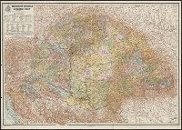
A Magyar korona országainak közigazgatási térképe / tervezte és rajzolta Kogutowicz Manó.
Creator:
Kogutowicz, Manó, 1851-1908
Published / Created:
1913
Call Number:
43 1913
Container / Volume:
BRBL_00250
Image Count:
1
Resource Type:
Maps, Atlases & Globes
Publisher:
Magyar földrajzi intézet,
Subject (Geographic):
Hungary--Political and administrative divisions--Maps
Found in:
Beinecke Rare Book and Manuscript Library
>
A Magyar korona országainak közigazgatási térképe / tervezte és rajzolta Kogutowicz Manó.
PREVIOUS
«
1
2
…
4
5
6
7
8
9
10
11
12
…
1,254
1,255
»
NEXT
Limit your search
Extent of Digitization
Completely digitized
11,039
Partially digitized
199
Unspecified
51
Access
Public
11,287
Yale Community Only
2
Repository
Beinecke Rare Book and Manuscript Library
11,289
Format
cartographic
11,275
mixed material
7
still image
6
text
1
Genre
Maps
✖
[remove]
11,289
Engravings
201
Maps in books
183
Hand coloring
100
Prints (Visual works)
94
Atlases
75
Illustrations
57
Early works
36
Annotations (Provenance)--18th century
28
Topographic maps
23
more
Genre
»
Resource Type
Maps, Atlases & Globes
✖
[remove]
11,289
Language
English
6,766
French
1,356
Latin
1,036
German
845
Italian
632
Spanish; Castilian
239
Dutch; Flemish
152
Russian
61
Japanese
38
Portuguese
38
more
Language
»
Creator
Rand McNally and Company
193
United States. Office of Strategic Services. Research and Analysis Branch
193
United States. Army Map Service
171
Great Britain. War Office. General Staff. Geographical Section
143
L'Isle, Guillaume de, 1675-1726
103
United States. General Land Office
67
Geological Survey (U.S.)
60
Sanson, Nicolas, 1600-1667
57
Blaeu, Willem Janszoon, 1571-1638
51
Homann, Johann Baptist, 1663-1724
45
more
Creator
»
Subject (Topic)
World War, 1914-1918--Maps
61
Railroads--United States--Maps
51
World maps--Early works to 1800
50
World War, 1939-1945--Campaigns--Western Front--Historical geography--Maps
36
Railroads--West (U.S.)--Maps
30
Navigation --Early works to 1800
28
Pilot guides --Atlantic Coast (U.S.) --Early works to 1800
28
Pilot guides --Caribbean Area --Early works to 1800
28
Railroads--Canada--Maps
25
Streets--California--Los Angeles--Maps
23
more
Subject (Topic)
»
Subject (Name)
Bien, Julius, 1826-1909
53
United States. Army Map Service
48
Julius Bien & Co
42
Streeter, Thomas W.--(Thomas Winthrop),--1883-1965--Ownership
35
Homann Erben (Firm)
33
United States. General Land Office
32
United States. Office of Strategic Services. Reproduction Branch
32
Arnold, Robert M.--Ownership
29
Roeser, C. (Charles)
29
Vallardi, Francesco
27
more
Subject (Name)
»
Publication Place
London :
864
New York :
445
Paris :
341
[Washington, D.C.] :
341
[S.l. :
301
Washington, D.C. :
285
[London] :
278
Milano :
262
Chicago :
246
Amstelodami :
155
more
Publication Place
»
Date Created
View distribution
Current results range from
917
to
2003
Date Created range begin
Date Created range end
View larger »
[Missing]
389