Chernyshov, Ivan Georgievich Dury, Andrew., creator Sayer, Robert, 1725-1794
Published / Created:
1787 October 24
Call Number:
1982 Folio 10
Image Count:
1
Alternative Title:
Map of the present seat of war, between the Russians, Poles, and Turk
Description:
Also shows parts of Hungary and Poland., Includes paste-on addition to northwestern sheet depicting Bosnia, Herzegovina, and the Dalmatian Coast., No. 26 of 43 maps bound together in composite atlas., Prime meridian: Ferro., Relief shown pictorially., Scale [ca. 1:2,500,000]., and Sheets mounted together to form 2 sheets.
Publisher:
Wm. Faden
Subject (Geographic):
Black Sea --Maps --Early works to 1800 and Russia --Maps --Early works to 1800
Subject (Topic):
Russo-Turkish War, 1787-1792 --Maps --Early works to 1800
"K atlasu prilagai︠u︡tsi︠a︡ obʺi︠a︡snenīi︠a︡, napechatannyi︠a︡ otdi︠e︡lʹnoi︠u︡ knigoi︠u︡.", Blank versos of maps not digitized., and Joel Sumner Smith "Catalogue of Books" No. 856.
Publisher:
Izd. Kartograficheskago zavedenīi︠a︡ A. Ilʹina,
Subject (Geographic):
Russia--Historical geography and Russia--Historical geography--Maps
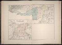
Atlas fisico y politico de la Republica de Venezuela ... por ... Agustin Codazzi ...
Image Count:
1
Resource Type:
Maps, Atlases & Globes
Alternative Title:
Carta del Canton de Caycara de la provincia de la Guayana
Description:
Double page width, tab mounted. and Lith. de Thierry Fres. Cite Bergere 1 a Paris, printers.
Subject (Geographic):
Apure (Venezuela)--Maps, Bolivar (Venezuela : State)--Maps, Guayana Region (Venezuela)--Maps, Orinoco River Valley (Venezuela and Colombia), and Venezuela --Maps