Skip to search
Skip to main content
Skip to first result
Search
You Searched For
Extent of Digitization
Partially digitized
Genre
Maps
New Search
Search Results
Call Number:
Taylor 136
Collection Title:
La cosmographia, y geographia del S. Hieronimo Girava Tarragones : en la qual se contiene la
Image Count:
1
Description:
Map has several small holes along fold lines. and On verso: map has several small marks ranging from yellow to brown and gray.
Subject (Name):
Miranda, Giovanni de, 16th cent
Subject (Topic):
Discoveries in geography --Early works to 1800, Discoveries in geography --Spanish, Maps --Early works to 1800, and Maps in books --1570
Collection Created:
En Venetia : Por Iordan Zileti, y su companero,
Found in:
Beinecke Rare Book and Manuscript Library > Typo de la carta cosmographica de Gaspar Vopellio Medeburgense
Creator:
Published / Created:
[1596]
Call Number:
Pequot +L65
Collection Title:
Nauigatio ac itinerarium Iohannis Hugonis Linscotani in Orientalem siue Lusitanorum Indiam
Image Count:
1
Description:
[Scale ca. 1:13,000,000]., Bound in following title page of "Descriptio totius Guineae tractus ...", In ink on top left panel of left verso: 3., and Map has several small tears now repaired on verso.
Subject (Geographic):
Africa, West --Maps --Early works to 1800
Subject (Name):
Claesz, Cornelis, ca. 1546-1609, publisher, Elzevier, Gillis, bookseller, and Hendricksz, Aelbrecht, fl. 1573-1605, printer
Subject (Topic):
Voyages and travels --Early works to 1800
Collection Created:
Hagae-Comitis : Ex officina Alberti Henrici, impensis authoris & Cornelii Nicolai, prostantque apud Aegidium Elseuirum, anno 1599
Found in:
Beinecke Rare Book and Manuscript Library > Typus orarum maritimarum Guineae, Manicongo & Angolae ultra promontorium Bonae Spei ...
Creator:
Published / Created:
1821
Call Number:
1996 142
Collection Title:
United States directory for the use of travellers and merchants : giving an account of the
Image Count:
1
Resource Type:
Maps, Atlases & Globes
Description:
Verso blank.
Publisher:
M. Carey & son
Subject (Geographic):
United States --Guidebooks
Collection Created:
Philadelphia : Printed by James Maxwell ..., 1822
Found in:
Beinecke Rare Book and Manuscript Library > United States of America compiled from the latest & best authorities
Published / Created:
[1625]
Call Number:
Pequot +P978
Collection Title:
Purchas his pilgrimes : In fiue bookes. The first, contayning the voyages and peregrinations made
Image Count:
1
Description:
Bound in following p. 1690.
Subject (Geographic):
America--Discovery and exploration--Early works to 1800
Subject (Topic):
Geography--Early works to 1800, Religions--Early works to 1800, and Voyages and travels--Early works to 1800
Collection Created:
London :
Found in:
Beinecke Rare Book and Manuscript Library > Virginia
Creator:
Published / Created:
[1732]
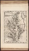
Call Number:
E1015 M66 1732
Collection Title:
Atlas minor: or a set of sixty-two new and correct maps, of all parts of the world. All composed
Image Count:
1
Description:
Autograph of Gravely. Autograph of Baldock. Autograph of Aston. Autograph of W. Alington.
Subject (Geographic):
America--Maps--Early works to 1800
Subject (Topic):
Atlases--Early works to 1800.
Collection Created:
London :
Found in:
Beinecke Rare Book and Manuscript Library > Virginia and Maryland by H. Moll geographer.
Creator:
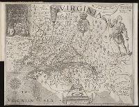
Call Number:
Taylor 256
Collection Title:
A map of Virginia : vvith a description of the covntrey, the commodities, people, government and
Image Count:
1
Abstract:
Inset depicting Powhatan.
Subject (Geographic):
Virginia --History --Colonial period, ca. 1600-1775
Subject (Topic):
Voyages and travels
Collection Created:
At Oxford : Printed by Joseph Barnes, 1612
Found in:
Beinecke Rare Book and Manuscript Library > Virginia discouered and described by Captayn John Smith
Call Number:
1973 Folio 114
Collection Title:
The English pilot: describing the West-India navigation, from Hudson's-Bay to the river Amazones
Image Count:
1
Resource Type:
Maps, Atlases & Globes
Subject (Geographic):
Atlantic Ocean --Maps --Early works to 1800, Maryland --Maps --Early works to 1800, New Jersey --Maps --Early works to 1800, and Virginia --Maps --Early works to 1800
Subject (Topic):
Navigation --Early works to 1800, Pilot guides --Atlantic Coast (U.S.) --Early works to 1800, and Pilot guides --Caribbean Area --Early works to 1800
Collection Created:
London : Printed for W. and J. Mount, T. Page and son, on Tower-Hill, MDCCLIX [1759]
Found in:
Beinecke Rare Book and Manuscript Library > Virginia, Maryland, Pennsilvania, east & west New Jarsey
Published / Created:
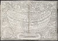
[1542]
Call Number:
Taylor 86
Collection Title:
Rvdimenta cosmographica
Image Count:
1
Alternative Title:
Universalis cosmographia
Description:
Map of the world
Subject (Topic):
Cosmography, Early maps, and Geography, Medieval
Collection Created:
Impressvm in inclyta Transylvaniae Corona 1542
Found in:
Beinecke Rare Book and Manuscript Library > Vniversalis cosmographia
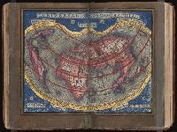
Call Number:
1977 1341
Collection Title:
Geographiae vniversae opvs habentur Cl. Ptolemaei ... Geographicae enarationis libri octo [tr. by W
Image Count:
1
Resource Type:
Maps, Atlases & Globes
Subject (Topic):
Geography--Early works to 1800
Collection Created:
Venetiis : Apud Haeredes Simonis Galignani de Karera, 1596
Found in:
Beinecke Rare Book and Manuscript Library > Vniversi orbis descriptio ad vsvm navigantivm
Call Number:
Gfp94 gf525j
Collection Title:
Geographiae vniversae ... opvs ... habentur Cl. Ptolemaei ... Geographicae enarrationis libri octo
Image Count:
1
Resource Type:
Maps, Atlases & Globes
Subject (Topic):
Geography--Early works to 1800
Collection Created:
Venetiis : Apud Haeredes Simonis Galignani de Karera, 1596
Found in:
Beinecke Rare Book and Manuscript Library > Vniversi orbis descriptop as vsvm navigantivm
Branch:v1.61.8 ,Deployed:2024-06-20T11:15:02-04:00