No. 18 of 43 maps bound together in composite atlas., Reduite d'apres la grande carte pour trouver facilement ce qu'on a envie de chercher dans celle-la., Relief shown pictorially., Scale [ca 1:3,750,000]., Table alphabetique des villes ... qui se trouvent dans cette carte., and With inset map: Morceau detache qui represente l'acroissement des etats de sa majeste le roi de Sardaigne, depuis l'an 1680.
British & Spanish territories according to the treaty of 1784
Description:
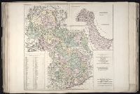
For a description of the second and third states see Stevens and Tree, Comparative Cartography, Map Collectors' Circle (1967)., Includes historical notes and a color key., Includes text., No. 40 of 43 maps bound together in composite atlas., Prime meridian: London., Relief shown pictorially., Scale [ca. 1:6,750,000]., and Shows numerous boundary changes.
Publisher:
Willm. Faden
Subject (Geographic):
United States --Boundaries --Maps --Early works to 1800 and United States --Maps --Early works to 1800