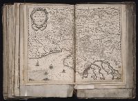
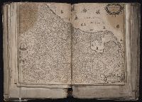
[Atlas factice of 96 maps by Blaeu, Visscher, Jansson, Hondius and others]
Image Count:
1
Description:
Imperfect: bar scale and imprint cut-out and repaired with loss of text. Reinforced along edges with printed waste. Sheet measures 38.8 x 51 cm. No. 83 of 92 maps bound together. and Numbered 89 on verso.
Publisher:
Joannis Janssonius excudit
Subject (Geographic):
Carniola (Slovenia) --Maps --Early works to 1800 and Croatia --Maps --Early works to 1800
Comenius, Johann Amos, 1592-1670 Goos, Abraham, engraver Visscher, Claes Jansz., 1586 or 7-1652
Published / Created:
[ca. 1627]
Call Number:
1983 Folio 19
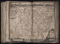
Collection Title:
[Atlas factice of 96 maps by Blaeu, Visscher, Jansson, Hondius and others]
Image Count:
1
Description:
Imperfect: mutilated along fold, with some loss of text; bottom half, including bar scale and edition statement, cut off, partially replicated in ms. Reinforced along edges with printed waste. Sheet measures 45.6 x 54.7 cm. No. 80 of 92 maps bound together. and Numbered 86 on verso.
Publisher:
Claes Jansz. Visscher
Subject (Geographic):
Moravia (Czech Republic) --Maps --Early works to 1800
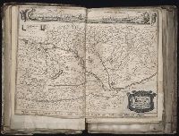
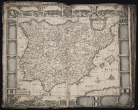
[Atlas factice of 96 maps by Blaeu, Visscher, Jansson, Hondius and others]
Image Count:
1
Description:
Imperfect: mutilated and repaired, with loss of cartouche, replicated in ms. with new cartouche title Hungariae regnum partim a Turcis, partima Christianis occupatum. Sheet measures 39.8 x 52.6 cm. No. 9 of 92 maps bound together.
Gryp, Dirck, engraver Hondius, Jodocus, 1594 or 5-1629
Published / Created:
[ca. 1630]
Call Number:
1983 Folio 19
Collection Title:
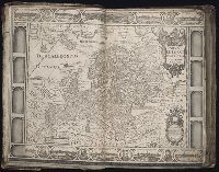
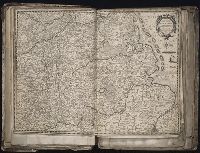
[Atlas factice of 96 maps by Blaeu, Visscher, Jansson, Hondius and others]
Image Count:
1
Description:
Imperfect: torn and mutilated along fold and edges, partially repaired, with some loss of text. Sheet measures 45.5 x 53.7 cm. No. 63 of 92 maps bound together. and Numbered 68 on verso.
Publisher:
Jodocus Hondius
Subject (Geographic):
Brabant (Belgium) --Maps --Early works to 1800, Brabant (Duchy) --Maps --Early works to 1800, and North Brabant (Netherlands) --Maps --Early works to 1800
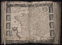
[Atlas factice of 96 maps by Blaeu, Visscher, Jansson, Hondius and others]
Image Count:
1
Description:
Imperfect: torn along fold, with some loss of text; portions of decorative border cut or torn and repaired, with missing sections replicated in ms.; tears repaired. Sheet measures 45.3 x 56.4 cm. No. 2 of 92 maps bound together.
Duetecum, Baptista, engraver Hondius, Hendrik, 1597-1651 Wit, Frederik de
Published / Created:
1652
Call Number:
1983 Folio 19
Collection Title:
[Atlas factice of 96 maps by Blaeu, Visscher, Jansson, Hondius and others]
Image Count:
1
Description:
Imperfect: torn and repaired along folds and in corners, with some loss of text. Sheet measures 38.8 x 54.8 cm. Reinforced along edges with manuscript waste. No. 50 of 92 maps bound together. and Numbered 54 on verso.
[Atlas factice of 96 maps by Blaeu, Visscher, Jansson, Hondius and others]
Image Count:
1
Description:
Imperfect: torn along fold, with some loss of text; portions of decorative border cut or torn and repaired, with missing sections replicated in ms.; tears repaired. Sheet measures 46.1 x 56 cm. No. 1 of 92 maps bound together.
[Atlas factice of 96 maps by Blaeu, Visscher, Jansson, Hondius and others]
Image Count:
1
Description:
Imperfect: mutilated along fold, with some loss of text; portions of decorative border cut or torn and repaired; tears repaired. Sheet measures 46.1 x 55 cm. No. 26 of 92 maps bound together.