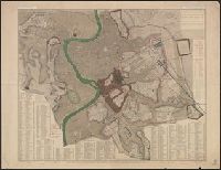
"Engraved by W. Harwood ... London." and ALS, signed, tipped in. Letter of transmittal to the Boston Athenaeum includes Parker's statement "I do not propose to publish it [the plan], but have made a few copies printed for private circulation only."
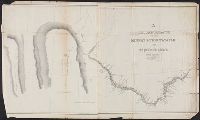
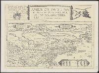
Chrrah tanka; the Great Hills or Coteau De Prairie. and Minnay shoshoh chrray; or Great Hills of the Missouri.
Description:
Includes Indian and French terms., Includes maps of "Minnay shoshoh chrray; or Great Hills of the Missouri," and "Chrrah tanka; the Great Hills or Coteau De Prairie.", Relief shown by hachures., and Shows points of interest and topography.
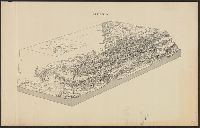
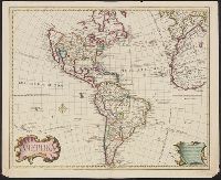
Includes text., Prime meridian: Ferro., Relief shown pictorially., Shows northwest coast in the form used in Guillaume De L'Isle's 1722 map of America. Cf. Wagner, H.R. Cartog. of the NW coast, p. 142., and Tooley refers to this map in Mapping of America, p. 13,
Publisher:
s.n.,
Subject (Geographic):
America--Maps--Early works to 1800
Subject (Name):
L'Isle, Guillaume de, 1675-1726 and L'Isle, Joseph Nicolas de, 1688-1768