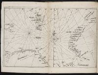
Descriptio ac delineatio geographica detectionis freti, sive, transitus ad occasum supra terras
Image Count:
1
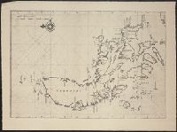
Description:
Bound in after p. [40]., Map has water stain on recto in upper right corner., Printed on recto in lower right corner: F., and Scale [ca. 1:10,000,000].
Subject (Geographic):
Barents Sea --Maps --Early works to 1800. and Norwegian Sea --Maps --Early works to 1800
Collection Created:
Amsterodami Ex officina Hesse lij Gerardi. Anno 1613
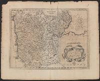
Coverage includes Breda, Leuven, Maastricht, Eindhoven, and the portion of Germany containing Aachen., Legend in German; place names in Dutch with parenthetical German forms., and Title supplied by cataloger.
Publisher:
s.n.,
Subject (Geographic):
Belgium--Boundaries--Netherlands--Maps and Netherlands--Boundaries--Belgium--Maps