Search
You Searched For
Search Results
- Creator:
- Clark, William, 1770-1838
Lewis, Samuel, 1753 or 4-1822
- Published / Created:
- [ca. 1814]
- Call Number:
- Zc10 814Le
- Collection Title:
- History of the expedition under the command of Captains Lewis and Clark, to the sources of the
- Image Count:
- 2
- Resource Type:
- Maps, Atlases & Globes
- Description:
- Verso blank.
- Subject (Geographic):
- Columbia River, Missouri River, and West (U.S.)
- Subject (Topic):
- Lewis and Clark Expedition (1804-1806)
- Collection Created:
- Philadelphia : Bradford & Inskeep ; New York : A.H. Inskeep : J. Maxwell, Printer, 1814
- Found in:
- Beinecke Rare Book and Manuscript Library > A map of Lewis and Clark's track, across the western portion of North America fom the Mississippi to the Pacific Ocean; by order of the Executive of the United States . In 1804, 5 & 6
- Call Number:
- 1977 +392
- Collection Title:
- A survey of the cities of London and Westminster : containing the original, antiquity, increase
- Image Count:
- 1
- Description:
- Plate between p. 60-61.
- Subject (Geographic):
- London
- Collection Created:
- London : Printed for A. Churchill, J. Knapton, R. Knaplock, J. Walthoe [and 6 others],
- Found in:
- Beinecke Rare Book and Manuscript Library > A map of St. Giles Cripple Gate without. With large additions and corrections
- Call Number:
- 1977 +392
- Collection Title:
- A survey of the cities of London and Westminster : containing the original, antiquity, increase
- Image Count:
- 1
- Resource Type:
- Maps, Atlases & Globes
- Description:
- Plate between p. 44-45.
- Subject (Geographic):
- London (England)--History
- Collection Created:
- London : Printed for A. Churchill, J. Knapton, R. Knaplock, J. Walthoe [and 6 others], 1720
- Found in:
- Beinecke Rare Book and Manuscript Library > A map of the parish if St. Katherines by the Tower
- Call Number:
- 1977 +392
- Collection Title:
- A survey of the cities of London and Westminster : containing the original, antiquity, increase
- Image Count:
- 1
- Resource Type:
- Maps, Atlases & Globes
- Description:
- Plate between p. 46-47.
- Subject (Geographic):
- London (England)--History
- Collection Created:
- London : Printed for A. Churchill, J. Knapton, R. Knaplock, J. Walthoe [and 6 others], 1720
- Found in:
- Beinecke Rare Book and Manuscript Library > A map of the parish of St. Dustans Stepney and Stebunheath divided into hamlets
- Call Number:
- 1977 +392
- Collection Title:
- A survey of the cities of London and Westminster : containing the original, antiquity, increase
- Image Count:
- 1
- Description:
- Plate between p. 74-75.
- Subject (Geographic):
- London
- Collection Created:
- London : Printed for A. Churchill, J. Knapton, R. Knaplock, J. Walthoe [and 6 others],
- Found in:
- Beinecke Rare Book and Manuscript Library > A mapp of the parish of St. Giles's in the Fields taken from the last servey, with corrections and additions
- Call Number:
- 1977 +392
- Collection Title:
- A survey of the cities of London and Westminster : containing the original, antiquity, increase
- Image Count:
- 1
- Resource Type:
- Maps, Atlases & Globes
- Description:
- Plate between p. 108-109.
- Subject (Geographic):
- London (England)--History
- Collection Created:
- London : Printed for A. Churchill, J. Knapton, R. Knaplock, J. Walthoe [and 6 others], 1720
- Found in:
- Beinecke Rare Book and Manuscript Library > A mapp of the parishes of St. Clements Danes, St. Mary Savoy; with the Rolls Liberty and Lincolns Inn, taken from the last survey with corrections and additions
- Call Number:
- 1977 +392
- Collection Title:
- A survey of the cities of London and Westminster : containing the original, antiquity, increase
- Image Count:
- 1
- Resource Type:
- Maps, Atlases & Globes
- Description:
- Plate between p. 26-27.
- Subject (Geographic):
- London (England)--History
- Collection Created:
- London : Printed for A. Churchill, J. Knapton, R. Knaplock, J. Walthoe [and 6 others], 1720
- Found in:
- Beinecke Rare Book and Manuscript Library > A mapp of the parishes of St. Saviours Southwark and St. Georges taken from the last survey with corrections
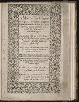
- Creator:
- Hare, Richard --Autograph, 1733
R. T. (Robert Tanner)
- Call Number:
- Taylor 180
- Collection Title:
- A mirror for mathematiques: a golden gem for geometricians: a sure safety for saylers, and an
- Image Count:
- 4
- Description:
- Title within ornamental border. Running title: The trauailers ioy and felicitie.
- Subject (Topic):
- Geometry --Early works to 1800., Mathematics --Early works to 1800., and Nautical astronomy --Early works to 1800
- Collection Created:
- Imprinted at London, By J. C. and are to be sold in Paules Churchyard, by Richard Watkins, 1587
- Found in:
- Beinecke Rare Book and Manuscript Library > A mirror for mathematiques: a golden gem for geometricians ...
- Creator:
- Bennett, John
Sayer, Robert, 1725-1794
- Call Number:
- 1977 Folio 78
- Collection Title:
- A New and accurate chart of the West-India Islands and coast, with the gulf passage through the New
- Image Count:
- 1
- Resource Type:
- Maps, Atlases & Globes
- Subject (Geographic):
- Caribbean Area., Central America., Cuba., Florida., Hispaniola., Jamaica., Louisiana., Puerto Rico., and West Indies
- Subject (Topic):
- Nautical charts
- Collection Created:
- London, Printed for Robert Sayer and John Bennett, Fleet-Street, 1779
- Found in:
- Beinecke Rare Book and Manuscript Library > A new general chart of the West Indies from the latest marine journals and surveys. Regulated and ascertained by astronomical observations
- Call Number:
- 1977 +379
- Collection Title:
- Geografia; cioe, Descrittione vniversale della terra. Partita in due volumi, nel primo de' quali si
- Image Count:
- 1
- Alternative Title:
- [Geographia. Italian]
- Subject (Geographic):
- Africa. and Guinea
- Subject (Topic):
- Geography
- Collection Created:
- In Padova, Appresso Paolo, & Francesco Galignani, fratelli, 1620-21 [v.1, 1621]
- Found in:
- Beinecke Rare Book and Manuscript Library > A new map of that part of Africacalled the coast of Guinea ...