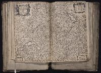
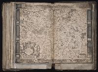
[Atlas factice of 96 maps by Blaeu, Visscher, Jansson, Hondius and others]
Image Count:
1
Description:
Date in imprint has been altered to read "1656". Without watermarks. Reinforced along lower edges with manuscript waste. Sheet measures 39.4 x 50.3 cm. No. 60 of 92 maps bound together. and Numbered 65 on verso.
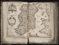
[Atlas factice of 96 maps by Blaeu, Visscher, Jansson, Hondius and others]
Image Count:
1
Description:
Imperfect: some ill. cut out or mutilated and replaced in ms.; torn along fold, with some loss of text. Sheet measures 41.3 x 57.5 cm. Reinforced along edges with printed waste. No. 87 of 92 maps bound together. and Numbered 93 on verso.
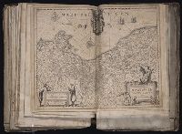
Blaeu, Willem Janszoon, 1571-1638 Lubin, Eilhard, 1565-1621 Rogiers, Salomon, engraver
Published / Created:
[ca. 1630]
Call Number:
1983 Folio 19
Collection Title:
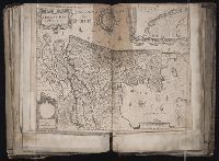
[Atlas factice of 96 maps by Blaeu, Visscher, Jansson, Hondius and others]
Image Count:
1
Description:
Imperfect: slightly mutilated along fold, with no loss of text. Reinforced along edges with printed waste. Sheet measures 39.1 x 51.2 cm. No. 79 of 92 maps bound together. and Numbered 85 [81, cancelled] on verso.
Publisher:
Guiljelm. Blaeuw excudit
Subject (Geographic):
Pomerania (Poland and Germany) --Maps --Early works to 1800
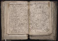
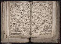
[Atlas factice of 96 maps by Blaeu, Visscher, Jansson, Hondius and others]
Image Count:
1
Description:
Imperfect: torn and repaired in lower right corner, with no loss of text. Sheet measures 39.5 x 50.2 cm. Reinforced along edges with paper. No. 53 of 92 maps bound together. and Numbered 57 on verso.
Publisher:
Everardus Cloppenburghius excudit
Subject (Geographic):
Bohemia (Czech Republic) --Maps --Early works to 1800
Appears in Wit's Atlas major., Includes coats of arms., No. 22 of 69 maps bound together in composite atlas., Relief shown pictorially., and Scale [ca. 1:1 100 000].
Publisher:
[Frederik de Wit]
Subject (Geographic):
Italy, Southern --Maps --Early works to 1800 and Naples (Kingdom) --Maps --Early works to 1800