Skip to search
Skip to main content
Skip to first result
Search
You Searched For
Extent of Digitization
Completely digitized
Format
cartographic
New Search
Search Results
Published / Created:
1873?]
Call Number:
844cbf 1873A
Container / Volume:
BRBL_00613
Image Count:
1
Resource Type:
Maps, Atlases & Globes
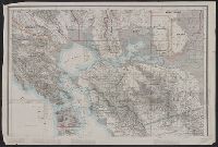
Description:
Library's copy missing southern sheet., Relief shown by hachures and spot heights. Depths shown by soundings., and Title devised by cataloger.
Publisher:
State Geological Survey of California?,
Subject (Geographic):
California--Maps
Subject (Name):
Geological Survey of California
Found in:
Beinecke Rare Book and Manuscript Library > [Topographical map of central California].
Published / Created:
[1940?]
Call Number:
456 1918A
Container / Volume:
BRBL_00259
Image Count:
1
Resource Type:
Maps, Atlases & Globes
Description:
Red lines connecting some towns printed over base map. and Relief shown by shading.
Publisher:
Kgl. Ung. Staatl. Kartographischen Institutes,
Subject (Geographic):
Transylvania (Romania)--Maps
Found in:
Beinecke Rare Book and Manuscript Library > [Transylvania] / Entworfen von Robert Csallner.
Published / Created:
1840-1844.
Call Number:
23 1844
Container / Volume:
BRBL_00020
Image Count:
3
Resource Type:
Maps, Atlases & Globes
Description:
Islands of Fakaafo or Bowditch ca. 1:300,000; Nuku-Nono or Duke of Clarence 1:75,000; Oatáfu or Duke of York 1:75,000; Swains, Jarvis, Birnies, Enderbury, Hull, New York or Washington all ca. 1:75,000; Funafuti or Ellices, Nukufetau o and Preliminary record.
Subject (Geographic):
Oceania--Maps
Found in:
Beinecke Rare Book and Manuscript Library > [U.S. Exploring Expedition Pacific Ocean] Engraved by Sherman and Smith, New York. By the U.S. Ex.Ex.
Branch:v1.61.8 ,Deployed:2024-06-20T11:14:46-04:00