English text on verso entitled: The description of the kingdom of Tartary, p. 39-40 (signature: V)., Illustrations on left border: A. Samoged -- Tartar genteel woman -- A Tartar -- Tartar country woman., Illustrations on right border: Samoged woman -- Tartar gentleman -- Tartar woman -- Tartar country man., Illustrations on top border: Astrakhan -- Samarkand -- Cambalu -- The House in Nova Zemla., Map folio 39 from: The theatre of the Empire of Great Britaine ... as also a prospect of the most famous parts of the world / John Speed. London : Thomas Bassett & Richard Chiswell, 1676., Map of Tartary [i.e. Mongolia] to the north of China controlled by marauding Mongols in the 13th-14th centuries. The map shows its provinces and cities stretching north from the Himalayas, west to eastern Europe and north of Chinae Regni Pars [i.e. China] and Corea Isle [i.e. Korea]. One feature is the Great Wall of China along the Chinese border on the lower right side of the map. There are many decorative features including along the top of the map pictorial scenes of the cities of Astrakhan, Samarkand and Cambalu, as well as an illustration of a "house in Nova Zemla". Left and right borders eight colourful illustrations of ethnic costumes from some of the peoples of Tartary., Relief shown pictorially., Text at top centre of map reviewing the discovery of Nova Zembla [i.e. the archipelago Novaya Zemlya] by the Dutch explorer William Hollander in 1594-96., and Watermark.
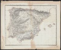
Abteilung II. Oro- und hydrographische Karte der Pyrenäischen Halbinsel, nach Berghaus, Oro- und hydrographische Karte der Pyrenäischen Halbinsel, nach Berghaus, and Platt's grosser Atlas der Erde.
Description:
Relief shown by hachures. and Stamp: Karpinski-von Wieser Map Collection.
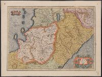
Appeared in Jansson's Accuratissima orbis antiqui delineatio., Covers also a portion of Libya., Manuscript notes on map. Manuscript number in upper left corner: 52., Oriented with north to the right., and Relief shown pictorially.
Subject (Geographic):
Egypt--Maps--Early works to 1800
Subject (Name):
Jansson, Jan, 1588-1664. Accuratissima orbis antiqui delineatio
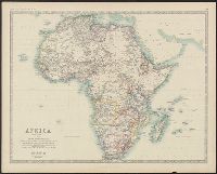
Boundaries hand colored., From Johnston's Royal atlas of modern geography., Prime meridian: Greenwich., Relief shown by hachures., Upper left: Keith Johnston's general atlas., and Upper right: 39.
Subject (Geographic):
Africa--Maps
Subject (Name):
Johnston, Alexander Keith, 1804-1871. Royal atlas of modern geography and W. & A.K. Johnston Limited
Boundaries hand colored., From Johnston's Royal atlas of modern geography?, Prime meridian: Greenwich., Relief shown by hachures., and Upper right: 36.
Subject (Geographic):
Africa--Maps
Subject (Name):
Johnston, Alexander Keith, 1804-1871. Royal atlas of modern geography and W. & A.K. Johnston Limited, publisher