Skip to search
Skip to main content
Skip to first result
Search
You Searched For
Language
Italian
New Search
Search Results
Published / Created:
1849]
Call Number:
40 M72 1849
Container / Volume:
BRBL_00211
Image Count:
12
Resource Type:
Maps, Atlases & Globes
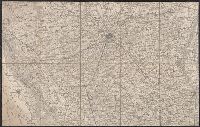
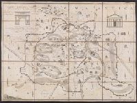
Description:
Wanting sheet 13?
Publisher:
Istituto Geographico Militare,
Subject (Geographic):
Modena (Italy : Province)--Maps
Found in:
Beinecke Rare Book and Manuscript Library > Carta topografica del Ducato di Modena.
Call Number:
402cbf 1814
Container / Volume:
BRBL_00233A
Image Count:
4
Resource Type:
Maps, Atlases & Globes
Description:
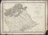
"Stampato oggi 22 Febbo. 1815"., Imperfect: Sheets wanting., and Relief shown by hachures.
Subject (Geographic):
Lombardo-Venetian Kingdom--Maps
Found in:
Beinecke Rare Book and Manuscript Library > Carta topografica del Regno Lombardo-Veneto, con paesi limitrofi ...
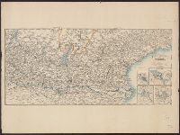
Creator:
Call Number:
40 T276 1840A
Image Count:
1
Resource Type:
Maps, Atlases & Globes
Description:
Imperfect: Small hole with loss of imagery. and Relief shown by hachures.
Subject (Geographic):
Veneto (Italy)--Maps
Subject (Name):
Remondini, Giuseppe Antonio, 1747-1811
Found in:
Beinecke Rare Book and Manuscript Library > Carta topografica del paese Trevigiano : posto tra la Brenta e la Livenza / di Giuseppe Malvolti.
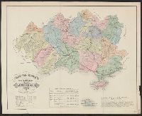
Published / Created:
1880
Call Number:
40 R66 1880
Image Count:
6
Resource Type:
Maps, Atlases & Globes
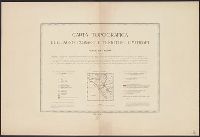
Description:
[Title sheet] -- Roma -- Civita-Vecchia -- Nettuno -- Palo -- Civita-Castellana., Map of Nettuno includes inset map of Velletri., Map of Palo has an inset table and graph showing the growth of the agro romano., and This map is a reproduction of the map published
Publisher:
Lit. Virano e Teano,
Subject (Geographic):
Civita Castellana (Italy)--Maps, Civitavecchia (Italy)--Maps, Nettuno (Italy)--Maps, Palo (Italy)--Maps, Rome (Italy)--Maps, Rome Region (Italy)--Maps, and Velletri (Italy)--Maps
Subject (Name):
Canevari, Raffaello and Lit. Virano e Teano
Found in:
Beinecke Rare Book and Manuscript Library > Carta topografica dell'agro romano e territori limitrofi in scala di 1 a 80.000 [cartographic material].
Creator:
Published / Created:
1805
Call Number:
400am R66 1805
Container / Volume:
BRBL_00233
Image Count:
1
Resource Type:
Maps, Atlases & Globes
Alternative Title:
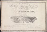
Carta topografica dell' antichità di Roma
Description:
"La quale esattamente contiene tutte le vestigie delle Antiche fabriche, e monumenti secondo il giro metodico di tutte le Antichità". and 400am R66 1805: Dissected and mounted on linen. Bookseller's label: Venance Monaldini ... Roma.
Publisher:
Si vende in Roma nel Negozio si Stampe, e Libri di Venanzia, Monaldini in Piazza di Spagna ...,
Subject (Geographic):
Rome (Italy)--Maps
Subject (Name):
Monaldini, Venanzio and Pronti, Domenico, 1750- engraver
Subject (Topic):
Geography, Ancient--Maps
Found in:
Beinecke Rare Book and Manuscript Library > Carta topografica dell'antichità di Roma [cartographic material] / Andrea Manazzale inv. ; D. Pronti inc.
Published / Created:
1848
Call Number:
40hc 1848
Container / Volume:
BRBL_00231
Image Count:
1
Resource Type:
Maps, Atlases & Globes
Publisher:
Presso la libreria d'Istruzione da Andrea Ubicini,
Subject (Geographic):
Italy--Maps
Found in:
Beinecke Rare Book and Manuscript Library > Carta topografica della guerra dell'Anno 1848.
Published / Created:
[ca. 1864]
Call Number:
40hc 1864
Container / Volume:
BRBL_00231
Image Count:
1
Resource Type:
Maps, Atlases & Globes
Description:
4 inset maps: [1.] Legnago -- [2.] Peschiera -- [3.] Verona -- [4.] Mantova.
Publisher:
Presso la libreria d'Educazione e d'Istruzione da Andrea Ubicini,
Subject (Geographic):
Italy, Northern--Maps
Found in:
Beinecke Rare Book and Manuscript Library > Carta topografica della guerra.
Published / Created:
[1860?]
Call Number:
40FB G914 1860
Container / Volume:
BRBL_00229
Image Count:
1
Resource Type:
Maps, Atlases & Globes
Publisher:
Lit. di Ach. Paris,
Subject (Geographic):
Grosseto (Italy : Province)--Maps
Found in:
Beinecke Rare Book and Manuscript Library > Carta topografica della provincia di Grosseto / redatta a cura dell'Ingegnere Capo Gaetano Niccoli.
Published / Created:
1866
Call Number:
40 M313 1859A
Container / Volume:
BRBL_00210
Image Count:
1
Resource Type:
Maps, Atlases & Globes
Publisher:
Cesare Crivelli,
Subject (Geographic):
Mantua (Italy : Province)--Maps
Found in:
Beinecke Rare Book and Manuscript Library > Carta topografica militare della Provincia di Mantova : il perimetro dello stato suo attuale l'ultima rettifica del giorno 18 Mag. 1866.
Published / Created:
1859
Call Number:
40 M313 1859
Container / Volume:
BRBL_00210
Image Count:
1
Resource Type:
Maps, Atlases & Globes
Publisher:
Cesare Crivelli,
Subject (Geographic):
Mantua (Italy : Province)--Maps
Found in:
Beinecke Rare Book and Manuscript Library > Carta topografica militare della Provincia di Mantova : il perimetro dello stato suo attuale l'ultima rettifica del giorno 28 Mag. 1859.
Branch:v1.61.6 ,Deployed:2024-06-12T09:55:33-04:00