National Geographic Society (U.S.). Cartographic Division
Published / Created:
1978
Call Number:
739 1978
Container / Volume:
BRBL_00389
Image Count:
2
Resource Type:
Maps, Atlases & Globes
Alternative Title:
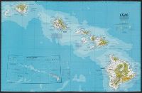
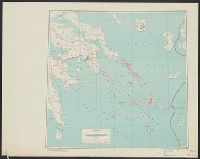
Canada, British Columbia, Alberta, and the Yukon Territory
Description:
Folded title: Close-up, Canada, British Columbia, Alberta, Yukon Territory., Includes descriptive notes., On verso: Yukon Territory, 1:4,900,000.--Canada's Rocky Mountain Parks, 1:2,375,000.--Victoria and Vancouver,, and Relief shown by shading and spot heights.
Publisher:
The Society,
Subject (Geographic):
Alberta--Maps, British Columbia--Maps, and Yukon--Maps
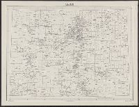
Great Britain. War Office. General Staff. Geographical Section. [G.S.G.S.] ; 4234, Great Britain. War Office. General Staff. Geographical Section. G.S.G.S. ; 4234., and GSGS (Series) ; 4234.
Description:
In upper margin: France 1:7,000., Military grid., and Some important streets and buildings are named.
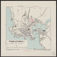
Great Britain. War Office. General Staff. Geographical Section
Published / Created:
1942
Call Number:
212 C81 1942
Container / Volume:
BRBL_00014
Image Count:
1
Resource Type:
Maps, Atlases & Globes
Alternative Title:
Geographical section, General staff. ; no. 4321 and GSGS (Series) ; 4321.
Description:
"Enlarged from an Admiralty chart [no. 1946] dated 1918. The position, alignment and value of all features is only approximate.", Elevations are shown by form lines., In upper margin: Azores 1:100,000 ..., Inset: Azores islands., and Military grid.
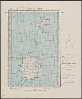
Publisher:
Army Map Service, U. S. Army,
Subject (Geographic):
Corvo Island (Azores)--Maps and Flores Island (Azores)--Maps
Its A.M.S. ; 6201 and Series (Standard map series designation system) ; 6201.
Description:
"Conical orthomorphic projection (Lambert conformal conic projection).", Elevations are shown by hachures and spot heights in meters., Inset shows area with detailed transportation information., and Principal roads, trails and railroads are shown.
"11-47.", "5207.", "Polyconic projection.", Elevations are shown by hachures and spot heights in feet., Previous issue included in series AMS 6201., and Principal roads and railroads are shown.