Search
You Searched For
Search Results
- Published / Created:
- [1711?]
- Call Number:
- 90 1711B
- Image Count:
- 1
- Found in:
- Beinecke Rare Book and Manuscript Library > A New and Exact map of the coast, countries and Islands within ye limits of ye South Sea Company ... Herman Moll, Geographer
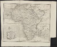
- Creator:
- Bowen, Emanuel, 1693 or 1694-1767
- Published / Created:
- 1748.
- Call Number:
- 60 1748
- Image Count:
- 1
- Found in:
- Beinecke Rare Book and Manuscript Library > A new and correct map of Africa : drawn from the most approved modern maps and charts, and adjusted by astronomical observations, representing also the course of the trade winds, monsoons, &c.
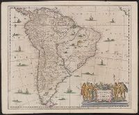
- Creator:
- Hondius, Hendrik, 1597-1651
- Published / Created:
- [1647]
- Call Number:
- 90 1645
- Image Count:
- 2
- Found in:
- Beinecke Rare Book and Manuscript Library > Americae pars meridionalis [cartographic material].
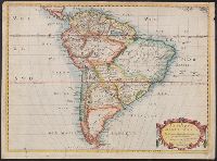
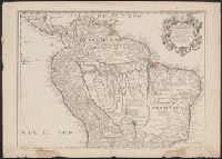
- Creator:
- Sanson, Nicolas, 1600-1667
- Published / Created:
- 1650.
- Call Number:
- 90 1650
- Image Count:
- 1
- Found in:
- Beinecke Rare Book and Manuscript Library > Amerique meridionale
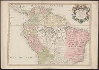
- Creator:
- L'Isle, Guillaume de, 1675-1726
- Published / Created:
- [1718]
- Call Number:
- 90 1703A
- Image Count:
- 1
- Found in:
- Beinecke Rare Book and Manuscript Library > Carte de la Terre Ferme, du Perou, du Bresil : et du Pays des Amazones
- Creator:
- L'Isle, Guillaume de, 1675-1726
- Published / Created:
- [1718]
- Call Number:
- 90 1703
- Image Count:
- 1
- Found in:
- Beinecke Rare Book and Manuscript Library > Carte de la Terre Ferme, du Perou, du Bresil : et du Pays des Amazones
- Creator:
- L'Isle, Guillaume de, 1675-1726
- Published / Created:
- 1700 [i.e. 1708]
- Call Number:
- 90 1700
- Image Count:
- 1
- Found in:
- Beinecke Rare Book and Manuscript Library > L'Amerique meridionale : dressée sur les observations de Mrs. de l'Academie Royale des Sciences & quelques autres, & sur les memoires les plus recens
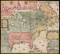
- Creator:
- Fer, Nicolas de, 1646-1720
- Published / Created:
- 1718.
- Call Number:
- 71 1718
- Image Count:
- 2
- Found in:
- Beinecke Rare Book and Manuscript Library > La France Occidentale dans l'Amérique Septentrionale : ou le cours de la Rivière de St. Laurens, aux environs de la quelle se trouvent Le Canada, L'Acadie, et la Gaspasie, Les Esquimaux, Les Hurons, Les Iroquois, Les Illinois & La Virginie, La Marie-Lande, La Pensilvanie, Le Nouveau-Jersay, La Nouvelle Yorck, La Nouvelle Angleterre et l'Isle de Terre-Neuve
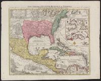
- Creator:
- Lotter, Tobias Conrad, 1717-1777, cartographer
- Published / Created:
- [between 1741 and 1760]
- Call Number:
- 85 1740D
- Image Count:
- 1
- Resource Type:
- cartographic image
- Found in:
- Beinecke Rare Book and Manuscript Library > Mappa geographica regionem Mexicanam et Floridam terrasque adjacentes, ut et anteriores Americae insulas, cursus itidem et reditus navigantium versus flumen Missisipi et alias colonias ob oculos ponens / [cartographic material]
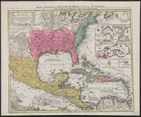
- Creator:
- Lotter, Tobias Conrad, 1717-1777, cartographer
- Published / Created:
- [between 1741 and 1760]
- Call Number:
- 71 1737A
- Image Count:
- 1
- Resource Type:
- cartographic image
- Found in:
- Beinecke Rare Book and Manuscript Library > Mappa geographica regionem Mexicanam et Floridam terrasque adjacentes, ut et anteriores Americae insulas, cursus itidem et reditus navigantium versus flumen Missisipi et alias colonias ob oculos ponens / [cartographic material]