Skip to search
Skip to main content
Skip to first result
Search
You Searched For
Genre
Maps
Language
Italian
New Search
Search Results
Published / Created:
[1918?]
Call Number:
40 1918
Container / Volume:
BRBL_00202
Image Count:
1
Resource Type:
Maps, Atlases & Globes
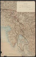
Description:
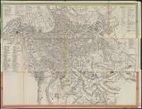
Shows pre-war boundaries and the Armistice line, Nov. 3, 1918. and Title supplied by cataloger.
Publisher:
Instituto Geografico Militare,
Subject (Geographic):
Italy, Northern--Maps
Found in:
Beinecke Rare Book and Manuscript Library > [New Boundaries of Italy in the Northeast].
Published / Created:
1892?]
Call Number:
40 1892
Container / Volume:
BRBL_00202
Image Count:
2
Resource Type:
Maps, Atlases & Globes
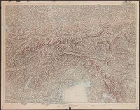
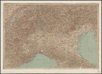
Description:
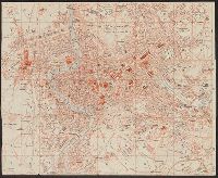
Stamp on verso: "Officiers-Bibliotek des k.k. Landwehr-Infanterie-Regiments Brünn Nr. 14."
Publisher:
s.n.,
Subject (Geographic):
Italy, Northern--Maps
Found in:
Beinecke Rare Book and Manuscript Library > [Northern Italy].
Published / Created:
[approximately 1960]
Call Number:
Art Storage 1019
Image Count:
2
Resource Type:
cartographic image
Description:
Twentieth century forgery of a portlan chart with seaport names given for all coastlines; based on chart from the circle of Vesconte Maggiolo., Title devised by cataloger., Pen-and-ink in gold, brown, red, blue, and green., Contains eight compass roses., Decoration: armorial shields, city views with gilded banners, tents, and Madonna with child., Pasted on wood backing with modern brocade edging., and Coordinates not present on map and are approximated.
Subject (Geographic):
Mediterranean Sea, North Atlantic Ocean, Black Sea, Africa, West, Mediterranean Sea., North Atlantic Ocean., Black Sea., and Africa, West.
Subject (Topic):
Nautical charts
Found in:
Beinecke Rare Book and Manuscript Library > [Portolan chart of the Mediterranean Sea, the North Atlantic Ocean, the Black Sea, and the northwestern African coast].
Published / Created:
[1885?].
Call Number:
40 R66 1885A
Container / Volume:
BRBL_00219
Image Count:
1
Resource Type:
Maps, Atlases & Globes
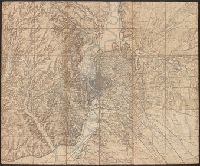
Description:
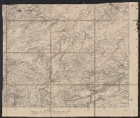
Title supplied by cataloger.
Publisher:
s.n.,
Subject (Geographic):
Rome (Italy : Province)--Maps
Found in:
Beinecke Rare Book and Manuscript Library > [Rome and Environs].
Creator:
Published / Created:
[187-?]
Call Number:
40 R66 1910A
Container / Volume:
BRBL_00219
Image Count:
1
Resource Type:
Maps, Atlases & Globes
Description:
Index in Italian., Indexed., Relief shown by hachures., and Title supplied by cataloger.
Publisher:
Geograph. Anst. v. Wagner & Debes,
Subject (Geographic):
Rome (Italy)--Maps
Subject (Name):
Kiepert, Heinrich, 1818-1899
Found in:
Beinecke Rare Book and Manuscript Library > [Rome] [cartographic material] / H. Kiepert dis.
Published / Created:
1910]
Call Number:
40 R66 1910
Container / Volume:
BRBL_00219
Image Count:
1
Resource Type:
Maps, Atlases & Globes
Description:
"From Hand-book" on catalog card.
Publisher:
s.n.,
Subject (Geographic):
Rome (Italy)--Maps
Found in:
Beinecke Rare Book and Manuscript Library > [Rome].
Call Number:
1983 Folio 44
Collection Title:
Isolario : descrittione geografico-historica, sacro-profana, antico-moderna, politica, naturale, e
Image Count:
3
Resource Type:
Books, Journals & Pamphlets
Subject (Geographic):
Lazzaretto Nuovo Island (Italy) and Murano (Italy)--Maps, Pictorial--Early works to 1800
Subject (Topic):
Geography --Early works to 1800 and Islands--Italy
Collection Created:
In Venetia : A’ spese dell’autore, 1696 [i.e. 1697]
Found in:
Beinecke Rare Book and Manuscript Library > [Selected pages]
Branch:v1.61.8 ,Deployed:2024-06-20T11:15:02-04:00