Search
You Searched For
Search Results
- Creator:
- Lapie, M. (Pierre), 1779-1850
- Published / Created:
- [1814?]
- Call Number:
- BrSides Folio 2017 79
- Image Count:
- 1
- Resource Type:
- Maps, Atlases & Globes
- Found in:
- Beinecke Rare Book and Manuscript Library > Le royaume de Danemark : avec une partie de la Súede / par Mr. Lapiel ; Tardieu jeune sculp., Pelicier scrip.
- Creator:
- Sanson, Nicolas, 1600-1667.
- Published / Created:
- [ca. 1700?]
- Call Number:
- 1973 Folio 18
- Image Count:
- 1
- Resource Type:
- Maps, Atlases & Globes
- Found in:
- Beinecke Rare Book and Manuscript Library > Les Provinces des Pays-Bas catholiques [cartographic material] : distinguées suivant qelles sont presentement partagées entre le Roy de France, le Roy d'Espagne et les Estats Generaux des Provinces-Unies / par le Sr. Sanson.
- Creator:
- Danckerts, Theodore.
- Published / Created:
- ca. 1680]
- Call Number:
- 1973 Folio 18
- Image Count:
- 1
- Resource Type:
- Maps, Atlases & Globes
- Found in:
- Beinecke Rare Book and Manuscript Library > Lotharingiae et Utriusque Alsatiae in ditiones minores divisarum tractibusque insertis et finitimis circumscriptarum novissima, nitidissima et accuratissima delineatio [cartographic material] / per Theodorum Danckerts, cum privilegio.
- Creator:
- Blaeu, Willem Janszoon, 1571-1638
- Call Number:
- Lanman 32 1648
- Image Count:
- 2
- Resource Type:
- Maps, Atlases & Globes
- Found in:
- Beinecke Rare Book and Manuscript Library > Magna Britanniae et hiberniae tabvla / Guiljelmus Blaeuw excudit.
- Creator:
- Seutter, Matthaeus, 1678-1756, cartographer.
- Published / Created:
- [between 1731 and 1741]
- Call Number:
- BrSides Double Folio 2019 104
- Image Count:
- 1
- Resource Type:
- Maps, Atlases & Globes
- Found in:
- Beinecke Rare Book and Manuscript Library > Magni Turcarum dominatoris imperium per Europam, Asiam, et Africam : se extendens regiones tam proprias, quam tributarias et clientelares ut et omnes beglerbegatus sive praefecturas generales oculis sistens / accuratissima cura delineatum per Mattheum Seu
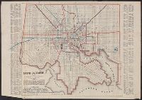
- Creator:
- Sides, William
- Published / Created:
- 1859
- Call Number:
- 777 B21 1859
- Container / Volume:
- BRBL_00503
- Image Count:
- 1
- Resource Type:
- Maps, Atlases & Globes
- Found in:
- Beinecke Rare Book and Manuscript Library > Map of Baltimore.
- Creator:
- Thomas Cook (Firm), cartographer.
- Published / Created:
- [1896]
- Call Number:
- BrSides Folio 2017 10
- Image Count:
- 2
- Resource Type:
- Maps, Atlases & Globes
- Found in:
- Beinecke Rare Book and Manuscript Library > Map of Cook's tours in Europe.
- Published / Created:
- [1846?]
- Call Number:
- 796hc 1846
- Image Count:
- 1
- Resource Type:
- Maps, Atlases & Globes
- Found in:
- Beinecke Rare Book and Manuscript Library > Map of Texas.
- Creator:
- United States. Army. Corps of Engineers.
- Published / Created:
- 1941
- Call Number:
- 60gmb 1941
- Image Count:
- 2
- Resource Type:
- Maps, Atlases & Globes
- Found in:
- Beinecke Rare Book and Manuscript Library > Map of central North Africa, including Lake Tchad / prepared under direction of the Chief of Engineers, U.S. Army.
- Creator:
- Pioneer Abstract Co.
- Published / Created:
- Nov. 29, 1911
- Call Number:
- 833 C429 1911
- Container / Volume:
- BRBL_00584
- Image Count:
- 2
- Resource Type:
- Maps, Atlases & Globes
- Found in:
- Beinecke Rare Book and Manuscript Library > Map of city of Cheyenne and adjacent subdivisions / compiled by the Pioneer Abstract Co., Cheyenne, Wyo. from government, county, and other official records ; H.G. Porak, del. ; compliments of Mark A. Chapman, fire, insurance, and real estate.