Skip to search
Skip to main content
Skip to first result
Search
You Searched For
Publication Place
London :
New Search
Search Results
Published / Created:
1811
Call Number:
38 1811
Container / Volume:
BRBL_00154
Image Count:
1
Resource Type:
Maps, Atlases & Globes
Publisher:
J. Cary,
Subject (Geographic):
France--Maps
Found in:
Beinecke Rare Book and Manuscript Library > A new map of France ... divison into provinces as previous to the revolution ... John Cary, Engraver.
Published / Created:
1794
Call Number:
38 1794A
Container / Volume:
BRBL_00153
Image Count:
1
Resource Type:
Maps, Atlases & Globes
Publisher:
Laurie & Whittle,
Subject (Geographic):
France--Maps--Early works to 1800
Found in:
Beinecke Rare Book and Manuscript Library > A new map of France ... in 1790.
Published / Created:
1793
Call Number:
38 1793B
Container / Volume:
BRBL_00153
Image Count:
1
Resource Type:
Maps, Atlases & Globes
Description:
Inset: Environs of Paris.
Publisher:
John Andrews,
Subject (Geographic):
France--Maps--Early works to 1800
Found in:
Beinecke Rare Book and Manuscript Library > A new map of France ... into 83 departments ... all the Post & Cross Roads ... by John Andrews.
Published / Created:
1799
Call Number:
38 1799A
Container / Volume:
BRBL_00154
Image Count:
1
Resource Type:
Maps, Atlases & Globes
Publisher:
J. Cary,
Subject (Geographic):
France--Maps
Found in:
Beinecke Rare Book and Manuscript Library > A new map of France divided into departments as decreed by the National Assembly, 1790 ... John Cary, Engraver.
Creator:
Published / Created:
Jany. 1st , 1793.
Call Number:
1977 Folio 177
Image Count:
2
Resource Type:
Maps, Atlases & Globes
Description:
Bar scales given in "great French leagues," "common French leagues," and "British miles"., Prime meridian: Paris., Relief shown pictorially., Sheet measures 55.6 x 73.6 cm. No. 16 of 34 maps bound together., and Watermark.
Publisher:
Printed for Robert Sayer,
Subject (Geographic):
France--Administrative and political divisions--Maps--Early works to 1800 and France--Maps--Early works to 1800
Found in:
Beinecke Rare Book and Manuscript Library > A new map of France divided into eighty three departments according to the decree of the National Assembly in 1790.
Published / Created:
1805
Call Number:
36 1805A
Container / Volume:
BRBL_00119
Image Count:
1
Resource Type:
Maps, Atlases & Globes
Publisher:
Laurie & Whittle,
Subject (Geographic):
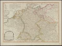
Germany--Maps
Found in:
Beinecke Rare Book and Manuscript Library > A new map of Germany divided into its circles ...
Published / Created:
1799
Call Number:
36 1799
Container / Volume:
BRBL_00119
Image Count:
1
Resource Type:
Maps, Atlases & Globes
Publisher:
J. Cary,
Subject (Geographic):
Germany--Maps--Early works to 1800
Found in:
Beinecke Rare Book and Manuscript Library > A new map of Germany divided into its circles ... with the Kingdom of Bohemia etc ... John Cary, Engraver.
Creator:
Published / Created:
April 28, 1811.
Call Number:
36 1811
Container / Volume:
BRBL_00119
Image Count:
1
Resource Type:
Maps, Atlases & Globes
Description:
Pg. no. on verso: 21.
Publisher:
Printed for J. Cary, engraver & map-seller, No. 181 Strand,
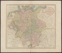
Subject (Geographic):
Germany--Maps
Found in:
Beinecke Rare Book and Manuscript Library > A new map of Germany, divided into its circles : viz. the upper and lower Rhine, Swabia, Austria, Bavaria, upper and lower Saxony, Franconia and Westphalia, with the Kingdom of Bohemia &c. From the latest authorities / by John Cary, engraver, 1811.
Published / Created:
1811
Call Number:
59 1811A
Container / Volume:
BRBL_00316
Image Count:
1
Resource Type:
Maps, Atlases & Globes
Description:
Inset: Ceylon.
Publisher:
J. Cary,
Subject (Geographic):
India--Maps
Found in:
Beinecke Rare Book and Manuscript Library > A new map of Hindoostan ... By John Cary, Engraver.
Published / Created:
1811
Call Number:
43 1811
Container / Volume:
BRBL_00250
Image Count:
1
Resource Type:
Maps, Atlases & Globes
Publisher:
J. Cary,
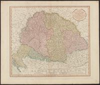
Subject (Geographic):
Hungary--Maps
Found in:
Beinecke Rare Book and Manuscript Library > A new map of Hungary ... / by John Cary, engraver.
Branch:v1.61.6 ,Deployed:2024-06-12T09:55:31-04:00